Report
VERIFIED
CLOSED
Dec 31, 2023
Jawa Barat, Indonesia
Indonesia, M4.1 Earthquake in Sumedang (West Java)
VERIFIED
CLOSED
Dec 31, 2023
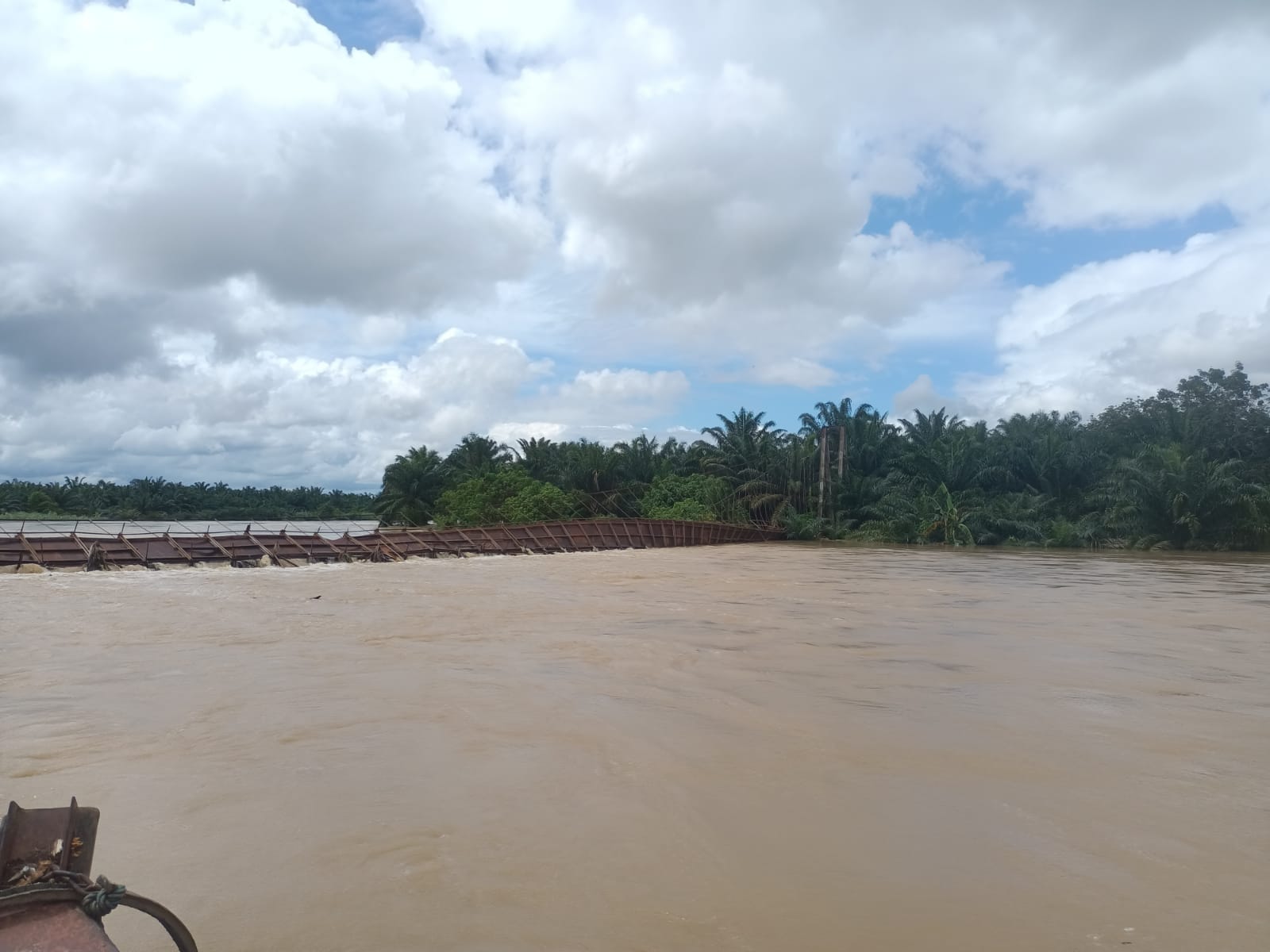
Sumatera Selatan, Indonesia
Indonesia, Flooding in Musi Rawas Utara (South Sumatera)
VERIFIED
CLOSED
Dec 31, 2023
Sumatera Utara, Indonesia
Indonesia, Flooding in Padang Lawas Utara (North Sumatra)
VERIFIED
CLOSED
Dec 30, 2023
Sumatera Utara, Indonesia
Indonesia, Flooding in Padang Lawas (North Sumatera)
VERIFIED
CLOSED
Dec 30, 2023
Sumatera Barat, Indonesia
Indonesia, Flooding in Dharmasraya (West Sumatera)
VERIFIED
CLOSED
Dec 30, 2023
Sumatera Utara, Indonesia
Indonesia, Flooding in Labuhan Batu (North Sumatera)
VERIFIED
CLOSED
Dec 29, 2023
Sumatera Barat, Indonesia
Indonesia, Flooding and Landslide in Pasaman (West Sumatera)
VERIFIED
CLOSED
Dec 28, 2023
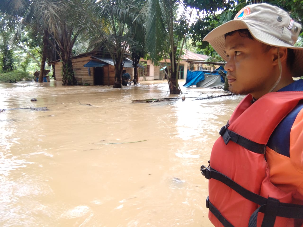
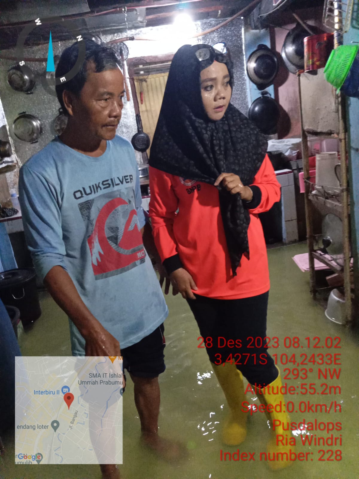
Sumatera Selatan, Indonesia
Indonesia, Flooding in Prabumulih City (South Sumatera)
VERIFIED
CLOSED
Dec 27, 2023
Sumatera Barat, Indonesia
Indonesia, Flooding in Pasaman (West Sumatera)
VERIFIED
CLOSED
Dec 27, 2023
Sumatera Utara, Indonesia