Indonesia, Flooding in Aceh Tenggara (Aceh)
Nov 13, 2023 22:00
Nov 23, 2023 12:38
Location
Coordinate:
3.3694044154551, 97.697598065704
Administrative:
Aceh, Indonesia
Affected Area:
Aceh
Hazard
Main : Flood- Inundated Area (km) = -
- Maximum Flood Depth (cm) = -
Description
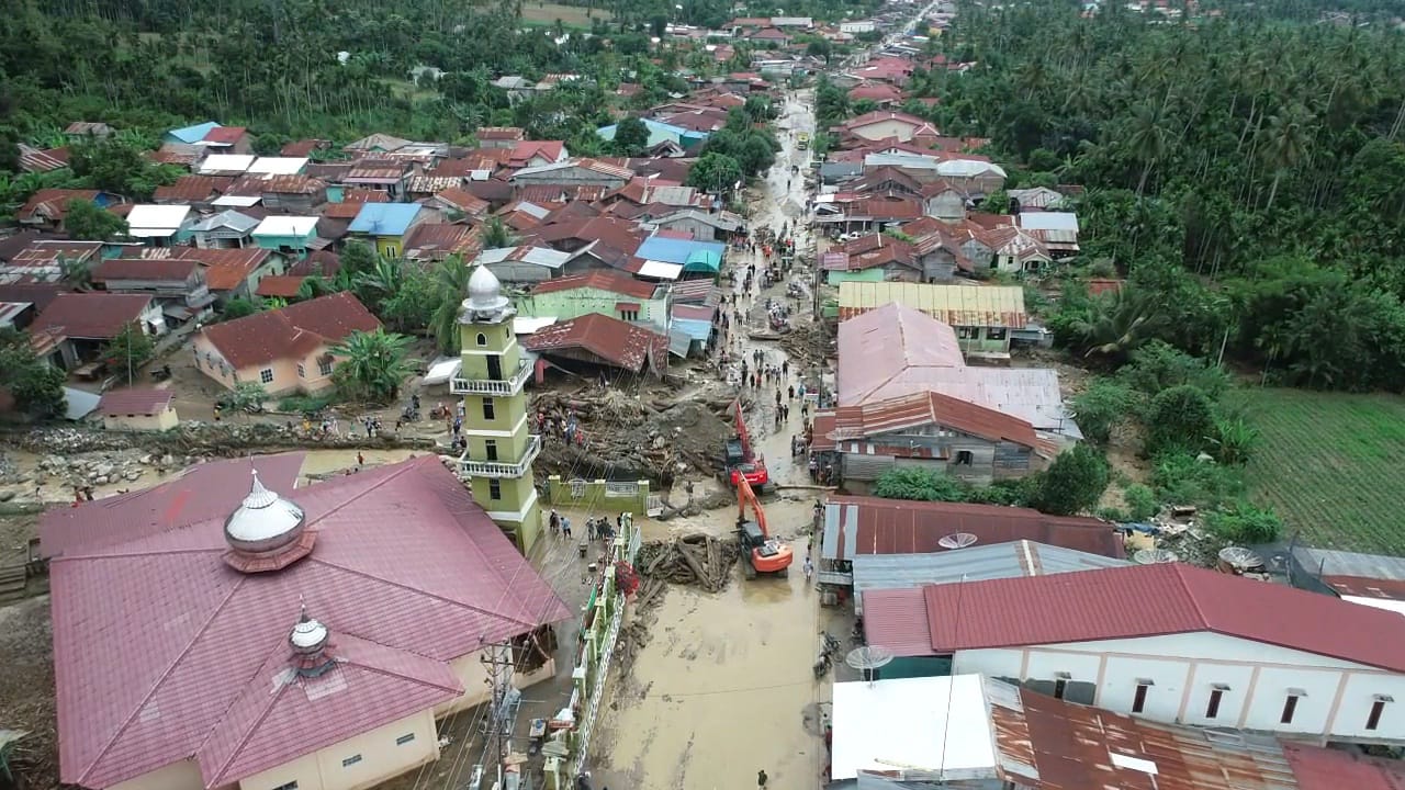
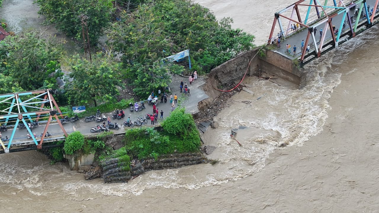
Cause: Heavy rainfall and overflowing of the rivers
Location:
• Kec. Bambel
- Desa Pinding
- Desa Kuning I
- Desa Kuta Buluh
- Desa Bambel Gabungan
- Desa Trt. Seperai
- Desa Kute Seri
- Desa Lembah Haji
- Desa Mbiak Muli Baru
- Desa Pulo Perengge
• Kec. Semadam
- Desa Pasar Puntung
- Desa Kampung Baru
- Desa Titi Pasir
• Babussalam
- Desa Mbarung
- Desa Pulolatong
- Desa Mendabe
• Kec. Lawe Bulan
- Desa Pulonas Baru
- Desa Kandang Mbelang Mandiri
- Desa Lawe Sagu Hulu
- Desa Kutambaru Bencawan
- Desa Kutambaru
• Kec. Ketambe
- Desa Bukit Baru
- Desa Lak-lak
• Kec. Lawe Sumur
- Desa Trt. Megara Lawe Pasaran (Dsn Nasi)
- Desa Kisam Gabungan
- Desa Kisam Lestari
- Desa Teger Miko
• Kec. Bukit Tusam
- Desa Darul Imami
- Desa Gumpang
- Desa Kute Lingga
- Desa Kute Gekhat
- Desa Tenembak Bintang
- Desa Maha Singkil
• Kec. Tanoh Alas
- Desa Salim Pinim I
- Desa Tuhi Jungkat
- Desa Alas Mesikhat
- Desa Timang Khase
• Kec. Babul Rahmah
- Desa Salim Pipit
• Kec. Lawe Alas
- Desa Darul Amin
• Kec. Darul Hasanah
- Desa Rambung Teldak
• Kec. Deleng Pokison
- Desa Lembah alas
- Desa Ranto Diur
- Desa Tading Nihulihi
- Desa Tenembak Lang-lang
- Desa Muhajirin
- Desa Lawe Pangkat
• Kec. Lawe sigala
- Desa lawe serke
- Desa Ndauh Nitenggo
- Desa Mulia Dame
- Desa Kuta Tengah
• Kec. Babul makmur
- Desa Muara Situlen
*data collection are on going as of reporting time 15 Nov at 0700 HRS UTC+7
Impact Statistic
3
Dead
0
Missing
7
Injured
6.6K
Affected Person
271
Displaced
External Video
News
Human SADDD
- Dead 3
- Missing -
- Injured 7
- Affected Person 3,747
- Affected Family 1,155
- Internaly Displaced People 271
- Refugees -
- Evacuation Center (in Country) 2
- Evacuation Center (out Of Country) -
House
- Affected Houses 1,155
- Damage Partial 1,095
- Totally Damage 60
Infrastructure
- Bridges 2
- Number of Roads -
- Road Distance (km) -
Public
- Schools 7
- Health -
- Government Office / Public Facilities -
- Settlements -
- Worship Places 2
- Others 17
General
Cost
- Local Currency -
- Cost of Damages -
- Cost of Damages (USD) -
- Cost of Assistance -
- Cost of Assistance (USD) -
Agricultural
- Rice Field 142.00
- Other Crops 326.00
- Fish Ponds -
- Cattle -
- Poultries -
- Livestock -
Relevant Disasters
The ASEAN Disaster Information Network (ADINet) is a repository of information concerning hazards and disasters that have happened in the region. The platform is open for public, which means that the public can submit information about any hazard and disaster to the AHA Centre. Thereafter, the AHA Centre will verify and validate any submitted information to ensure the accuracy of the data inputs. The AHA Centre can also add new information when relevant and as necessary. ADINet has been recording disaster information in the region since the AHA Centre was operational in 2012.

Supported by :