Report
VERIFIED
CLOSED
Jan 21, 2024
Papua Barat, Indonesia
Indonesia, Flooding in Teluk Bintuni (West Papua)
VERIFIED
CLOSED

Jan 21, 2024
Sumatera Selatan, Indonesia
Indonesia, Flooding in Musi Banyuasin (South Sumatra)
VERIFIED
CLOSED
Jan 20, 2024
Sulawesi Tenggara, Indonesia
Indonesia, Flooding in Kolaka (Southeast Sulawesi)
VERIFIED
CLOSED
Jan 19, 2024
Sumatera Barat, Indonesia
Indonesia, Flooding in Pesisir Selatan (West Sumatera)
VERIFIED
CLOSED
Jan 19, 2024
Jawa Tengah, Indonesia
Indonesia, Strong Winds in Wonosobo (Central Java)
VERIFIED
CLOSED
Jan 19, 2024
Jawa Tengah, Indonesia
Indonesia, Strong Winds in Temanggung (Central Java)
VERIFIED
CLOSED
Jan 18, 2024
Jawa Tengah, Indonesia
Indonesia, Storms and Winds in Kebumen (Central Java)
VERIFIED
CLOSED
Jan 18, 2024
Sulawesi Selatan, Indonesia
Indonesia, Flooding in Makassar (South Sulawesi)
VERIFIED
CLOSED
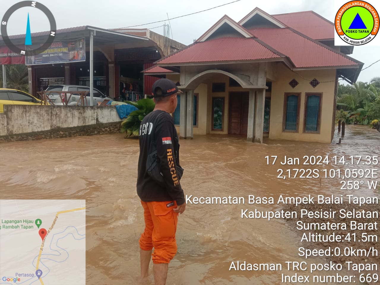
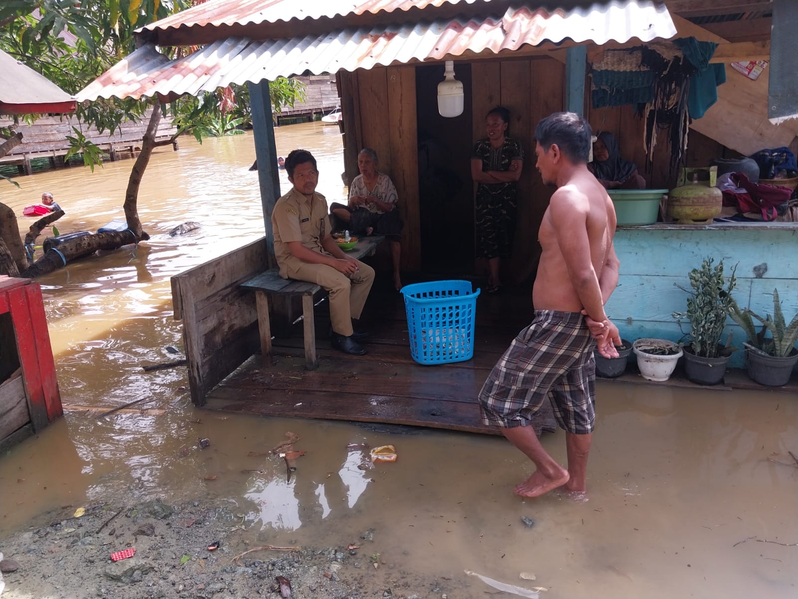
Jan 17, 2024
Sumatera Barat, Indonesia
Indonesia, Flooding in Pesisir Selatan (West Sumatera)
VERIFIED
CLOSED
Jan 17, 2024
Kalimantan Tengah, Indonesia
Indonesia, Flooding in Kapuas (Central Kalimantan)
VERIFIED
CLOSED
Jan 17, 2024
Kalimantan Tengah, Indonesia
Indonesia, Flooding in Barito Selatan (Central Kalimantan)
VERIFIED
CLOSED
Jan 17, 2024
Kalimantan Tengah, Indonesia
Indonesia, Flooding in Kotawaringin Barat (Central Kalimantan)
VERIFIED
CLOSED
Jan 16, 2024
Kalimantan Tengah, Indonesia
Indonesia, Flooding in Barito Utara (Central Kalimantan)
VERIFIED
CLOSED
.jpeg)
Jan 16, 2024
Kalimantan Selatan, Indonesia
Indonesia, Flooding in Balangan (South Kalimantan)
VERIFIED
CLOSED
Jan 16, 2024
Sulawesi Selatan, Indonesia