Affected Area/s
- Cao Bằng
- Yên Bái
- Lai Châu
- Lào Cai
- Nghệ An
- Sơn La
- Thanh Hóa
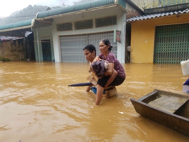
Floods and landslides in northern mountainous and central provinces have killed 15 people and left four missing, along with heavy losses in property, according to the Central Steering Committee for Natural Disaster Prevention and Control. Torrential rains persisting from late August that led to serious floods and landslides have ravaged the northern mountainous provinces of Son La, Lao Cai, Cao Bang, Yen Bai and Lai Chau and central Thanh Hoa and Nghe An provinces. The committee’s statistics as of September 2 showed that one death was reported in Son La, one in Yen Bai, one in Lang Son, one in Hoa Binh, two in Lai Chau and nine in Thanh Hoa. Three locals in Thanh Hoa and another in Lai Chau were still missing. As many as 364 houses were destroyed, while 754 other families had to evacuate. Floods drown 6,523 hectares of rice and crops, with the largest area of 4,586 being in Thanh Hoa province. Alongside, 512 cattle and 56,367 poultry were killed. Floods also swept away 963 hectares of aquatic farm, while damaging 620m dykes and 6,174m of canals. The localities reported nearly 90,000 cubic metres of landslides. Currently, the localities are promptly applied measures to overcome consequences of the disasters and clear the roads. So far, national highways crossing Son La, Hoa Binh, Yen Bai, Dien Bien and Thanh Hoa have been smooth, but many provincial and district roads have still been blocked. In Lai Chau, floods and landslides blocked many sections of national highways 4D, 4H and 12, along with provincial roads 127, 128 and 129, causing traffic congestion. Local authorities warned locals not to go out and keep away from areas with high risks of landslides. At the same time, the Mekong Delta provinces of Long An, An Giang, Kien Giang and Dong Thap are likely to suffer from floods in the rainy season.
Dead
Missing
Injured
Affected Person
Displaced