Report
VERIFIED
CLOSED
.jpeg)
Oct 12, 2023
Sulawesi Selatan, Indonesia
Indonesia, Drought in Sidenreng Rappang Regency (South Sulawesi)
VERIFIED
CLOSED
.jpeg)
Oct 09, 2023
Sulawesi Selatan, Indonesia
Indonesia, Drought in Takalar Regency (South Sulawesi)

VERIFIED
CLOSED
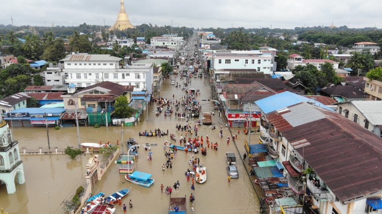
Oct 08, 2023
Bago, Myanmar
Myanmar, Flooding in Bago, Mon, Yangon, Naypyidaw, and Shan
VERIFIED
CLOSED
Oct 07, 2023
Jawa Tengah, Indonesia
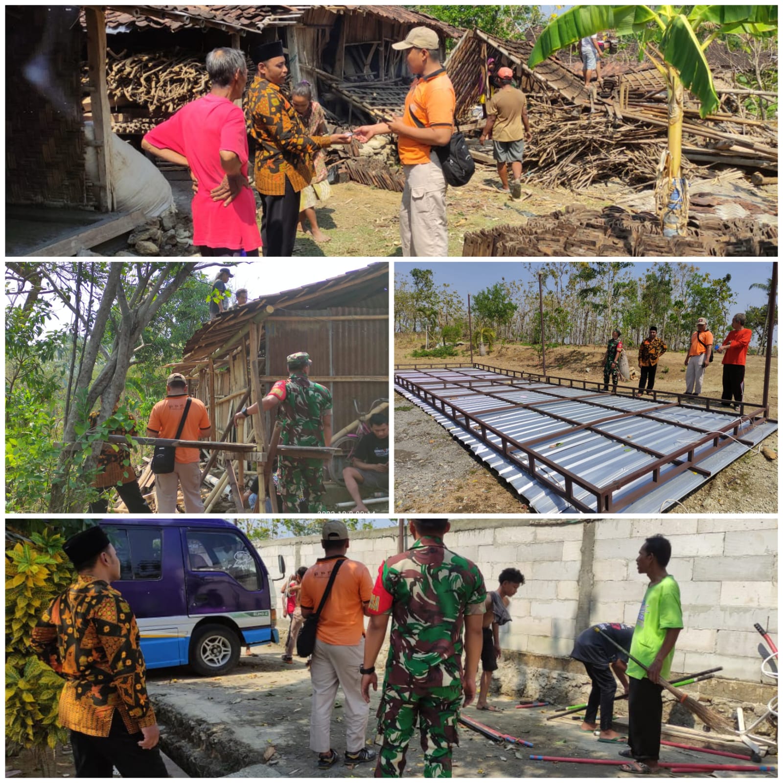
Indonesia, Tornadoes in Sragen Regency (West Java)
VERIFIED
CLOSED
Oct 06, 2023
Sumatera Utara, Indonesia
Indonesia, Flooding in Deli Serdang (North Sumatra)
VERIFIED
CLOSED
Oct 06, 2023
Kelantan, Malaysia
Malaysia, Flooding in Bachok and Kota Baharu (Kelantan)
VERIFIED
CLOSED
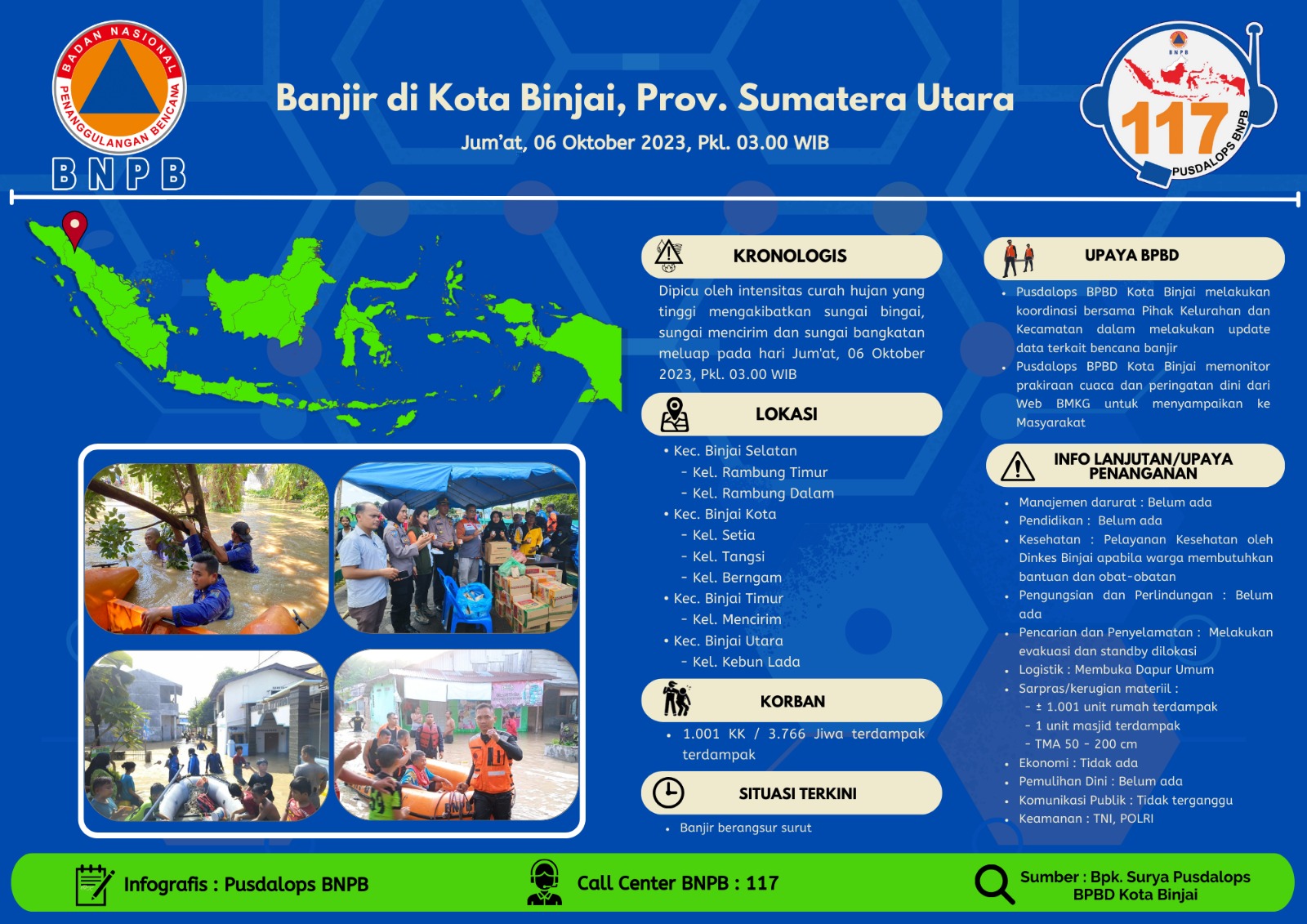
Oct 06, 2023
Sumatera Utara, Indonesia
Indonesia, Flooding in Binjai (North Sumatra)
VERIFIED
CLOSED
Oct 04, 2023
Misamis Occidental, Philippines