Thailand, Floods in several provinces
Oct 17, 2017 09:27
Sep 27, 2026 15:11
Location
Coordinate:
15.224192, 101.931375
Administrative:
Nakhon Ratchasima, Thailand
Affected Area:
Lop Buri, Nakhon Ratchasima, Phrae, Si Sa Ket
Hazard
Main : Flood- Inundated Area (km) = fill value here
- Maximum Flood Depth (cm) = fill value here
Description
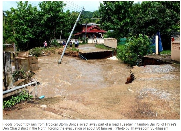
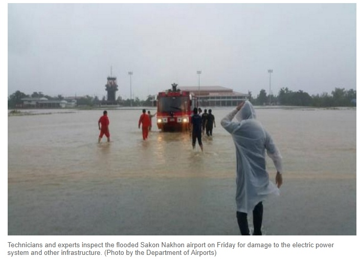
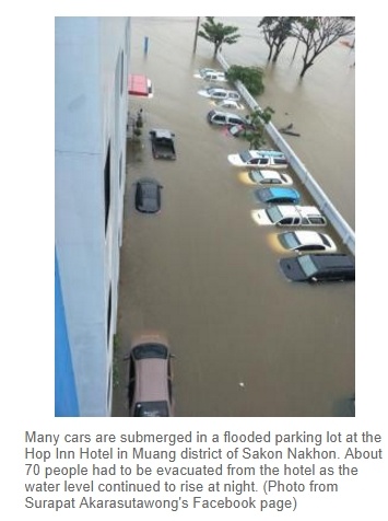
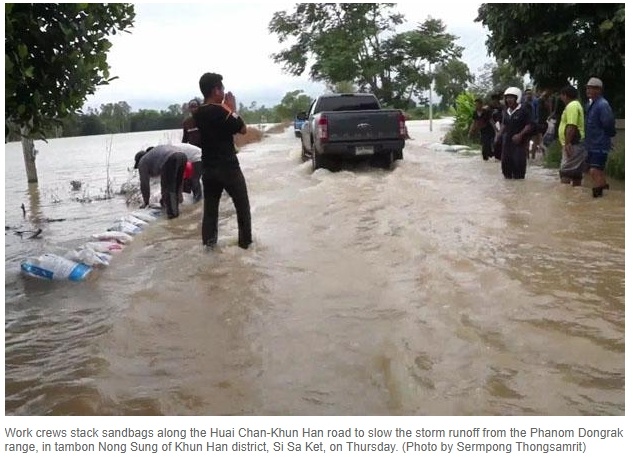
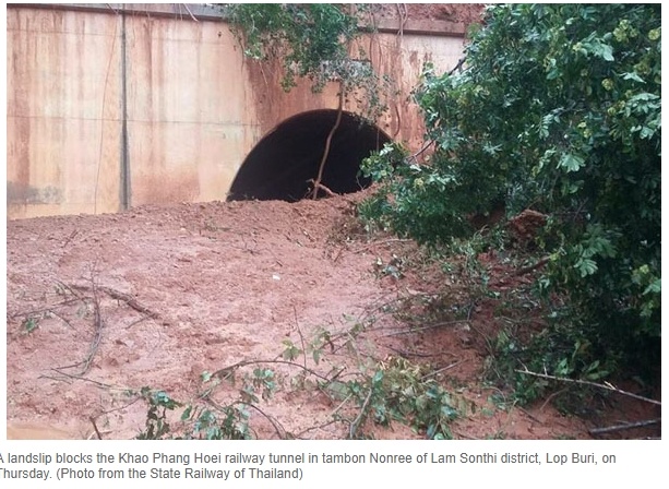
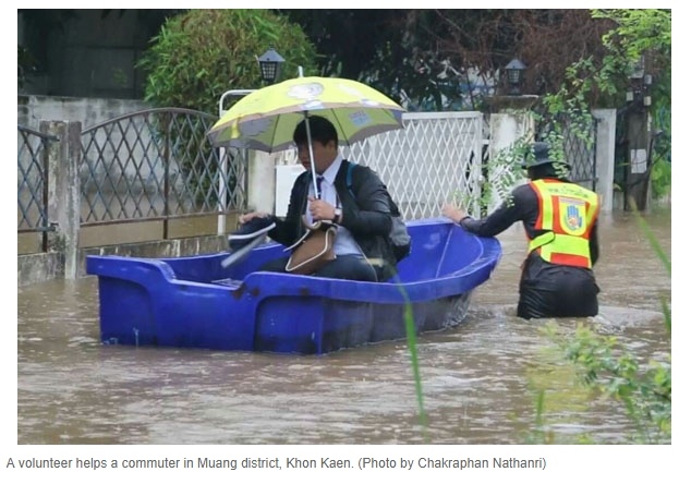
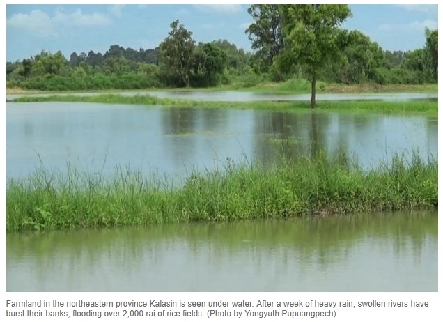
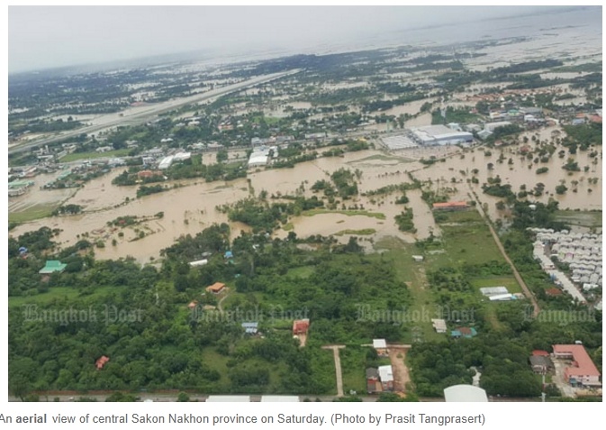
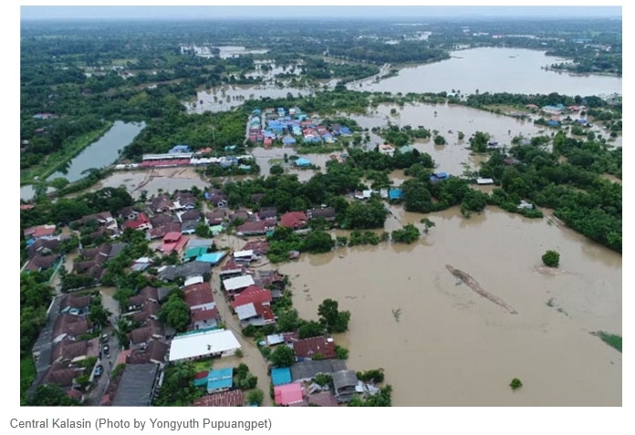
The continuous heavy rain, enhanced by the Tropical Depression "Sonca", has increased the flood and landslide incidents in the northeast, northern and central provinces of Thailand. The Department of Disaster Prevention and Mitigation stated that 17 provinces have been affected by flooding which included Sakon Nakhon, Lop Buri, Nakhon Ratchasima, Phrae, Si Sa Ket, Ubon Ratchathani, Maha Sarakham, Ayutthaya, Buri Ram, Phichit, Kalasin, Sukhothai, Mae Hong Son, Ranong, Khon Kaen, Uttaradit and Phitsanulok. In Nakhon Ratchasima, the flood has inundated 229 villages in five districts, including 50 houses in Theparak District. 40,000 rai (6,400 ha) of agriculture land was also damaged by floods. The water runoff from Theparak District has also flowed to several villages in Lop Buri Province causing inundation and blocking the railway. Meanwhile in Phrae Province, the military evacuated 50 flood affected families. Flood also affected Si Sa Ket and Ubon Ratchathani Province. Further in Kalasin, about 500 houses and more than 25,000 rai (4,000 ha) of farmland was inundated in 15 of 17 districts. The Tropical Storm "Sonca" has severely affected Sakon Nakhon Province. The storm has caused widespread flooding in 18 districts which paralyzed the airport and cut off major roads, leaving several villages isolated. One person was reportedly to have died because of the flood. The Governor of Sakon Nakhon stated that the flooding was the worst over the last 20 years. In this crisis, the local government has mobilised their resources to help the people. The rescue team has evacuated 70 families from the flood. 70 people were also evacuated from the local hotel due which submerged by floodwater. Three relief centres were also set up near the city hall to help the victims. About 100 people took shelter in the temporary evacuation shelter near the provincial hall. Water pumps were also install to drain the water from the roads. At this stage, the authority is assessing the impact. Alert for potential flooding has been also issued to the communities as the heavy rains was expected to happen until 28 July.
Impact Statistic
0
Dead
0
Missing
0
Injured
3K
Affected Person
170
Displaced
Human SADDD
- Dead -
- Missing -
- Injured -
- Affected Person 3,000
- Affected Family 600
- Internaly Displaced People 170
- Refugees 0
- Evacuation Center (in Country) -
- Evacuation Center (out Of Country) 0
House
- Affected Houses 0
- Damage Partial 0
- Totally Damage -
Infrastructure
- Bridges 0
- Number of Roads 0
- Road Distance (km) 0.00
Public
- Schools -
- Health -
- Government Office / Public Facilities 0
- Settlements 0
- Worship Places 0
- Others 0
General
Cost
- Local Currency 0.00
- Cost of Damages 0.00
- Cost of Damages (USD) -
- Cost of Assistance 0.00
- Cost of Assistance (USD) -
Agricultural
- Rice Field 0.00
- Other Crops 10,400.00
- Fish Ponds 0
- Cattle 0
- Poultries 0
- Livestock 0
Relevant Disasters
The ASEAN Disaster Information Network (ADINet) is a repository of information concerning hazards and disasters that have happened in the region. The platform is open for public, which means that the public can submit information about any hazard and disaster to the AHA Centre. Thereafter, the AHA Centre will verify and validate any submitted information to ensure the accuracy of the data inputs. The AHA Centre can also add new information when relevant and as necessary. ADINet has been recording disaster information in the region since the AHA Centre was operational in 2012.

Supported by :