Myanmar - Flood and landslides in Hpakant township
Jun 25, 2018 11:38
Sep 27, 2026 15:17
Location
Coordinate:
25.619621, 96.301431
Administrative:
Kachin, Myanmar
Affected Area:
Kachin
Hazard
Main : Flood- Inundated Area (km) = fill value here
- Maximum Flood Depth (cm) = fill value here
Description
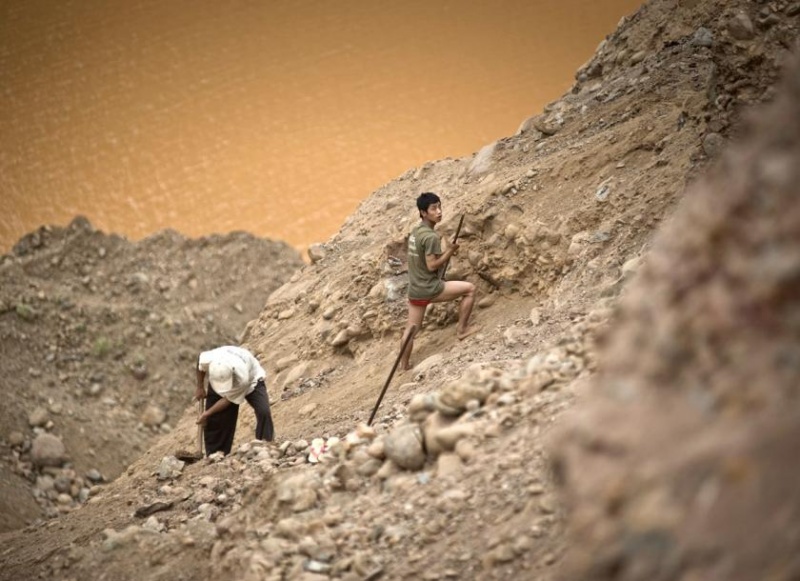
Update 3 Jul 2018 = Heavy rains have raised the Uru Creek water level and flooded Hpakant of Kachin State since Monday. Some wards and villages of the township have been flooded – there’s also flooding in Lonekhin and Hpakant bridges. Residents have been evacuated as floods worsen, according to the Township Information and Public Relations Department. Credit - Information and Public Relations Department ------------------------------- At least 11 people were killed in a flash flood in Hpakant township in Kachin State triggered by daylong heavy rains that loosened mountains of soil, a senior town official told The Myanmar Times on Sunday. U Kyaw Swa Aung, Hpakant township administrator, said at least 70 houses were destroyed in the landslides on Saturday. He said six people were injured in the accident. “Rainfall was high. People living in huts near the mountains and scavengers died in the landslide. Earth cuttings are piled randomly and recklessly here,” U Kyaw Swa Aung. “When it rains heavily, some places are blocked, At present, we are clearing the cuttings that blocked the ditches flowing into Uru creek.” U Kyaw Swa Aung said reddish-coloured watery mud rushed down the mountains and inundated the town. Residents are worried the muddy water could loosen the soil and cause landslides. Due to the extraction of jade in Hpakant, ten people died in one day as there is loose soil everywhere and locals are anxious because of the risk of it collapsing. Five people died from the floods between Soot Aung and Ma Mone village in Sate Mu village tract of Hpakant, and lakes formed at these locations as loose soil piled up to block the drains. This is evident of the environmental destruction of Hpakant, said U Nawng Latt, an executive of local environmental group Green Land. “People don’t do environmental related cases systematically. Besides, the Jade Law says the digging depth should not be over 30 feet. But people are actually digging up to 500 feet deep. The soil is dumped wherever they want. River tributaries are not maintained. We residents suffer anytime it rains,” said U Nawng Latt. Because of undisciplined jade digging in Hpakant since 2007, many forests and mountains were damaged and 23 creeks disappeared, he said. As the creeks disappeared, the water course changed and eroded soil mounds, said U Kyaw Swa Aung. “We are able to clear the ditches. If it rains more, the soil mountains will be eroded and may lead to landslides. Hpakant is a mining area, and the disposal of soil is not systematic. People are living in downtown areas by expanding and building on the mountains of earth. These places can collapse when it rains heavily. We are studying the places where landslides can happen,” said U Kyaw Swa Aung. “We will ask state officials to build retaining walls,” he said, adding that public awareness is critical to wards and villages that could suffer from landslides.
Impact Statistic
11
Dead
0
Missing
6
Injured
361
Affected Person
0
Displaced
Human SADDD
- Dead 11
- Missing -
- Injured 6
- Affected Person 361
- Affected Family 70
- Internaly Displaced People -
- Refugees 0
- Evacuation Center (in Country) -
- Evacuation Center (out Of Country) 0
House
- Affected Houses 70
- Damage Partial 0
- Totally Damage 70
Infrastructure
- Bridges 0
- Number of Roads 0
- Road Distance (km) 0.00
Public
- Schools -
- Health -
- Government Office / Public Facilities 0
- Settlements 0
- Worship Places 0
- Others 0
General
Cost
- Local Currency 0.00
- Cost of Damages 0.00
- Cost of Damages (USD) -
- Cost of Assistance 0.00
- Cost of Assistance (USD) -
Agricultural
- Rice Field 0.00
- Other Crops 0.00
- Fish Ponds 0
- Cattle 0
- Poultries 0
- Livestock 0
Relevant Disasters
The ASEAN Disaster Information Network (ADINet) is a repository of information concerning hazards and disasters that have happened in the region. The platform is open for public, which means that the public can submit information about any hazard and disaster to the AHA Centre. Thereafter, the AHA Centre will verify and validate any submitted information to ensure the accuracy of the data inputs. The AHA Centre can also add new information when relevant and as necessary. ADINet has been recording disaster information in the region since the AHA Centre was operational in 2012.

Supported by :