Myanmar, Landslide in Sankhar village
Jul 09, 2018 14:56
Sep 27, 2026 15:17
Location
Coordinate:
25.641124, 96.287374
Administrative:
Kachin, Myanmar
Affected Area:
Kachin
Hazard
Main : Landslide- Inundated Area (km) = fill value here
- Maximum Flood Depth (cm) = fill value here
Description
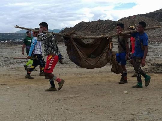
At least 15 people were killed and around 40 others injured in a landslide at Mahar Gem block near Sankhar village in Lonekhin village-tract in Hpakant Township in Kachin State on July 14, according to Deputy Police Major Sein Myint Tun from Lonekhin Region Police Station. Min Zaw from Myint Myat Thu Social Organization said: “Now the bodies of 15 people killed in the accident have been recovered. We are collecting the exact number of victims. The death toll is expected to exceed 50. We are unable to carry out the searches for the bodies of those buried the mud due to ongoing landslides.” Ko Bo Thein (aka) Ko Min Min Thein, an eyewitness said: “The old mining pit collapsed soon after a mine exploded during the miners’ lunch break.” There are more than 200,000 migrant workers in Hpakant region. The authority finds to difficult to solve related problems. More than 300 people died every year due to frequent landslides, according to the records from social organizations and police. More than 20 villages near jade mine blocks are in danger of landslide. The floor level of Uru River is as high as 20 feet as jade mining companies from Hpakant region are carrying out indiscriminate disposals of soil wastes into Uru River and its tributaries. Since the previous 10 years, Hpakant and nearby villages are facing flooding.
Impact Statistic
15
Dead
0
Missing
40
Injured
0
Affected Person
0
Displaced
External Video
News
Human SADDD
- Dead 15
- Missing -
- Injured 40
- Affected Person -
- Affected Family -
- Internaly Displaced People -
- Refugees 0
- Evacuation Center (in Country) -
- Evacuation Center (out Of Country) 0
House
- Affected Houses 0
- Damage Partial 0
- Totally Damage -
Infrastructure
- Bridges 0
- Number of Roads 0
- Road Distance (km) 0.00
Public
- Schools -
- Health -
- Government Office / Public Facilities 0
- Settlements 0
- Worship Places 0
- Others 0
General
Cost
- Local Currency 0.00
- Cost of Damages 0.00
- Cost of Damages (USD) -
- Cost of Assistance 0.00
- Cost of Assistance (USD) -
Agricultural
- Rice Field 0.00
- Other Crops 0.00
- Fish Ponds 0
- Cattle 0
- Poultries 0
- Livestock 0
Relevant Disasters
The ASEAN Disaster Information Network (ADINet) is a repository of information concerning hazards and disasters that have happened in the region. The platform is open for public, which means that the public can submit information about any hazard and disaster to the AHA Centre. Thereafter, the AHA Centre will verify and validate any submitted information to ensure the accuracy of the data inputs. The AHA Centre can also add new information when relevant and as necessary. ADINet has been recording disaster information in the region since the AHA Centre was operational in 2012.

Supported by :