Affected Area/s
- Mawlamyine
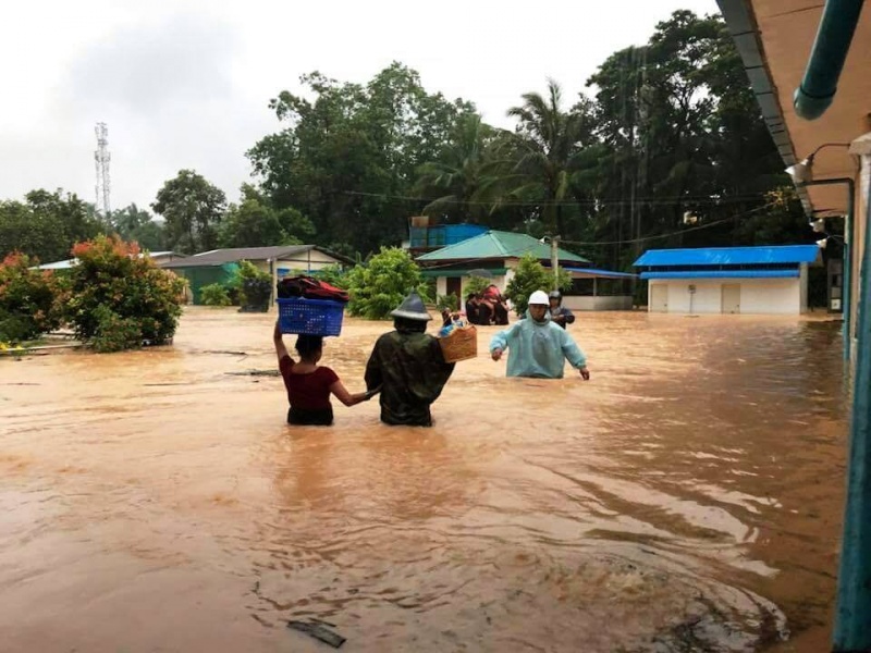
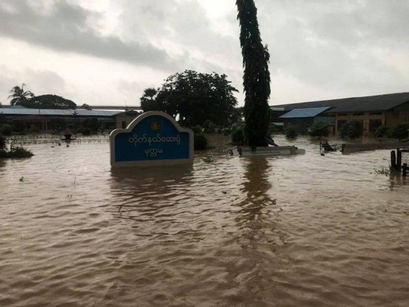
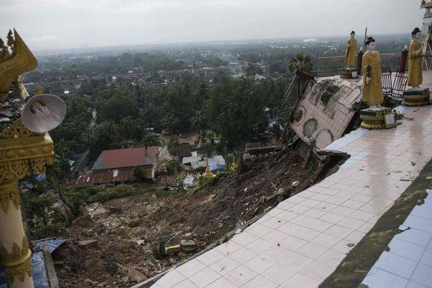
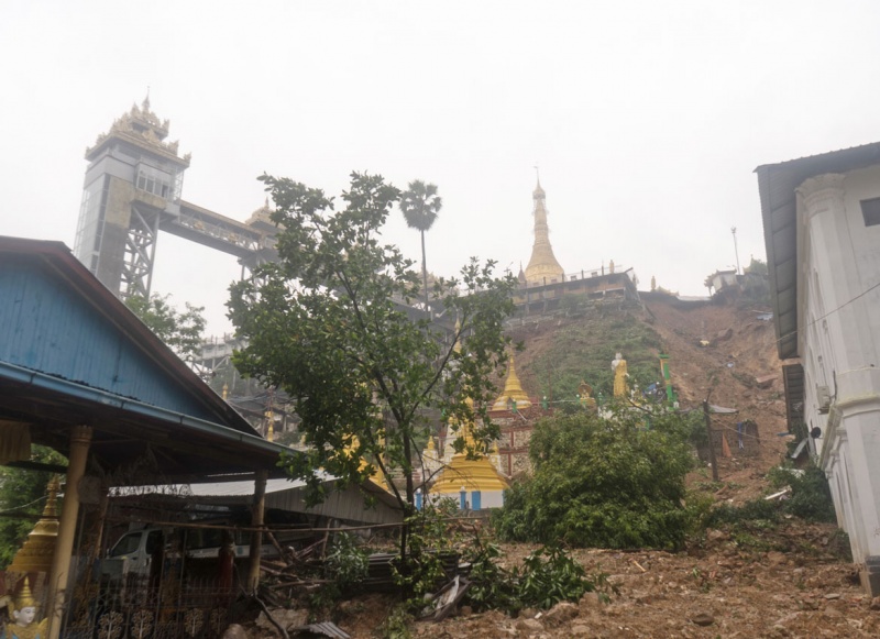
Government of Myanmar, Ministry of Information reported a landslide in Mon State on 18 June 2018, morning. The landslide was due to heavy rainfall since 16 June, which measured at 297 mm in 24 hours between 16-17 June 2018, and record high of 296 mm set in 2004. Most areas in Mawlamyine are flooded, such as Thiri Mingalar, Thiri Myaing, Kyauk Tan, Zayar Thiri and Thaya Aye. This flooding in southern Myanmar has caused a landslide at a famed Buddhist pagoda, submerged homes and displaced hundreds of people. Initial estimation suggests that the landslide cost Ks 1.5 million of damages. Local authorities and social organization members went to the scene to carry out rescue operations and the disaster affected victims are being given necessary assistance by the village officials. Around 1,000 people in Mawlamyine were displaced and sheltered in various locations.
Dead
Missing
Injured
Affected Person
Displaced