Philippines, Landslide in Zamboanga del Sur
Oct 06, 2018 11:45
Sep 27, 2026 15:17
Location
Coordinate:
7.767123, 123.204774
Administrative:
Zamboanga del Sur, Philippines
Affected Area:
Zamboanga del Sur
Hazard
Main : Landslide- Inundated Area (km) = fill value here
- Maximum Flood Depth (cm) = fill value here
Description
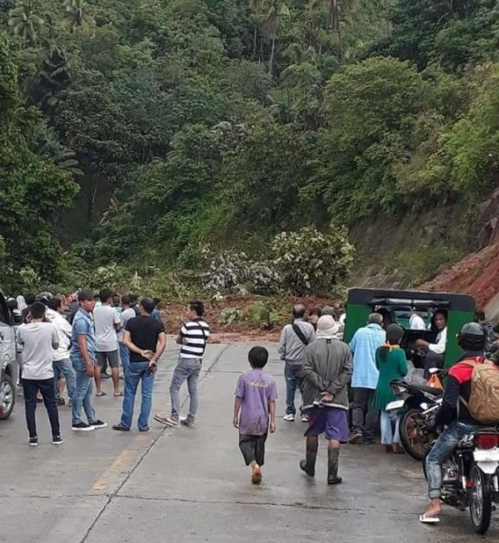
undreds of bus passengers were stranded for 2 1/2 hours along the highway in Barangay Lacupayan, Tigbao town, Zamboanga del Sur after heavy rain caused a landslide on Saturday afternoon. Engineer Francisco Maca, Provincial Disaster Risk Reduction and Management (PDRRM) officer, told the Inquirer that trips of passenger buses and other vehicles plying the Pagadian City to Zamboanga City route halted at 2:30 p.m. after the landslide rendered the highway impassable. There were no fatalities or casualties due to this incident, and traffic resumed again at 5 p.m., after the road was cleared of mud and debris.
Impact Statistic
0
Dead
0
Missing
0
Injured
200
Affected Person
0
Displaced
Human SADDD
- Dead -
- Missing -
- Injured -
- Affected Person 200
- Affected Family 40
- Internaly Displaced People -
- Refugees 0
- Evacuation Center (in Country) -
- Evacuation Center (out Of Country) 0
House
- Affected Houses 0
- Damage Partial 0
- Totally Damage -
Infrastructure
- Bridges 0
- Number of Roads 0
- Road Distance (km) 0.00
Public
- Schools -
- Health -
- Government Office / Public Facilities 0
- Settlements 0
- Worship Places 0
- Others 0
General
Cost
- Local Currency 0.00
- Cost of Damages 0.00
- Cost of Damages (USD) -
- Cost of Assistance 0.00
- Cost of Assistance (USD) -
Agricultural
- Rice Field 0.00
- Other Crops 0.00
- Fish Ponds 0
- Cattle 0
- Poultries 0
- Livestock 0
Relevant Disasters
The ASEAN Disaster Information Network (ADINet) is a repository of information concerning hazards and disasters that have happened in the region. The platform is open for public, which means that the public can submit information about any hazard and disaster to the AHA Centre. Thereafter, the AHA Centre will verify and validate any submitted information to ensure the accuracy of the data inputs. The AHA Centre can also add new information when relevant and as necessary. ADINet has been recording disaster information in the region since the AHA Centre was operational in 2012.

Supported by :