Philippines, Landslide in Boljoon Town, Cebu
Nov 07, 2017 19:24
Sep 27, 2026 15:11
Location
Coordinate:
9.61869, 123.490419
Administrative:
Cebu, Philippines
Affected Area:
Cebu
Hazard
Main : Landslide- Inundated Area (km) = fill value here
- Maximum Flood Depth (cm) = fill value here
Description
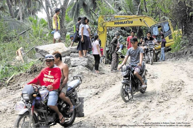
AHA Centre understands that fault line movement has caused a landslide in Boljoon Town, Cebu Province, on Friday 27 October 2017 with emergency response and early recovery are underway until 1 November 2017. Rocks and other landslide debris have blocked the flow of water in a river in Lusopan River of Barangai Lower Becerril, and putting Barangay Poblacion at risk to potential flash flood. The landslide also blocked road access in Barangay Lower Becerril and impassable to big vehicles. Emergency response as of 29 October 2017 1a) Boljoon Municipal Disaster Risk Reduction Management Office (DRRMO), promptly evacuating approximately 100 residents to the town‘ Sport Complex in Barangay Poblacion. 2a) Boljoon Municipal DRRMO and Cebu Province DRRMO have deployed backhoes and other heavy equipment to remove landslide debris that blocking the river. Emergency response update on 1 November 2017 1b) Number of evacuees in Boljoon Town is recorded at 300 residents. 2b) Water level in Lusopan River has decreased by 3 meters. Clearing operation is still on the way until the water flow fully to the sea. 3) Road access in Barangay Lower Becerril is currently passable to cars. 4) Boljoon municipal government is in coordination with Mines and Geosciences Bureau to assess whether residents would be allowed to return to their homes.
Impact Statistic
0
Dead
0
Missing
0
Injured
300
Affected Person
300
Displaced
Human SADDD
- Dead -
- Missing -
- Injured -
- Affected Person 300
- Affected Family 60
- Internaly Displaced People 300
- Refugees 0
- Evacuation Center (in Country) 1
- Evacuation Center (out Of Country) 0
House
- Affected Houses 0
- Damage Partial 0
- Totally Damage -
Infrastructure
- Bridges 0
- Number of Roads 0
- Road Distance (km) 0.00
Public
- Schools -
- Health -
- Government Office / Public Facilities 0
- Settlements 0
- Worship Places 0
- Others 0
General
Cost
- Local Currency 0.00
- Cost of Damages 0.00
- Cost of Damages (USD) -
- Cost of Assistance 0.00
- Cost of Assistance (USD) -
Agricultural
- Rice Field 0.00
- Other Crops 0.00
- Fish Ponds 0
- Cattle 0
- Poultries 0
- Livestock 0
Relevant Disasters
The ASEAN Disaster Information Network (ADINet) is a repository of information concerning hazards and disasters that have happened in the region. The platform is open for public, which means that the public can submit information about any hazard and disaster to the AHA Centre. Thereafter, the AHA Centre will verify and validate any submitted information to ensure the accuracy of the data inputs. The AHA Centre can also add new information when relevant and as necessary. ADINet has been recording disaster information in the region since the AHA Centre was operational in 2012.

Supported by :