Affected Area/s
- Tanintharyi
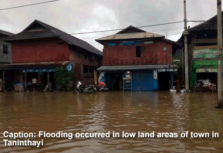
Tanintharyi- Low lying areas of town were flooded when Tanintharyi River swelled beyond danger levels on July 15. “Low lying areas such as Shwe Leikpyar road, Toechae 1st,2nd,3rd and 5th streets in Chaung Gyi ward in Tanintharyi Township are now flooded. The danger level of Tanintharyi River is 17 feet. At present, the water level is at 17.6 feet. About 60 houses in low land are flooded now,” said Kyaw Myo from Tanintharyi. Tanintharyi River originates from the coastal region of Dawei, flowing along Tanintharyi mountain ranges. Whenever there are heavy rains, river water usually floods. As there is now heavy rain the region, flooding has occurred and is continuing without sign of cessation, according to locals.
Dead
Missing
Injured
Affected Person
Displaced