Indonesia, Landslide in Bogor Regency, West Java
Sep 10, 2021 15:00
Sep 27, 2026 15:19
Location
Coordinate:
-6.5599794428372, 106.7675307085
Administrative:
Jawa Barat, Indonesia
Affected Area:
Jawa Barat
Hazard
Main : Landslide- Inundated Area (km) = fill value here
- Maximum Flood Depth (cm) = fill value here
Description
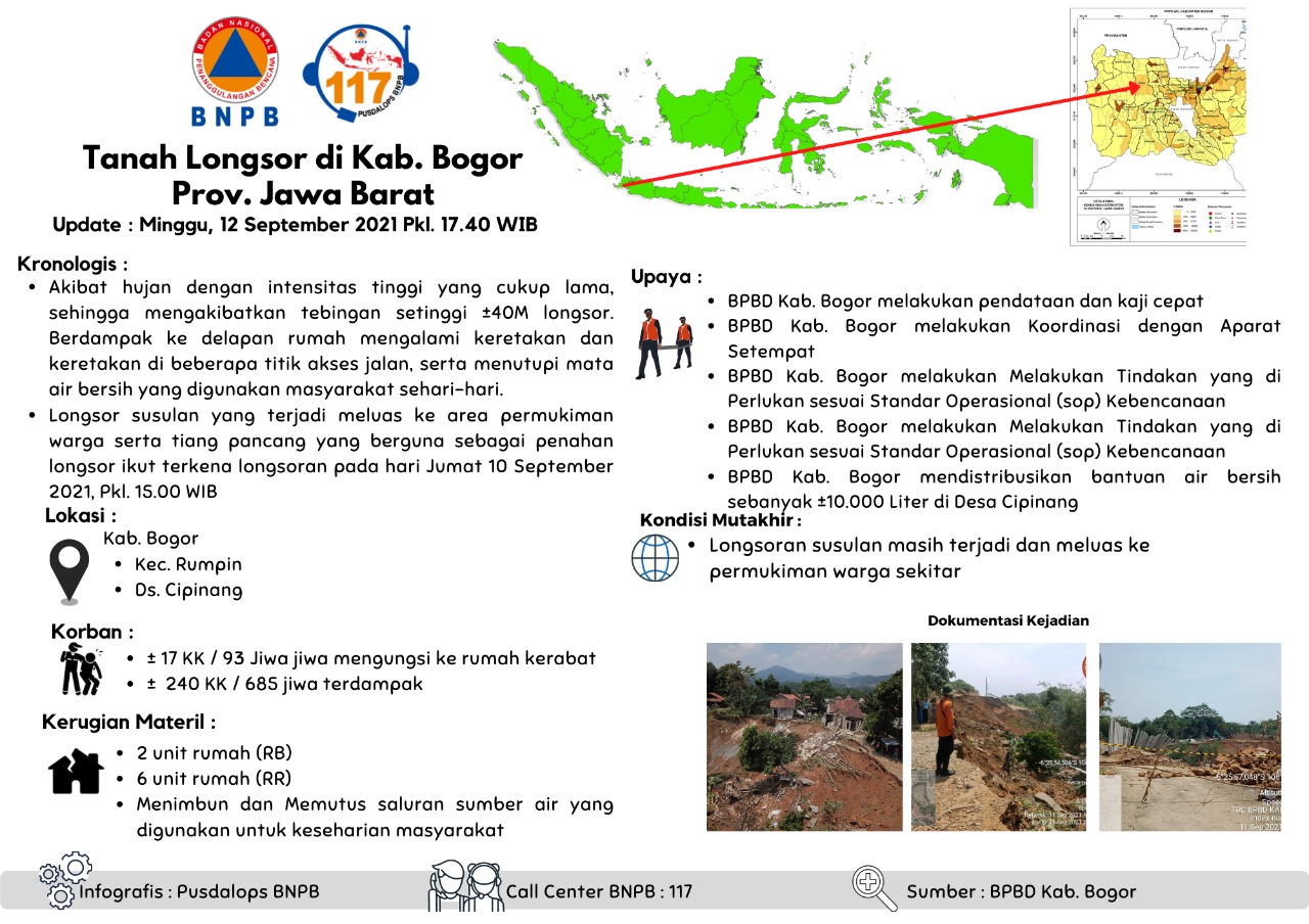
Landslide in Kab. Bogor, Prov. West Java
Update : Sunday, 12 September 2021, Pkl. 17.40 WIB
Chronology :
• Due to high intensity rain for a long time, resulting in landslides as high as ±40M cliffs. As a result, eight houses experienced cracks and cracks at several access road points, and covered the clean water springs used by the community on a daily basis.
• Subsequent landslides that occurred extended to residential areas as well as the piles that are useful as landslide barriers were also affected by the landslide on Friday, September 10, 2021, Pkl. 15.00 WIB
Location :
• Regency. Bogor
• Kec. Rumpin
• Ds. Cipinang
Impacts:
• ± 17 families / 93 people displaced
• ± 240 families / 685 people affected
Material Losses:
• 2 housing units heavily damage
• 6 housing units slightly damage
• Stockpiling and cutting off water sources used for daily life
Effort :
• BPBD Kab. Bogor conducts data collection and rapid assessment
• BPBD Kab. Bogor coordinates with local officials
• BPBD Kab. Bogor takes the necessary actions according to the Disaster Operational Standards (SOP)
BPBD Kab. Bogor distributes ±10,000 liters of clean water in Cipinang Village
Latest Condition:
• Subsequent landslides are still occurring and are spreading to local residents
Source :
• Pusdalops BPBD Kab. Bogor
Informed By:
BNPB PUSDALOPS
Complaint Number / Call Center : 117 (Toll Free)
Instagram : pusdalops_bnpb
Twitter : @Bnpbpusdalops
Update : Sunday, 12 September 2021, Pkl. 17.40 WIB
Chronology :
• Due to high intensity rain for a long time, resulting in landslides as high as ±40M cliffs. As a result, eight houses experienced cracks and cracks at several access road points, and covered the clean water springs used by the community on a daily basis.
• Subsequent landslides that occurred extended to residential areas as well as the piles that are useful as landslide barriers were also affected by the landslide on Friday, September 10, 2021, Pkl. 15.00 WIB
Location :
• Regency. Bogor
• Kec. Rumpin
• Ds. Cipinang
Impacts:
• ± 17 families / 93 people displaced
• ± 240 families / 685 people affected
Material Losses:
• 2 housing units heavily damage
• 6 housing units slightly damage
• Stockpiling and cutting off water sources used for daily life
Effort :
• BPBD Kab. Bogor conducts data collection and rapid assessment
• BPBD Kab. Bogor coordinates with local officials
• BPBD Kab. Bogor takes the necessary actions according to the Disaster Operational Standards (SOP)
BPBD Kab. Bogor distributes ±10,000 liters of clean water in Cipinang Village
Latest Condition:
• Subsequent landslides are still occurring and are spreading to local residents
Source :
• Pusdalops BPBD Kab. Bogor
Informed By:
BNPB PUSDALOPS
Complaint Number / Call Center : 117 (Toll Free)
Instagram : pusdalops_bnpb
Twitter : @Bnpbpusdalops
Impact Statistic
0
Dead
0
Missing
0
Injured
685
Affected Person
93
Displaced
External Video
News
Human SADDD
- Dead -
- Missing -
- Injured -
- Affected Person 685
- Affected Family 240
- Internaly Displaced People 93
- Refugees -
- Evacuation Center (in Country) -
- Evacuation Center (out Of Country) -
House
- Affected Houses 8
- Damage Partial 6
- Totally Damage 2
Infrastructure
- Bridges -
- Number of Roads -
- Road Distance (km) -
Public
- Schools -
- Health -
- Government Office / Public Facilities -
- Settlements -
- Worship Places -
- Others 1
General
Cost
- Local Currency 0.00
- Cost of Damages -
- Cost of Damages (USD) -
- Cost of Assistance -
- Cost of Assistance (USD) -
Agricultural
- Rice Field -
- Other Crops -
- Fish Ponds -
- Cattle -
- Poultries -
- Livestock -
Relevant Disasters
The ASEAN Disaster Information Network (ADINet) is a repository of information concerning hazards and disasters that have happened in the region. The platform is open for public, which means that the public can submit information about any hazard and disaster to the AHA Centre. Thereafter, the AHA Centre will verify and validate any submitted information to ensure the accuracy of the data inputs. The AHA Centre can also add new information when relevant and as necessary. ADINet has been recording disaster information in the region since the AHA Centre was operational in 2012.

Supported by :