Affected Area/s
- Dompu
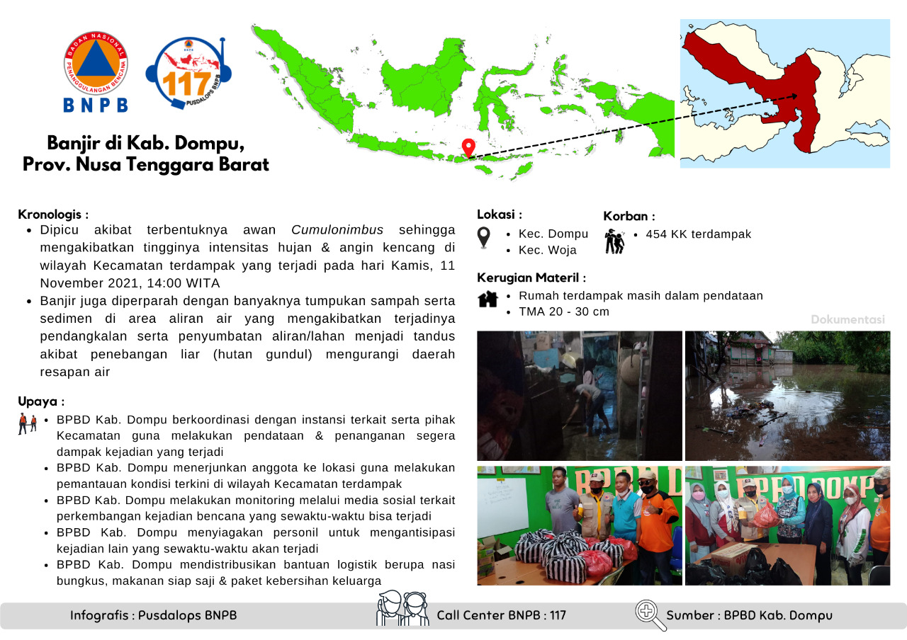
Floods in Kab. Dompu, Prov. West Nusa Tenggara
Chronology :
• Triggered by the formation of Cumulonimbus clouds resulting in high intensity of rain & strong winds in the affected District area which occurred on Thursday, 11 November 2021, 14:00 WITA
• Flooding is also exacerbated by the large pile of garbage and sediment in the watershed area which results in silting and blockage of flow/land becomes barren due to illegal logging (denuded forest) reducing water catchment areas
Location:
• Kec. Dompu
• Kec. Woja
Impacts:
• 454 HHs affected
Material Losses:
• Affected houses are still being collected
• Flood depth 20 - 30 cm
Effort :
• BPBD Kab. Dompu coordinates with relevant agencies and sub-districts to collect data & immediately handle the impact of events that occur
• BPBD Kab. Dompu dispatched members to the location to monitor the latest conditions in the affected sub-district
• BPBD Kab. Dompu conducts monitoring through social media regarding the development of disaster events that can occur at any time
• BPBD Kab. Dompu alerts personnel to anticipate other events that may occur at any time
• BPBD Kab. Dompu distributes logistical assistance in the form of packaged rice, ready-to-eat food & family hygiene packages
Source :
• BPBD Kab. Dompu
Informed By:
BNPB PUSDALOPS
Complaint Number / Call Center : 117 (Toll Free)
Instagram : pusdalops_bnpb
Twitter : @Bnpbpusdalops
Dead
Missing
Injured
Affected Person
Displaced