Affected Area/s
- Pahang
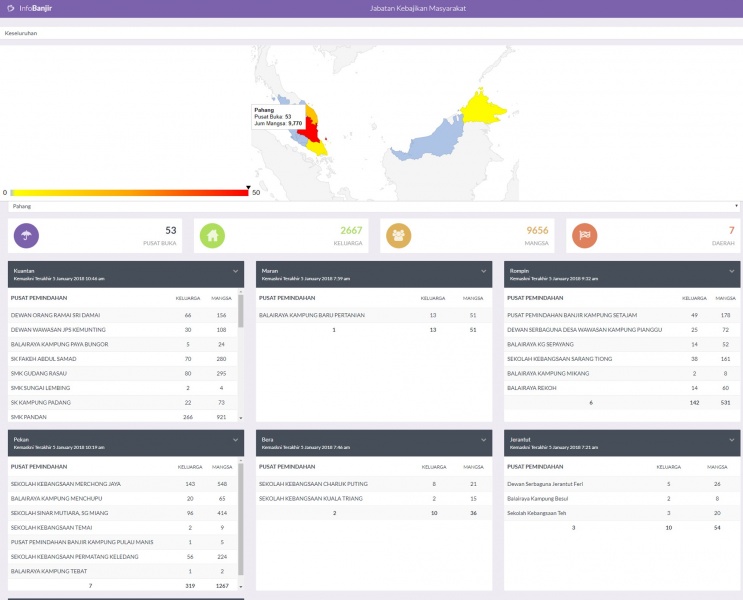
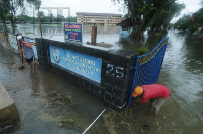
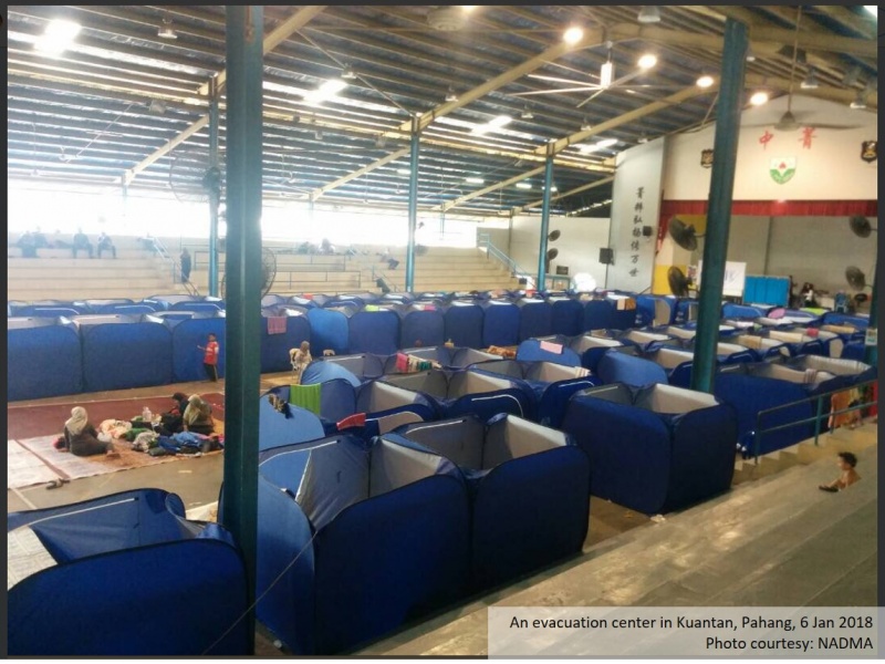
Initial report on Week 1 = National Disaster Management Agency of Malaysia (NADMA) reported significant flooding in State of Pahang, which started on 2 January 2018 08:52 local time. Six rivers in Pahang are on its highest alert level (red alert), i.e. Lepar River in Gelugor Bridge (30.08 m), Pahang River in Paloh Hinai (10.71 m), Pahang River in Sungai Yap Jeratut (52.48 m), Kuala Sungai Chini (14.97 m) and Sungai Belat in Sri Damai (5.84 m). In total, Seven municipalities are affected namely Kuantan, Maran, Rompin, Pekan, Bera, Jerantut and Lipis. As of 5 January 2018, 9656 people (2667 families) are affected and being evacuated to 53 evacuation centers in seven affected municipalities. It is also reported that two persons also died due to the flooding. The flooding also affected education activities as 21 schools remain closed during flooding period. NADMA and InfoBanjir Malaysia provide near-real time status of affected people and number of families and persons sheltered in each evacuation center.
Dead
Missing
Injured
Affected Person
Displaced