Affected Area/s
- Kelantan
= Update as of 7 December 2017 =
National Disaster Management Agency of Malaysia (NADMA) reported all evacuation sites in Kelantan have closed and all affected people returned to original dwellings.
= Update as of 6 December 2017 =
National Disaster Management Agency of Malaysia (NADMA) reported 1 evacuation site in Kelantan is still open, sheltering 32 IDPs of 8 families.
= Update as of 5 December 2017 =
National Disaster Management Agency of Malaysia (NADMA) reported 2,411 IDPs were still sheltered in evacuation sites. This include 864 familities in Pasir Puteh, 1,417 IDPs (551 familities) in Pasir Mas. The water level in major rivers of the state are still hazardous level.
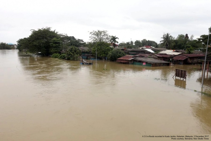
= Updates as of 3 December 2017 =
- Height of Sungai Golok, Kelantan, measured at 10.24 m (1.24 meter above its safe level).
- Number of evacuees have decreased to 10,903 at 41 flood relief center in five districts: Kota Baru, Pasir Mas, Tumpat, Pasir Putih and Tanah Merah.
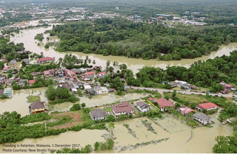
= Updates as of 2 December 2017 =
Sungai Golok in Rantau Panjang remains above its danger level, one week after the monsoon season flood wave hit Kelantan. According to Kelantan State Police Headquarter floods operation room, the major river was measured at 10.33 metres on 2 Dec 2017 morning
As for flood evacuees, the number stands at 13,738 people who are taking shelter at 60 relief centres state-wide; i.e. 9,236 evacuees in Pasir Mas, 3,302 in Tumpat, 814 in Pasir Puteh, 185 in Kota Baru, 101 in Tanah merah and 100 in Gua Musang.
Up to 17 major roads in the six affected districts are inundated and closed to traffic, with Pasir Mas and Tumpat being the worst affected.
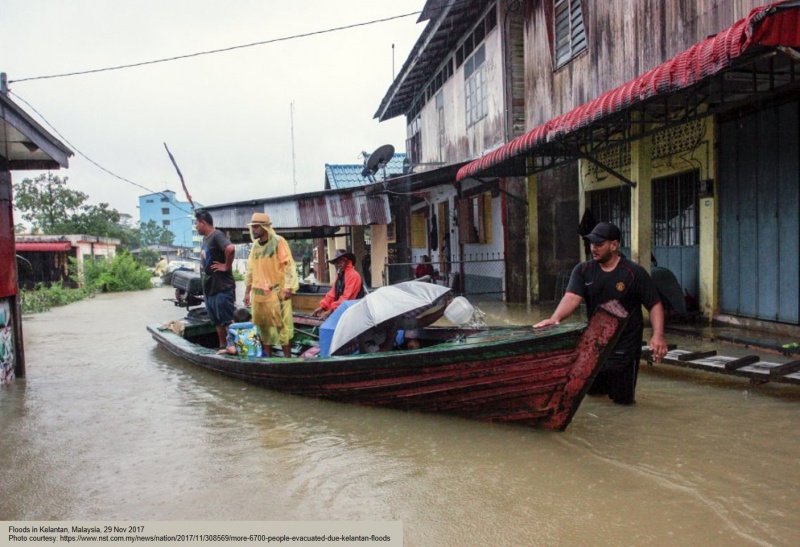
= Update as of 29 Nov 2017 =
The number of flood evacuees in Kelantan stands at 6,719 people as of 29 Nov 2017, 07.30 hrs local time.
The victims, from 2,052 families, are now seeking shelter at 97 relief centres in nine districts. Pasir Mas recorded the highest number of victims of 2,237, followed by Kota Baru (1301) and Tanah Merah (970). The other affected districts are Bachok, Jeli, Kuala Krai, Machang and Pasir Putih.
As of 29 Nov 2017, 07.30 hrs local time, the water level at Sungai Golok in Rantau Panjang was measured at 10.66m, which is 1.66m beyond its danger level of 9m. The water level at Sungai Golok in Jenob meanwhile was recorded at 23.52m (danger mark 23.50m).
News as of 28 Nov 2017
Flooding in Kelantan has worsened as the number of evacuees has doubled within the span of a few hours. A total of 319 flood victims have been evacuated as of 8.30pm compared to 157 at 6pm.
According to the state's online flood portal, the 319 from 90 families are now taking shelter at seven flood relief centres in four districts.
The affected districts were Tanah Merah, Pasir Putih, Pasir Mas and Kota Baru. The portal also stated that all the major rivers in Kelantan continue to increase following the non-stop heavy rain since Saturday but the levels have still not breached the dangerous mark. Heavy rain also caused seven roads – six in Machang and one in Kuala Krai – to be closed to all light traffic.
Dead
Missing
Injured
Affected Person
Displaced