Affected Area/s
- Sumatera Utara
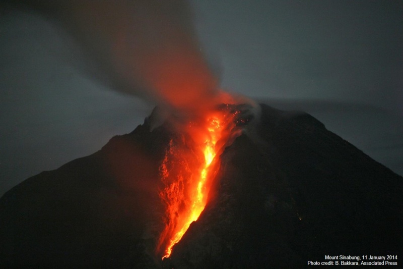
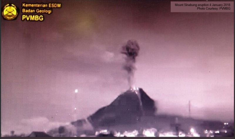
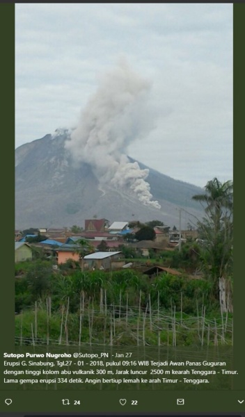
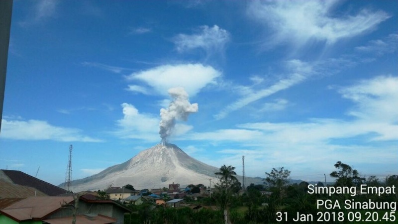
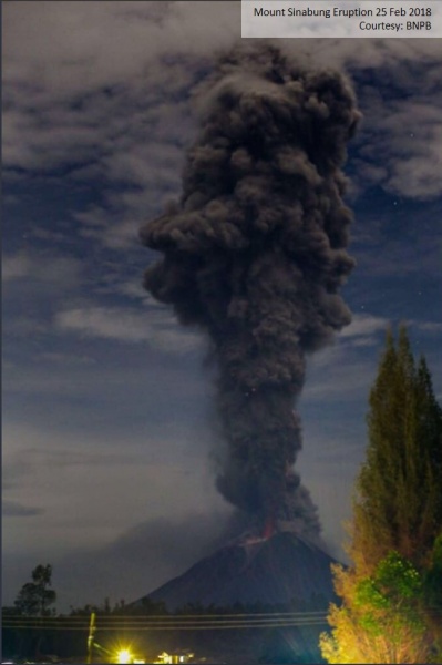
Update 6 April 2018 Mount Sinabung in Karo regency of North Sumatra province erupted again on Friday (6/4/2018) at 16.07 Wib. Eruption throws volcanic ash and pyroclastic material with strong pressure dark gray to as high as 5,000 meters. The eruption was also accompanied by a heat cloud as far as 3,500 meters to the Southeast- East and South-Southeast. There were no casualties from the eruption because in the danger zone area is already empty of community activities. People in the red zone have been displaced for a long time and some have been relocated. Status of Mount Sinabung remains Caution (level IV). PVMBG raises VONA to red. Volcanic activity remains high and there is the potential for subsequent eruptions. The eruption and the hot clouds that descend the slopes of Sinabung Mountain seemed to be a confirmation of the Sinabung mystery. The mystery that until now never revealed about when Sinabung will stop erupting. Currently some relocation sites have been built at the foot of Sinabung. As of March 2018, there are 30 relocation sites. The process of building houses in the location is varied, some are completed, but some are still proceeding to the completion of development. For example in Nang Belawan 2, as many as 341 houses have stood dashing. While in Surbakti 2, as many as 227 units of houses are being built with the construction process reached 63% until March 2018. The two locations of the expanse and the built house units are part of the post-disaster rehabilitation and reconstruction (RR) process of eruption or Sinabung eruption. BNPB in cooperation with BPBD North Sumatra Province, BPBD Karo District, the relevant Ministries / Institutions, and communities that carry out the construction of these houses. Stages of Relocation There are three stages of relocation for the post-disaster handling of this Sinabung eruption. The first phase, the fulfillment of relocation needs for 370 heads of families (KK) in Siosar coming from three villages namely Bekerah Village 112 KK, Sukameriah 128 KK, and Simacem 130 KK. In this location, besides the houses also built support facilities, public facilities, and social facilities for residents. The second phase, the fulfillment of the need for independent relocation for 1,655 families and 181 families of additional data coming from four villages namely Gurukinayan Village 778 KK, Kutatonggal 108 KK, Berastepu 611 KK and Gamber 158 KK. In this second phase, the community receives home funding and agricultural land support. The method used to build a house is an independent relocation spread over 22 stretches. Technically, the implementation of housing development is accompanied by Community-Based Settlement Rehabilitation and Reconstruction (Rekompak) from the Ministry of PUPR. As of March 2018, 1,170 houses were built and 485 other houses were still under construction. The third stage is the construction of infrastructure of supporting facilities at the completed self relocation site in the second phase and the clearing of the 3rd phase relocation land in Siosar for approximately 1,098 families who are still in the process of establishing verification by name by address. The residents will be relocated from Sigarang-garang village, Sukanalu village, Mardinding village and Lau Kawar hamlet. Challenges of Relocation Mount Sinabung keeps the mystery, that is when this volcano will stop erupting. Scientifically, the phenomenon of the continuous eruption of Sinabung after a long period of sleep has something to do with a large sequence of earthquakes occurring in subduction zones around the island of Sumatra. Researchers Matteo Lupi and Stephen Miller in his research in the Journal of Solid Earth concluded that the earthquakes that occurred in Sumatra, Aceh 2004, Nias 2005, and Mentawai 2010 have triggered another earthquake in Sumatra mainland. As a result stress (stress) that had been pressing and enclosing the magic kitchen Sinabung weakened. This weakening of the magma‘ kitchen enclosure causes the magma to migrate upward through the newly formed cracks until it finally erupts. A mountain will stop erupting when magma pressure is no longer able to push the magma out to the surface of the earth. On Mount Sinabung, there is still this magma pressure, as evidenced by the presence of deep and shallow volcanic earthquakes around the mountain as well as eruptions that continue to occur. This phenomenon explains why Mount Sinabung continues to erupt since 2010 and never stopped. This happens because Sinabung is looking for a new balance, so it is very difficult to predict when the eruption will end. In this year, on February 19, 2018, Sinabung‘ return erupts. With Sinabung continuously erupting and unpredictable when it will end, disaster mitigation efforts, especially the RR process at this location experience its own challenges. Implementation of the RR is conducted simultaneously and during the emergency response period. The implication is that RR efforts should also pay attention to the activities undertaken during the emergency, namely the fulfillment of basic needs such as clean water and logistics for people who have to evacuate because they live in danger zone. In addition, the damage and losses caused by the eruption Sinabung also continue to change. As a result the temporary calculation of damage and losses due to eruption of Mount Sinabung also changing. From September 2013 to May 2015 estimated damage and losses reached Rp1, 80 trillion. Consists of damage value of Rp 578.99 billion and loss value of Rp 1.23 trillion. The biggest damage and losses occur in the productive economic sector which includes agriculture, plantation, animal husbandry, trade, tourism, fisheries, SME and industry amounting to more than Rp 1.14 trillion. Next damage and losses in the housing sector amounted to Rp 505.9 billion, infrastructure Rp 83.93 billion, social Rp 53.43 billion and cross-sector of Rp 18.26 billion. Lessons from the RR Process Responding to the mystery of Sinabung mentioned above, then there are some things that should be the attention of the government and people living around Sinabung Mountain. BPBD and related agencies to keep guard at the entrance to the red zone where no activity should be in accordance with the recommendations of PVMBG. BNPB and BPBD in order to always be ready to cope if in case of displacement due to Sinabung eruption. BNPB and BPBD to continue to seek relocation and fulfillment of the needs of people who have to evacuate because they can not return to their homes. BPBD Karo District also to continue to socialize secondary threats from Mount Agung such as rain lava flood. From the side of society, then there are some preparations that can be done. Among these are the preparation of disaster preparedness masks and bags that contain various needs and important documents that are easy to carry when Sinabung erupts at any time. In the rainy season, people who live and move near the river that heads in the mount Sinabung agat remain alert to the threat of lava flood. Community knowledge about the dangers of volcano eruption also needs to be improved, including adaptation efforts that can be done. For example, the design of the house that adjusts the threat of ash rain, so it is not dangerous and easy to clean. Further provision and preparation of drinking water reserves if existing channels and supplies are disrupted by lava flood or impacted by eruption. In terms of disaster management, the eruption of Sinabung that occurred after a long period of inactivity showed similar phenomena can also occur in other mountains in Indonesia which amounted to 127 pieces. Therefore, the government, society, and the business world should not be negligent and must always be ready to face the risk of this volcano disaster. Especially for RR efforts, then what is done in Sinabung re-affirms that every disaster management effort is unique. This happens because each region has different local wisdom and different capacities, so special adjustments and approaches are adapted to the characteristics of the area. In this case, each local government has its own authority and policy in dete
Dead
Missing
Injured
Affected Person
Displaced