Philippines, Bulusan Volcano Eruption (Region V)
Apr 28, 2025 03:36
May 03, 2025 13:00
Location
Coordinate:
12.853925700047, 123.9290189416
Administrative:
Sorsogon, Philippines
Affected Area:
Sorsogon
Hazard
Main : Volcano- Alert Level = -
- Eruption Radius (km) = -
- Volcanic Cloud Height (masl) = -
Description
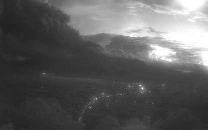
On 28 April 2025 at 04:36 AM, a phreatic eruption occurred from the summit crater of Bulusan Volcano and lasted 24 minutes based on seismic and infrasound records. The incident produced a bent plume that rose 4,500 meters above the crater before drifting west to southwest. Ashfall was reported in Brgys. Cogon and Bolos, Irosin, Brgys. Puting Sapa, Guruyan, and Buraburan, Juban, and Brgy. Tulatula Sur, Magallanes, Sorsogon Province. A pyroclastic density current (PDC) or “uson” descended the southwestern slopes and travelled within three (3) kilometers from the summit vent. Prior to the eruption, a total of fifty-three (53) volcanic earthquakes were recorded over the 24-hour period yesterday. Rumbling sounds were reported by local government officials approximately 15 minutes before the eruption and were recorded by infrasound sensors.
Alert Level 1 status is now raised over Bulusan Volcano, which means that the volcano is currently in a state of low-level unrest with chances of phreatic eruptions succeeding this morning’s event.
Alert Level 1 status is now raised over Bulusan Volcano, which means that the volcano is currently in a state of low-level unrest with chances of phreatic eruptions succeeding this morning’s event.
Impact Statistic
0
Dead
0
Missing
0
Injured
142.7K
Affected Person
278
Displaced
External Video
News
Human SADDD
- Dead -
- Missing -
- Injured -
- Affected Person 142,734
- Affected Family 30,276
- Internaly Displaced People -
- Refugees -
- Evacuation Center (in Country) -
- Evacuation Center (out Of Country) -
House
- Affected Houses -
- Damage Partial -
- Totally Damage -
Infrastructure
- Bridges -
- Number of Roads -
- Road Distance (km) -
Public
- Schools -
- Health -
- Government Office / Public Facilities -
- Settlements -
- Worship Places -
- Others -
General
Cost
- Local Currency -
- Cost of Damages 898,740.00
- Cost of Damages (USD) 16,191.00
- Cost of Assistance 26,200,348.00
- Cost of Assistance (USD) 471,993.00
Agricultural
- Rice Field -
- Other Crops -
- Fish Ponds -
- Cattle -
- Poultries -
- Livestock -
Relevant Disasters
The ASEAN Disaster Information Network (ADINet) is a repository of information concerning hazards and disasters that have happened in the region. The platform is open for public, which means that the public can submit information about any hazard and disaster to the AHA Centre. Thereafter, the AHA Centre will verify and validate any submitted information to ensure the accuracy of the data inputs. The AHA Centre can also add new information when relevant and as necessary. ADINet has been recording disaster information in the region since the AHA Centre was operational in 2012.

Supported by :