Indonesia, Flood in West Sumatra Province
Oct 09, 2018 00:00
Sep 27, 2026 15:17
Location
Coordinate:
-0.613507, 100.430116
Administrative:
Sumatera Barat, Indonesia
Affected Area:
Hazard
Main : Flood- Inundated Area (km) = fill value here
- Maximum Flood Depth (cm) = fill value here
Description
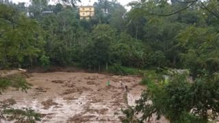
Some cities and regencies in West Sumatra Province were flooded and with some locations experience landslide between 9-11 October. In Pasaman regency, flood occurred on 9 October at around 23.30 hrs local time. Ministry of health reported that around 80 families / 320 people were affected. A school building and 80 houses were also submerged. Some areas in West Pasaman Regency also experienced landslides and floods on Thursday (11/10/2018) at 7:30 p.m. The areas that were affected by the disaster were Pasaman Subdistrict, Ranatan Batan, Koto Balingka, Sei Beremas, Melintang Valley, Mount Tuleh, Talamau, Sasak and Kinali. The victim of 1 person died and 2 people disappeared. Damage included about 500 units of houses submerged in floods, 3 units of suspension bridges collapsed and 2 units of houses washed away. BPBD Kab. Pasaman Barat together with other authorities carried out emergency handling. BPBD distributes logistical assistance to affected victims. Urgent need for heavy equipment, basic necessities, blankets and clothing. The Regent has set an emergency response period of 7 days (11-17 / 10/2018). In Tanah Datar Regency, a flash flood occured on 11 October, 1830 hrs local time. Three people were reported missing and 14 other injured. Five houses were destroyed. In Solok Regency, a major flood also occured on 11 October 2000 hrs local time. Hiliran Gumanti District was most affected. A total of 308 families and 1139 people were affected. In addition 1 health centre also destroyed. There were no fatalities in Solok Regency. In Padang Pariaman Regency, the heavy rain also caused a landslide in Enam Lingkung District. It resulted in fatalities of 3 people with other 3 injured.
Impact Statistic
4
Dead
5
Missing
17
Injured
4K
Affected Person
0
Displaced
Human SADDD
- Dead 4
- Missing 5
- Injured 17
- Affected Person 4,049
- Affected Family 910
- Internaly Displaced People -
- Refugees 0
- Evacuation Center (in Country) -
- Evacuation Center (out Of Country) 0
House
- Affected Houses 820
- Damage Partial 0
- Totally Damage 7
Infrastructure
- Bridges 3
- Number of Roads 0
- Road Distance (km) 0.00
Public
- Schools 1
- Health 1
- Government Office / Public Facilities 0
- Settlements 0
- Worship Places 0
- Others 0
General
Cost
- Local Currency 0.00
- Cost of Damages 0.00
- Cost of Damages (USD) -
- Cost of Assistance 0.00
- Cost of Assistance (USD) -
Agricultural
- Rice Field 0.00
- Other Crops 0.00
- Fish Ponds 0
- Cattle 0
- Poultries 0
- Livestock 0
Relevant Disasters
The ASEAN Disaster Information Network (ADINet) is a repository of information concerning hazards and disasters that have happened in the region. The platform is open for public, which means that the public can submit information about any hazard and disaster to the AHA Centre. Thereafter, the AHA Centre will verify and validate any submitted information to ensure the accuracy of the data inputs. The AHA Centre can also add new information when relevant and as necessary. ADINet has been recording disaster information in the region since the AHA Centre was operational in 2012.

Supported by :