Cambodia, Storm in Oddar Meanchey
Mar 08, 2018 20:06
Sep 27, 2026 15:17
Location
Coordinate:
12.60985, 103.594179
Administrative:
Batdâmbâng, Cambodia
Affected Area:
Otdar Mean Chey
Hazard
Main : Severe Local Storm- Precipitation (mm) = fill value here
Description
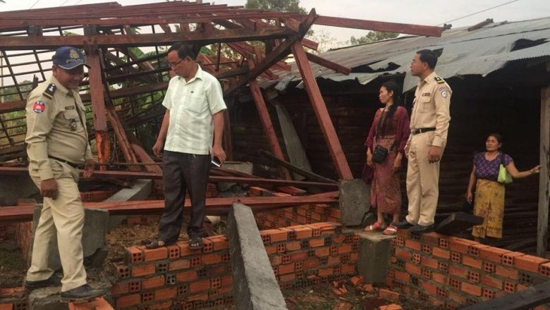
Initial report from the Phnom Penh Post = A fierce storm in Oddar Meanchey province damaged over 100 houses across five villages, and left two women injured on Monday evening, 5 March 2018. Un Sopheak, Samrong town governor, said that 50 of the homes were completely destroyed, while 67 more sustained severe damage to their roofs. “At this moment, 55 joint authority forces have intervened and deconstructed the damaged and collapsed houses so that they can repair them for the people … Authority forces are preparing a makeshift settlement,” Sopheak added. The Ministry of Meteorology and Water Resources issued an announcement on Monday warning that heavy rains and storms would continue across seven provinces in northern Cambodia from March 6 to 9. Koh Kong, Kampong Speu, Pursat, Battambang, Pailin, Banteay Meanchey and Siem Reap are all expected to be affected. However, Keo Vy, spokesman for the National Committee for Disaster Management, said the rains began March 3. Vy said at least 133 houses and two schools have been damaged in Battambang, Pailin and Oddar Meanchey so far.
Impact Statistic
0
Dead
0
Missing
2
Injured
665
Affected Person
0
Displaced
Human SADDD
- Dead -
- Missing -
- Injured 2
- Affected Person 665
- Affected Family 133
- Internaly Displaced People -
- Refugees 0
- Evacuation Center (in Country) -
- Evacuation Center (out Of Country) 0
House
- Affected Houses 133
- Damage Partial 78
- Totally Damage 50
Infrastructure
- Bridges 0
- Number of Roads 0
- Road Distance (km) 0.00
Public
- Schools 2
- Health -
- Government Office / Public Facilities 0
- Settlements 0
- Worship Places 0
- Others 0
General
Cost
- Local Currency 0.00
- Cost of Damages 0.00
- Cost of Damages (USD) -
- Cost of Assistance 0.00
- Cost of Assistance (USD) -
Agricultural
- Rice Field 0.00
- Other Crops 0.00
- Fish Ponds 0
- Cattle 0
- Poultries 0
- Livestock 0
Relevant Disasters
The ASEAN Disaster Information Network (ADINet) is a repository of information concerning hazards and disasters that have happened in the region. The platform is open for public, which means that the public can submit information about any hazard and disaster to the AHA Centre. Thereafter, the AHA Centre will verify and validate any submitted information to ensure the accuracy of the data inputs. The AHA Centre can also add new information when relevant and as necessary. ADINet has been recording disaster information in the region since the AHA Centre was operational in 2012.

Supported by :