Vietnam - Floods in Northwestern provinces
Jun 26, 2018 11:47
Sep 27, 2026 15:17
Location
Coordinate:
22.328046, 103.173676
Administrative:
Lai Châu, Viet Nam
Affected Area:
Hà Giang, Lai Châu, Lào Cai, Quảng Ninh
Hazard
Main : Flood- Inundated Area (km) = fill value here
- Maximum Flood Depth (cm) = fill value here
Description
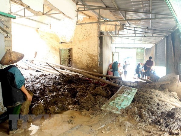
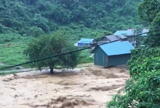
Update = Flash floods and landslides triggered by downpours in the past days had left 23 dead and 10 missing in the northern mountainous provinces, mainly in Lai Chau and Ha Giang. = Initial report = Of the victims, 16 deaths and 9 missing victims were in Lai Chau province, five deaths in Ha Giang, one death each in Quang Ninh and Lao Cai, and one missing person in Dien Bien, reported the Standing Office of the Central Steering Committee for Natural Disaster Prevention and Control. Floods also pulled down or swept away 161 houses, damaged 958 homes and submerged 1,800 others. In addition, more than 1,500 hectares of rice and crops were inundated or destroyed, while nearly 600 hectares of aquaculture were damaged and 738 cattle heads and over 13,800 poultry were killed. Total damage was estimated at nearly 500 billion VND (around 21.8 million USD). The same day, the Ministry of Agriculture and Rural Development launched a fundraising campaign to support the flood and landslide victims in northern provinces. According to the MARD Minister Nguyen Xuan Cuong, the proceeds, along with donations from the ministry’s labour union, will be promptly distributed to the provinces, helping people stabilise their lives and recover production. Heavy rains from June 23 to 26 had sparked floods and landslides in many areas in the northern mountainous provinces of Ha Giang and Lai Chau. Some areas reported rainfalls of over 500mm. Prime Minister Nguyen Xuan Phuc has issued a dispatch asking relevant ministries, sectors and localities to focus resources on search and rescue along with activities to overcome flood consequences in the affected localities.-VNA
Impact Statistic
23
Dead
10
Missing
16
Injured
14.1K
Affected Person
0
Displaced
Human SADDD
- Dead 23
- Missing 10
- Injured 16
- Affected Person 14,095
- Affected Family 2,919
- Internaly Displaced People -
- Refugees 0
- Evacuation Center (in Country) -
- Evacuation Center (out Of Country) 0
House
- Affected Houses 2,919
- Damage Partial 958
- Totally Damage 161
Infrastructure
- Bridges 0
- Number of Roads 0
- Road Distance (km) 0.00
Public
- Schools -
- Health -
- Government Office / Public Facilities 0
- Settlements 0
- Worship Places 0
- Others 0
General
Cost
- Local Currency 0.00
- Cost of Damages 0.00
- Cost of Damages (USD) 2,100,000.00
- Cost of Assistance 0.00
- Cost of Assistance (USD) -
Agricultural
- Rice Field 1,500.00
- Other Crops 600.00
- Fish Ponds 0
- Cattle 738
- Poultries 13,800
- Livestock 14,538
Relevant Disasters
The ASEAN Disaster Information Network (ADINet) is a repository of information concerning hazards and disasters that have happened in the region. The platform is open for public, which means that the public can submit information about any hazard and disaster to the AHA Centre. Thereafter, the AHA Centre will verify and validate any submitted information to ensure the accuracy of the data inputs. The AHA Centre can also add new information when relevant and as necessary. ADINet has been recording disaster information in the region since the AHA Centre was operational in 2012.

Supported by :