VERIFIED
 
CLOSED

Viet Nam, Floods in Hanoi

Thanh Hóa, Viet Nam
Event Date : Tue, 31 Jul 2018 | Disaster : Flood (1)
AHADID : AHA-FL-2018-000212-VNM | GLIDE Number :

Affected Area/s

  • Long Biên
  • Thanh Xuân
  • Ứng Hòa
  • Bắc Từ Liêm
  • Ba Đình
  • Ba Vì
  • Cầu Giấy
  • Đan Phượng
  • Chương Mỹ
  • Đống Đa
  • Đông Anh
  • Gia Lâm
  • Hà Đông
  • Hai Bà Trưng
  • Hoài Đức
  • Hoàn Kiếm
  • Hoàng Mai
  • Nam Từ Liêm
  • Mỹ Đức
  • Mê Linh
  • Phú Xuyên
  • Phúc Thọ
  • Quốc Oai
  • Sóc Sơn
  • Thanh Trì
  • Sơn Tây
  • Tây Hồ
  • Thạch Thất
  • Thanh Oai
  • Thường Tín

Description

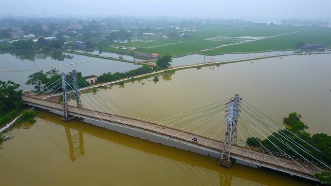
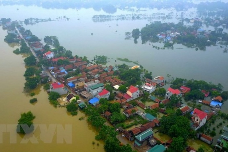
Viet Nam Disaster Management Authority (VDMA) / CCNDPC reported flooding in Hanoi, across Chuong My, Quoc Oai, and Thach That districts. The flooding was caused due to discharge from Bui and Tich River, which at its peak reached 7.52 m (or 1 m higher than third warning level). At least 14000 families have been temporarily displaced due to the inundation area. Many construction, transportation and irrigation works suffered heavy damages. At least 1300 ha rice fields, 260 ha vegetables fields, and 555 ha of aquaculture areas were damaged. Around 3 km of roads, 9,400 canals and 33 bridges were also damaged. Hanoi city authority has provided 10000 sand bags and undertaking various measures to strengthen the embankment. They have also provided relief items to the affected population.

Highest Impact

0

Dead

0

Missing

0

Injured

51.2K

Affected Person

51.2K

Displaced

Click to activate or deactivate legend

Related Event