Viet Nam, Flooding in Lao Cai
Jul 05, 2021 07:00
Sep 27, 2026 15:18
Location
Coordinate:
22.36451891584, 104.1127958519
Administrative:
Lào Cai, Viet Nam
Affected Area:
Lào Cai
Hazard
Main : Flood- Inundated Area (km) = fill value here
- Maximum Flood Depth (cm) = fill value here
Description
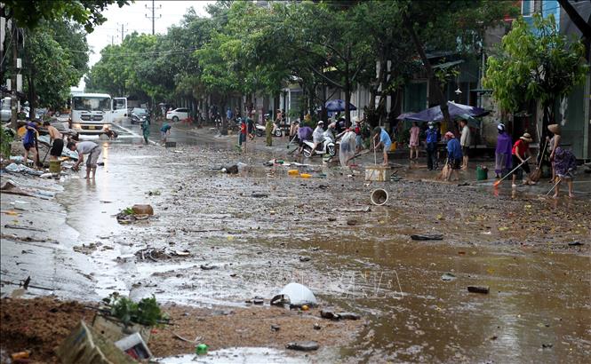
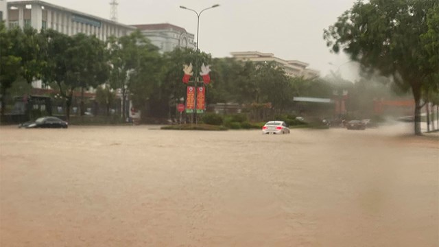
According to the Hydrometeorological Station of Lao Cai province, on the morning of July 5, due to the influence of the low pressure trench with an axis passing through the North, combined with the impact of the high-altitude wind convergence area, the province had heavy rainfall and thunderstorms. Torrential rain in Lao Cai city (Lao Cai province) throughout the night and lasted until early this morning has submerged many roads and streets and caused hundreds of households to fall into flood.
According to statistics, some places have moderate - heavy rain such as: Ta Cu Ty commune (Bac Ha); Nam Chay commune (Muong Khuong); Coc Le ward (Lao Cai city); Quang Kim commune (Bat Xat); Bat Xat town. Nam Cuong Ward (Lao Cai City) had very heavy rainfall.
Due to heavy rain in a short time period, rainwater could not be drained in time and flooded dozens of households in the area, causing flooding from 15 to 35 cm, in particular, on Le Thanh road (Bac Cuong ward), the rainwater was flooded from 50 to 80 cm deep, with points over 80 cm, causing local traffic jams, affecting the houses and properties of about 50 households.
Impact Statistic
0
Dead
0
Missing
0
Injured
250
Affected Person
0
Displaced
Human SADDD
- Dead -
- Missing -
- Injured -
- Affected Person 250
- Affected Family 50
- Internaly Displaced People -
- Refugees -
- Evacuation Center (in Country) -
- Evacuation Center (out Of Country) -
House
- Affected Houses 50
- Damage Partial -
- Totally Damage -
Infrastructure
- Bridges -
- Number of Roads -
- Road Distance (km) -
Public
- Schools -
- Health -
- Government Office / Public Facilities -
- Settlements -
- Worship Places -
- Others -
General
Cost
- Local Currency 0.00
- Cost of Damages -
- Cost of Damages (USD) -
- Cost of Assistance -
- Cost of Assistance (USD) -
Agricultural
- Rice Field -
- Other Crops -
- Fish Ponds -
- Cattle -
- Poultries -
- Livestock -
Relevant Disasters
The ASEAN Disaster Information Network (ADINet) is a repository of information concerning hazards and disasters that have happened in the region. The platform is open for public, which means that the public can submit information about any hazard and disaster to the AHA Centre. Thereafter, the AHA Centre will verify and validate any submitted information to ensure the accuracy of the data inputs. The AHA Centre can also add new information when relevant and as necessary. ADINet has been recording disaster information in the region since the AHA Centre was operational in 2012.

Supported by :