Viet Nam, Flooding and Landslide in Quang Nam, Quang Ngai, Binh Dinh, Phu Yen, Kon Tum
Nov 29, 2021 20:02
Sep 27, 2026 15:19
Location
Coordinate:
14.121256418989, 108.9513067704
Administrative:
Bình Định, Viet Nam
Affected Area:
Bình Định
Hazard
Main : Flood- Inundated Area (km) = fill value here
- Maximum Flood Depth (cm) = fill value here
Description
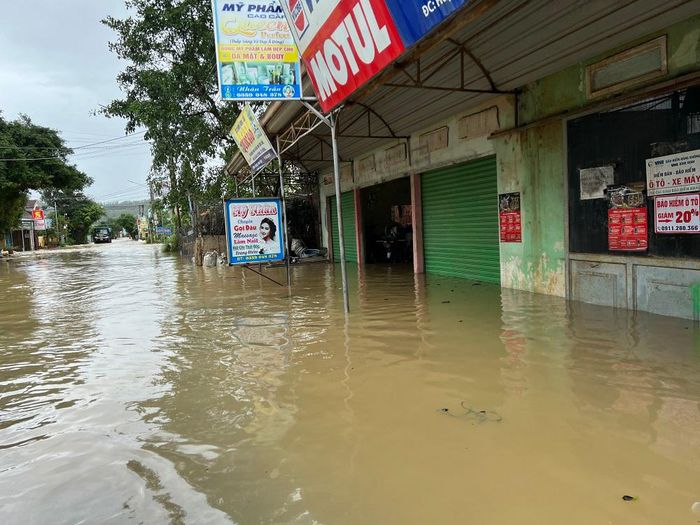
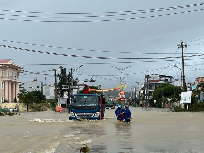
Flooding began after heavy rain from 26 November. Vietnam Disaster management Agency (VDMA), said heavy rain, flooding and landslides have affected the provinces of Quang Nam, Quang Ngai, Binh Dinh, Phu Yen and Kon Tum, with 2,617 houses damaged and 2 fatalities.
As of 01 December, VDMA reported 18 fatalities or missing across the provinces of Binh Dinh (03), Phu Yen (10), Khanh Hoa (02), Kon Tum (01) and Dak Lak (02).
Furthermore almost 60,000 houses have been flooded in Binh Dinh (31,100) and Phu Yen (28,639). Some areas of Tuy Phuoc District in Binh Dinh Province were under water up to 1.2 metres deep. Around 66,000 students in the province could not go to school due to the floods.
Over 6,000 households have been evacuated due to floods or landslides in the provinces of Quang Nam (53 households), Binh Dinh (439), Phu Yen (5,517) and Khanh Hoa (21).
Roads, including several national highways, have been cut by flooding or landslides. Wide areas of agriculture along with livestock have suffered damage.
As much as 432 mm of rain fell in 24 hours to 29 November in Song Tranh in Quang Nam. The folllwing 24 hour period My Thuan Lake in Binh Dinh saw 368 mm and Ea Bar in Phu Yen 429 mm. The National Centre for Hydro-Meteorological Forecasting reported flooding along the Côn river in Binh Dinh, the Ky Lo river in Phu Yen, and the Krong Ana river in Dak Lak. Further rain is expected in central areas.
Impact Statistic
18
Dead
0
Missing
0
Injured
298.7K
Affected Person
30.2K
Displaced
Human SADDD
- Dead 18
- Missing -
- Injured -
- Affected Person 298,695
- Affected Family 59,739
- Internaly Displaced People 30,150
- Refugees -
- Evacuation Center (in Country) -
- Evacuation Center (out Of Country) -
House
- Affected Houses 59,739
- Damage Partial 2,617
- Totally Damage -
Infrastructure
- Bridges -
- Number of Roads -
- Road Distance (km) -
Public
- Schools -
- Health -
- Government Office / Public Facilities -
- Settlements -
- Worship Places -
- Others -
General
Cost
- Local Currency 0.00
- Cost of Damages -
- Cost of Damages (USD) -
- Cost of Assistance -
- Cost of Assistance (USD) -
Agricultural
- Rice Field -
- Other Crops -
- Fish Ponds -
- Cattle -
- Poultries -
- Livestock -
Relevant Disasters
The ASEAN Disaster Information Network (ADINet) is a repository of information concerning hazards and disasters that have happened in the region. The platform is open for public, which means that the public can submit information about any hazard and disaster to the AHA Centre. Thereafter, the AHA Centre will verify and validate any submitted information to ensure the accuracy of the data inputs. The AHA Centre can also add new information when relevant and as necessary. ADINet has been recording disaster information in the region since the AHA Centre was operational in 2012.

Supported by :