Viet Nam, Flood and Landslide in Quang Ninh
Sep 08, 2015 01:00
Sep 27, 2026 15:11
Location
Coordinate:
20.469797, 107.021913
Administrative:
Quảng Ninh, Viet Nam
Affected Area:
Quảng Bình
Hazard
Main : Flood- Inundated Area (km) = fill value here
- Maximum Flood Depth (cm) = fill value here
Description
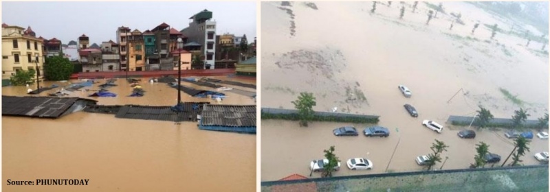
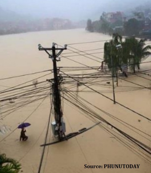
On 29 July 2015, the Viet Nam Central Steering Committee for Natural Disaster Prevention and Control reported flooding in the Quang Ninh Province. On early August, the flooding has expanded to the northern provinces including Ha Giang,Dien Bien, Tuyen Quang, Thai Nguyen, Bac Giang, Lang Son, Lai Chau, Cao Bang, Yen Bai, Lao Cai, Bac Kan, Son La, Thanh Hoa and Thai Binh. IMPACT - 32 death, 24 injured and 6 missing (including 17 death in Quang Ninh) - About 4,556 families or 18,224 people were affected - 7,735 houses were damaged - at least 20,000 ha of crops were submerged RESPONSE - The government lead the emergency response. - SAR and evacuation have been conducted by the government. - Relief items have been distributed to the victims. 17 people have died with 8 others injured due to torrential rain, floods and landslides that happen in Quang Ninh Province since 26 July 2015. The events have also caused fully destruction to 19 houses and submerged 3,700 houses, 1,065 ha of rice and vegetables plantation fields, as well as disruptions to number of aquacultures and roads. There are also reports of seven missing fishermen who were on two fishing vessels exposed by strong wind and high waves. In other provinces of Cao Bang and Hai Pong, the heavy downpour have also inundated numerous houses, farms and roads. The Viet Nam Central Steering Committee for Natural Disaster Prevention and Control sent a team to check the flood prevention measures and coordinate the remedial actions in the affected areas. Local leaders in Quang Ninh province have been assigned to lead the response to the events in coordination with the Military, including doing evacuation and rescuing victims.
Impact Statistic
32
Dead
6
Missing
24
Injured
18.2K
Affected Person
0
Displaced
Human SADDD
- Dead 32
- Missing 6
- Injured 24
- Affected Person 18,224
- Affected Family 4,556
- Internaly Displaced People -
- Refugees 0
- Evacuation Center (in Country) -
- Evacuation Center (out Of Country) 0
House
- Affected Houses 7,735
- Damage Partial 0
- Totally Damage 7,735
Infrastructure
- Bridges 0
- Number of Roads 0
- Road Distance (km) 0.00
Public
- Schools -
- Health -
- Government Office / Public Facilities 0
- Settlements 0
- Worship Places 0
- Others 0
General
Cost
- Local Currency 0.00
- Cost of Damages 0.00
- Cost of Damages (USD) -
- Cost of Assistance 0.00
- Cost of Assistance (USD) -
Agricultural
- Rice Field 0.00
- Other Crops 20,000.00
- Fish Ponds 0
- Cattle 0
- Poultries 0
- Livestock 0
Relevant Disasters
The ASEAN Disaster Information Network (ADINet) is a repository of information concerning hazards and disasters that have happened in the region. The platform is open for public, which means that the public can submit information about any hazard and disaster to the AHA Centre. Thereafter, the AHA Centre will verify and validate any submitted information to ensure the accuracy of the data inputs. The AHA Centre can also add new information when relevant and as necessary. ADINet has been recording disaster information in the region since the AHA Centre was operational in 2012.

Supported by :