Viet Nam, Flash Flood and Landslide in northern provinces
Jun 24, 2018 12:28
Sep 27, 2026 15:17
Location
Coordinate:
19.706273, 104.560975
Administrative:
Lai Châu, Viet Nam
Affected Area:
Lai Châu
Hazard
Main : Flood- Inundated Area (km) = fill value here
- Maximum Flood Depth (cm) = fill value here
Description
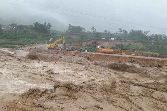
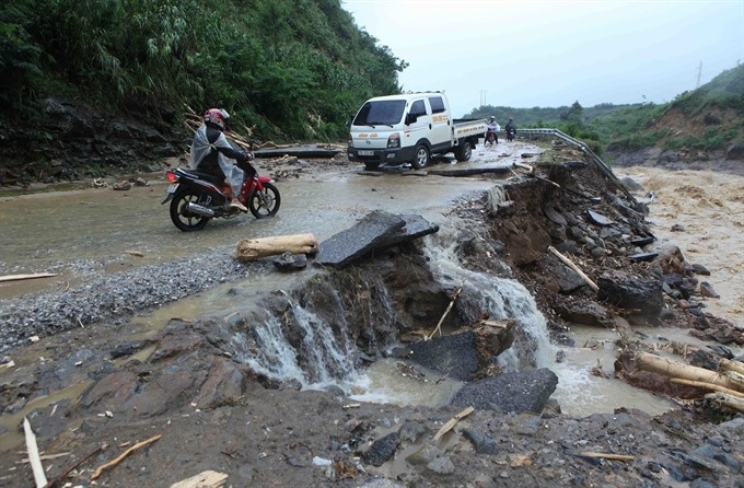
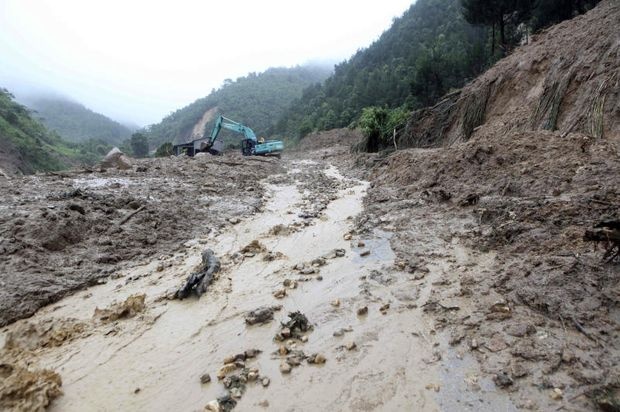
Viet Nam Disaster Management Authority (VDMA) reported flash flood and landslides in Lai Chau, Ha Giang and Lao Chai Provinces on 23-24 June 2018. At least three people have died, three are missing and five others have been injured in Lai Châu Province, according to provincial authorities. Director of the province’s Department of Agriculture and Rural Development, Hà Văn Um said the damage reached its peak at 2pm yesterday in the districts of Than Uyên and Mường Tè. More than 40ha of rice and others crops were completely destroyed by floods in the two districts. Rains and floods had damaged many roads and caused traffic jams on national roads 4D and 12, and landslides halted traffic in Tam Dương District. Floods also swept away a bridge in Than Uyen District and two irrigation plants in Muong Te District as well as crops, with total damage initially estimated at more than VNĐ20 billion (US$873,000). In Lao Cai Province, there were no casualties. However, dozens of houses and about 30 ha of rice had been destroyed.
Impact Statistic
7
Dead
12
Missing
0
Injured
4.2K
Affected Person
400
Displaced
Human SADDD
- Dead 7
- Missing 12
- Injured -
- Affected Person 4,153
- Affected Family 831
- Internaly Displaced People 400
- Refugees 0
- Evacuation Center (in Country) -
- Evacuation Center (out Of Country) 0
House
- Affected Houses 400
- Damage Partial 0
- Totally Damage 400
Infrastructure
- Bridges 0
- Number of Roads 0
- Road Distance (km) 0.00
Public
- Schools -
- Health -
- Government Office / Public Facilities 0
- Settlements 0
- Worship Places 0
- Others 0
General
Cost
- Local Currency 0.00
- Cost of Damages 20,000,000,000.00
- Cost of Damages (USD) 873,000.00
- Cost of Assistance 0.00
- Cost of Assistance (USD) -
Agricultural
- Rice Field 40.00
- Other Crops 0.00
- Fish Ponds 0
- Cattle 0
- Poultries 0
- Livestock 0
Relevant Disasters
The ASEAN Disaster Information Network (ADINet) is a repository of information concerning hazards and disasters that have happened in the region. The platform is open for public, which means that the public can submit information about any hazard and disaster to the AHA Centre. Thereafter, the AHA Centre will verify and validate any submitted information to ensure the accuracy of the data inputs. The AHA Centre can also add new information when relevant and as necessary. ADINet has been recording disaster information in the region since the AHA Centre was operational in 2012.

Supported by :