Viet Nam, Effect of Storm VAMCO
Oct 16, 2015 03:00
Sep 27, 2026 15:11
Location
Coordinate:
15.142723, 108.84015
Administrative:
Quảng Ngãi, Viet Nam
Affected Area:
Hazard
Main : Severe Local Storm- Precipitation (mm) = fill value here
Description
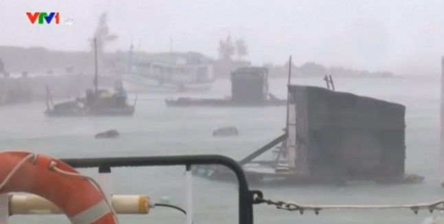
Tropical Storm VAMCO (Typhoon No.3 in Viet Nam), which developed 13 September 2015, has weakened and eventually dissipated on 15 September 2015. The Government of Viet Nam, in their initial assessment report, mentioned damages to the properties and agricultures in Danang City and Provinces of Ha Tinh, Quang Ngai, Quang Nam, Quang Binh, Binh Dinh, Hoa Binh, Phu Tho, Thanh Hoa and Nghe An as a result of the heavy rains. The impact of Storm Vamco is as follows IMPACT - 12 death - 1 missing - 4 injured - 4,231 houses were damaged and inundated - at least 15,000 ha of agricultural lands were affected (as reported by the affected provinces) - fisheries were also affected RESPONSE - The national and local government have taken several actions to raise public awareness on the potential damage and risks. The actions included issuing alerts for the public, monitoring the water level of rivers and dams, and instructing fisherfolks to anchor their boats.
Impact Statistic
12
Dead
1
Missing
4
Injured
21.2K
Affected Person
0
Displaced
Human SADDD
- Dead 12
- Missing 1
- Injured 4
- Affected Person 21,155
- Affected Family 4,231
- Internaly Displaced People -
- Refugees 0
- Evacuation Center (in Country) -
- Evacuation Center (out Of Country) 0
House
- Affected Houses 0
- Damage Partial 0
- Totally Damage -
Infrastructure
- Bridges 0
- Number of Roads 0
- Road Distance (km) 0.00
Public
- Schools -
- Health -
- Government Office / Public Facilities 0
- Settlements 0
- Worship Places 0
- Others 0
General
Cost
- Local Currency 0.00
- Cost of Damages 0.00
- Cost of Damages (USD) -
- Cost of Assistance 0.00
- Cost of Assistance (USD) -
Agricultural
- Rice Field 0.00
- Other Crops 15,000.00
- Fish Ponds 0
- Cattle 0
- Poultries 0
- Livestock 0
Relevant Disasters
The ASEAN Disaster Information Network (ADINet) is a repository of information concerning hazards and disasters that have happened in the region. The platform is open for public, which means that the public can submit information about any hazard and disaster to the AHA Centre. Thereafter, the AHA Centre will verify and validate any submitted information to ensure the accuracy of the data inputs. The AHA Centre can also add new information when relevant and as necessary. ADINet has been recording disaster information in the region since the AHA Centre was operational in 2012.

Supported by :