Thailand, Flooding in Surat Thani, Nakhon Si Thammarat, and Narathiwat (Southern Region)
Feb 23, 2025 09:00
Feb 25, 2025 06:00
Location
Coordinate:
6.1792336246739, 101.71952627582
Administrative:
Narathiwat, Thailand
Affected Area:
Narathiwat, Nakhon Si Thammarat, Surat Thani
Hazard
Main : Flood- Inundated Area (km) = -
- Maximum Flood Depth (cm) = -
Description
1.1 Flood
Due to the northeast monsoon and easterly winds covering the Gulf of Thailand, the South and the Andaman Sea,
there is quite a strong force, causing heavy rain in many areas of the South and very heavy rain in some areas between 23-24 February 2025
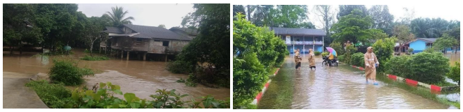
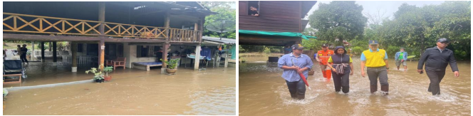
There is a flood situation in 3 provinces (Surat Thani, Nakhon Si Thammarat and Narathiwat) 6 districts, 7 sub-districts, 12 villages, 279 households were affected, no injuries or deaths, as follows:
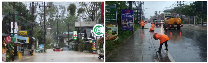
1) Surat Thani Province On 24 February 2025 at 3:00 p.m., heavy rain caused flooding in the area of
Ban Tai Sub-district (Village 4), Koh Phangan District. Initially, 1 household was affected, no injuries or deaths. The Provincial Disaster Prevention and Mitigation Office, Koh Samui Provincial Disaster Prevention and Mitigation Office, the district, police officers, local administrative organizations, volunteers, volunteers, foundations, and related agencies surveyed the damage and provided assistance in moving belongings to higher ground. And accelerate the drainage of water
from the area. The water level is currently stable.
2) Nakhon Si Thammarat Province, February 24, 68 at 2:00 p.m., heavy rain caused the water in Khlong Tha Dee
to overflow the banks and flood in 3 areas, 3 sub-districts, 6 m., Yang Khom Sub-district (Village No. 3), Pipun District, Chaiyamontri Sub-district (Village No. 1, 2, 5), Mueang District, Krung Ching Sub-district
(Village No. 7, 8), Nopphitam District. Initially, 137 households were affected. No one was injured or
dead. The Provincial Disaster Prevention and Mitigation Office, Pipun Branch, the district, police officers, local administrative organizations, Yang Khom Sub-district Administrative Organization, volunteers, volunteers, foundations, and relevant agencies surveyed the damage and provided assistance in moving belongings to higher ground and
expedited the drainage of water from the area. The water level is stable at present.
3) Narathiwat Province, February 24, 2025 at 09.00 hrs., heavy rain caused water in the canal to overflow the banks and flood in 2 districts, 3 sub-districts, and 5 m as follows: T. Riko (Village No. 7), Su-ngai Padi District, T. Waeng (Village No. 1, 2), T. Mae Dong (Village No. 3), Waeng District, T. Maruebotok (Village No. 8), Ra-ngae District. Initially, 141 houses were affected. No one was injured or died. The Provincial Disaster Prevention and Mitigation Office, the district, the police, the local government organization, volunteers, the defense volunteers, the foundation, and related agencies surveyed the damage and provided assistance. They moved belongings to higher ground and quickly drained water from the area. The water level has now decreased.
Impact Statistic
0
Dead
0
Missing
0
Injured
1.5K
Affected Person
0
Displaced
External Video
News
Human SADDD
- Dead -
- Missing -
- Injured -
- Affected Person 1,510
- Affected Family 302
- Internaly Displaced People -
- Refugees -
- Evacuation Center (in Country) -
- Evacuation Center (out Of Country) -
House
- Affected Houses 302
- Damage Partial -
- Totally Damage -
Infrastructure
- Bridges -
- Number of Roads -
- Road Distance (km) -
Public
- Schools -
- Health -
- Government Office / Public Facilities -
- Settlements -
- Worship Places -
- Others -
General
Cost
- Local Currency -
- Cost of Damages -
- Cost of Damages (USD) -
- Cost of Assistance -
- Cost of Assistance (USD) -
Agricultural
- Rice Field -
- Other Crops -
- Fish Ponds -
- Cattle -
- Poultries -
- Livestock -
Relevant Disasters
The ASEAN Disaster Information Network (ADINet) is a repository of information concerning hazards and disasters that have happened in the region. The platform is open for public, which means that the public can submit information about any hazard and disaster to the AHA Centre. Thereafter, the AHA Centre will verify and validate any submitted information to ensure the accuracy of the data inputs. The AHA Centre can also add new information when relevant and as necessary. ADINet has been recording disaster information in the region since the AHA Centre was operational in 2012.

Supported by :