Myanmar, Flooding in Kayin
Aug 11, 2026 11:49
Aug 17, 2026 17:00
Location
Coordinate:
17.141313850848, 97.797344100325
Administrative:
Kayin, Myanmar
Affected Area:
Kayin
Hazard
Main : Flood- Inundated Area (km) = -
- Maximum Flood Depth (cm) = -
Description
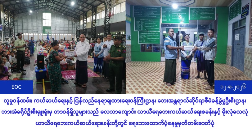
The officials from the Ministry of Social Welfare, Rescue and Resettlement, Disaster Management Department, Hpa-an District Headquarters Office have provided rice ration assistance (5,025,000/-) to (212) flood-affected households, totaling (485) males and (520) females, who were displaced to the Leytha School Temporary Flood Relief Camp and the Moe Leylon Temporary Flood Relief Camp due to heavy rains and rising water levels of the Thanlwin River on (11-8-2026) and (12-8-2026), and death assistance (300,000/-) to (1) person who died of electrocution due to water intrusion in Ward No. (5), Aung Nan (4) Street on (12-8-2026), It was reported that relief supplies were delivered to the affected people at (15:30) and (16:30) hours.
UPDATE:
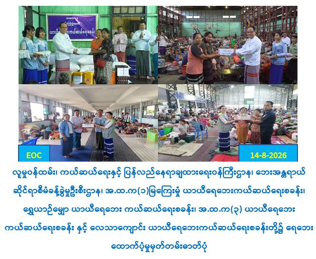
Officials from the Ministry of Social Welfare, Relief and Resettlement, Disaster Management Department, Kayin State Headquarters Office, distributed rice ration subsidy (5,605,000/-) to (11:00) hours on (14.8.2026) for (248) flood-affected households, population (523) males, (598) females, total population (1,121) who were relocated to (11.8.2026) Mya Kyi Hmun Temporary Flood Relief Camp, Shwe Yai Myaw Temporary Flood Relief Camp and (3) Temporary Flood Relief Camp due to heavy rains and rising water levels of the Thanlwin River from (11.8.2026) to (14.8.2026). Officials from the Hpa-an District Headquarters Office have provided rice rations (1,615,000 VND/-) to the flood-affected people at (14:00) on (14.8. 2026) for (78) households, (154) males and (169) females, totaling (323) people who have been relocated to the temporary indoor flood relief camp and the temporary flood relief camp at Leytha Kyaung.
UPDATE:
Officials from the Ministry of Social Welfare, Relief and Resettlement, Disaster Management Department, Kayin State Headquarters Office, distributed rice ration subsidy (5,605,000/-) to (11:00) hours on (14.8.2026) for (248) flood-affected households, population (523) males, (598) females, total population (1,121) who were relocated to (11.8.2026) Mya Kyi Hmun Temporary Flood Relief Camp, Shwe Yai Myaw Temporary Flood Relief Camp and (3) Temporary Flood Relief Camp due to heavy rains and rising water levels of the Thanlwin River from (11.8.2026) to (14.8.2026). Officials from the Hpa-an District Headquarters Office have provided rice rations (1,615,000 VND/-) to the flood-affected people at (14:00) on (14.8. 2026) for (78) households, (154) males and (169) females, totaling (323) people who have been relocated to the temporary indoor flood relief camp and the temporary flood relief camp at Leytha Kyaung.
Impact Statistic
1
Dead
0
Missing
0
Injured
2.9K
Affected Person
2.9K
Displaced
External Video
News
Human SADDD
- Dead 1
- Missing -
- Injured -
- Affected Person 2,876
- Affected Family 634
- Internaly Displaced People 2,875
- Refugees -
- Evacuation Center (in Country) -
- Evacuation Center (out Of Country) -
House
- Affected Houses -
- Damage Partial -
- Totally Damage -
Infrastructure
- Bridges -
- Number of Roads -
- Road Distance (km) -
Public
- Schools -
- Health -
- Government Office / Public Facilities -
- Settlements -
- Worship Places -
- Others -
General
Cost
- Local Currency -
- Cost of Damages -
- Cost of Damages (USD) -
- Cost of Assistance -
- Cost of Assistance (USD) -
Agricultural
- Rice Field -
- Other Crops -
- Fish Ponds -
- Cattle -
- Poultries -
- Livestock -
Relevant Disasters
The ASEAN Disaster Information Network (ADINet) is a repository of information concerning hazards and disasters that have happened in the region. The platform is open for public, which means that the public can submit information about any hazard and disaster to the AHA Centre. Thereafter, the AHA Centre will verify and validate any submitted information to ensure the accuracy of the data inputs. The AHA Centre can also add new information when relevant and as necessary. ADINet has been recording disaster information in the region since the AHA Centre was operational in 2012.

Supported by :