Myanmar, Flooding in Bago, Mon, Yangon, Naypyidaw, and Shan
Oct 08, 2023 14:31
Oct 24, 2023 09:46
Location
Coordinate:
18.2981806368, 96.130844155149
Administrative:
Bago, Myanmar
Affected Area:
Naypyitaw, Bago, Mon, Shan, Yangon
Hazard
Main : Flood- Inundated Area (km) = -
- Maximum Flood Depth (cm) = -
Description
Update impact from DDM Myanmar:
Flooding incident reported over Naypyidaw (Pobba Thiri), Bago (Bago, Thanatpin, Kawa, Waw, Taungoo, Yedashe), Mon (Kyaikto), Yangon (Taikkyi, Hlegu), and Shan (Hsipaw, Namtu)
*
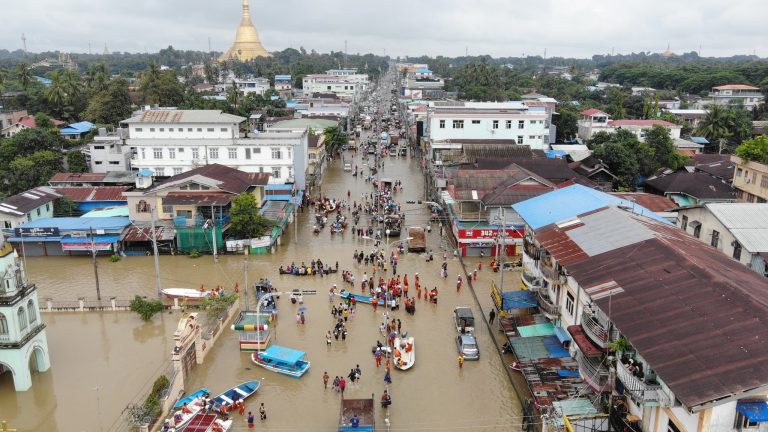
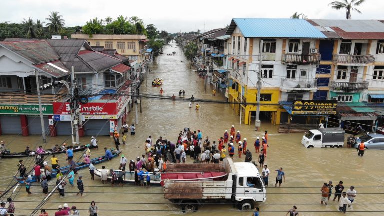
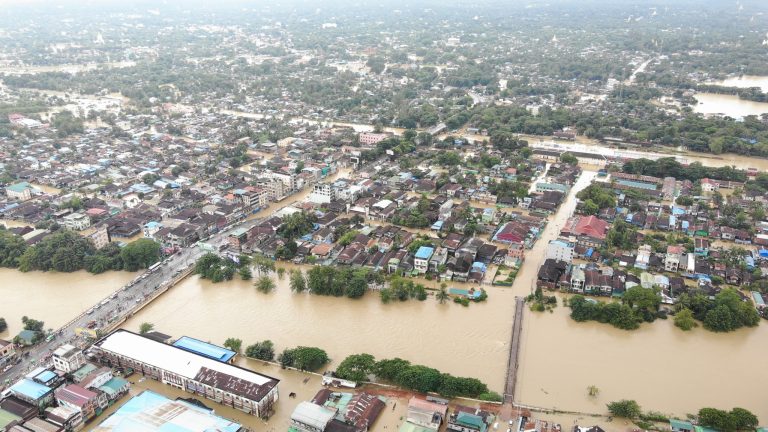
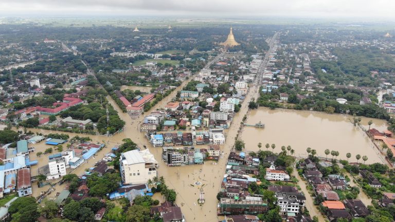
Due to the recorded rainfall of 200 mm in Bago Township of Bago Region on 8th October, the Bago River Water Level has exceeded 124 cm from its danger level. A riverine flood has been occurring in Bago Township and about 12000 people from over 2800 households were evacuated to the temporary camps (DDM).
DDM reported floods in Kyaikhto Township of Mon State due to the heavy rain of the Southwest Monsoon . The reports indicates about 55 people from 12 households had to move to the community shelters.
DDM also report a flooding events in Taikkyi Township of Yangon Region, and about 100 people displaced and 27 houses were flooded.
Necessary humanitarian assistance to the affected population has been timely provided by the State/ Region DDM Offices in the flood-affected area.
Impact Statistic
2
Dead
0
Missing
0
Injured
42K
Affected Person
42K
Displaced
External Video
News
Human SADDD
- Dead 2
- Missing -
- Injured -
- Affected Person 41,993
- Affected Family 9,879
- Internaly Displaced People 41,993
- Refugees -
- Evacuation Center (in Country) 2
- Evacuation Center (out Of Country) -
House
- Affected Houses 9,879
- Damage Partial -
- Totally Damage 47
Infrastructure
- Bridges -
- Number of Roads -
- Road Distance (km) -
Public
- Schools -
- Health -
- Government Office / Public Facilities -
- Settlements -
- Worship Places -
- Others -
General
Cost
- Local Currency -
- Cost of Damages -
- Cost of Damages (USD) -
- Cost of Assistance 122,992,000.00
- Cost of Assistance (USD) 58,448.00
Agricultural
- Rice Field -
- Other Crops -
- Fish Ponds -
- Cattle -
- Poultries -
- Livestock -
Relevant Disasters
The ASEAN Disaster Information Network (ADINet) is a repository of information concerning hazards and disasters that have happened in the region. The platform is open for public, which means that the public can submit information about any hazard and disaster to the AHA Centre. Thereafter, the AHA Centre will verify and validate any submitted information to ensure the accuracy of the data inputs. The AHA Centre can also add new information when relevant and as necessary. ADINet has been recording disaster information in the region since the AHA Centre was operational in 2012.

Supported by :