Malaysia, Flood in Sarawak
Feb 04, 2018 09:21
Sep 27, 2026 15:11
Location
Coordinate:
1.338508, 111.933
Administrative:
Sarawak, Malaysia
Affected Area:
Sarawak
Hazard
Main : Flood- Inundated Area (km) = fill value here
- Maximum Flood Depth (cm) = fill value here
Description
= Update as of 11 February 2018 =
InfoBanjir reported the number of IDPs recorded at 521 (126 families) in 2 evacuation centers, in Kemaskni town.
= Update as of 5 February 2018 =
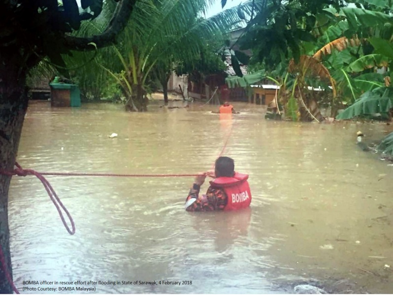
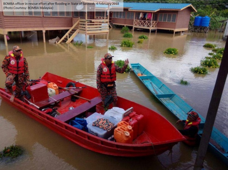
Agensi Pengurusan Bencana Negara (NADMA) and InfoBanjir Malaysia reported floods in four municipalities of Sarawak State namely Kuching, Samarahan, Bintulu and Serian.
As of 5 February 2018, 2,320 people (624 families) are evacuated in 20 evacuation centers in those four municipalities.
1) In Samarahan city, 1,154 people (304 families) are evacuated in 8 evacuation centers.
2) In Kuching, 240 are evacuated in 3 evacuation centers.
3) In Serian, 562 people are evacuated to 5 evacuation centers.
4) In Bintulu, 17 people are evacuated to 1 evacuation center
5) In Mukah, 187 people are evacuated to 3 evacuation centers.
Six schools (940 students) in Dalat are also affected and had to stopped educational activities in Serawak namely SK Klid/Plajau, SK St John Kg Medong, SJK Chin Hua SK Nanga, SK Kualaya Kenyana and SK Tanjung Pisang.
Impact Statistic
0
Dead
0
Missing
0
Injured
2.3K
Affected Person
2.3K
Displaced

Human SADDD
- Dead -
- Missing -
- Injured -
- Affected Person 2,320
- Affected Family 624
- Internaly Displaced People 2,320
- Refugees 0
- Evacuation Center (in Country) -
- Evacuation Center (out Of Country) 0
House
- Affected Houses 0
- Damage Partial 0
- Totally Damage -
Infrastructure
- Bridges 0
- Number of Roads 0
- Road Distance (km) 0.00
Public
- Schools 6
- Health -
- Government Office / Public Facilities 0
- Settlements 0
- Worship Places 0
- Others 0
General
Cost
- Local Currency 0.00
- Cost of Damages 0.00
- Cost of Damages (USD) -
- Cost of Assistance 0.00
- Cost of Assistance (USD) -
Agricultural
- Rice Field 0.00
- Other Crops 0.00
- Fish Ponds 0
- Cattle 0
- Poultries 0
- Livestock 0
Relevant Disasters
The ASEAN Disaster Information Network (ADINet) is a repository of information concerning hazards and disasters that have happened in the region. The platform is open for public, which means that the public can submit information about any hazard and disaster to the AHA Centre. Thereafter, the AHA Centre will verify and validate any submitted information to ensure the accuracy of the data inputs. The AHA Centre can also add new information when relevant and as necessary. ADINet has been recording disaster information in the region since the AHA Centre was operational in 2012.

Supported by :