Indonesia, Landslide and Flood in Brebes, Cirebon
Feb 23, 2018 14:24
Sep 27, 2026 15:11
Location
Coordinate:
-7.011965, 108.818178
Administrative:
Jawa Tengah, Indonesia
Affected Area:
Jawa Tengah
Hazard
Main : Flood- Inundated Area (km) = fill value here
- Maximum Flood Depth (cm) = fill value here
Description
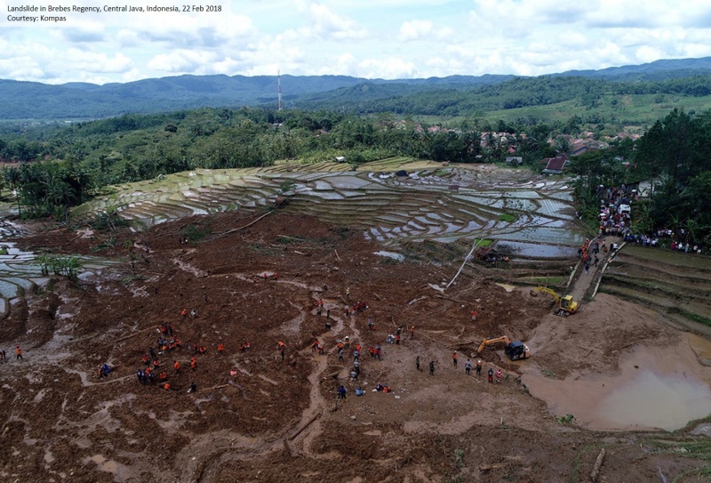
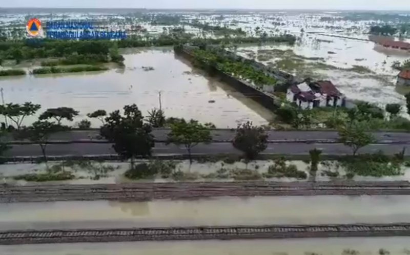
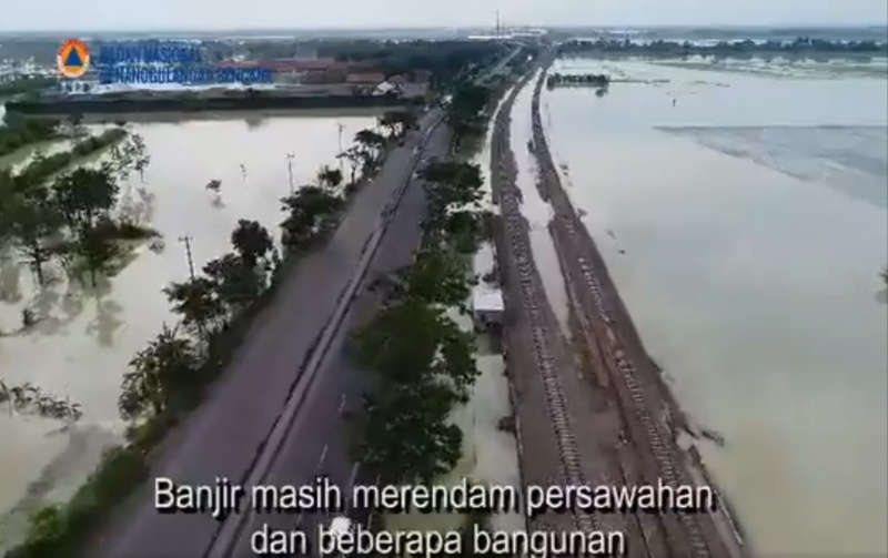
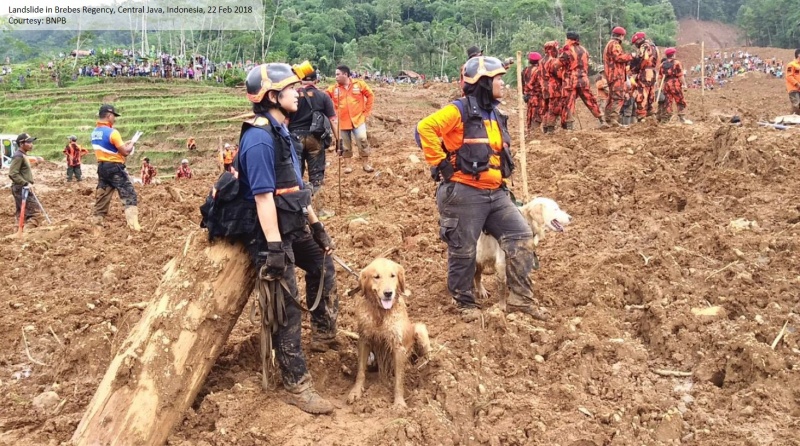
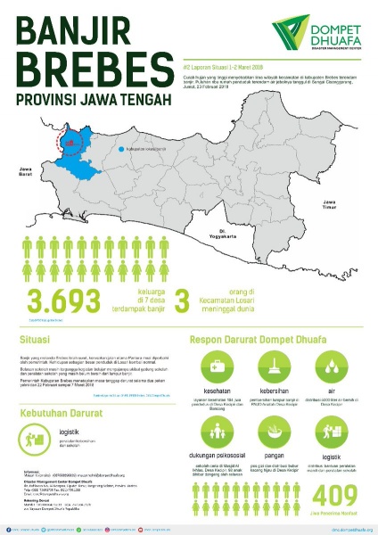
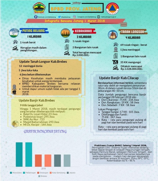
Due to intense rainfall from 21 Feb 2018, a major landslide has occurred in Pasir Panjang Village, Salem District, Brebes Regency, Central Java on 22 Feb 2018. The landslide was originated from production forest uphill and buried agricultural areas in lowland. The crown of landslide was measured at 120 meters, with length of landslide measured at 1 km. Landslide material depth was measured between 5-20 meters with the volume measured around 1.5 million meter cubic. The landslide have buried provincial road access between Salem and Banjargarjo District. Local Disaster Management Agency (BPBD) Brebes Regency declared emergency operations status from 22 February to 3 March 2018. BPBD Brebes Regency has setup a command post in SDN 2 Pasir Panjang (an elementary school) in Salem District. Joint search and rescue efforts are underway with teams coming from BPBD Brebes Regency, Basaras, Indonesian Armed Forces, Indonesian Police, Indonesian Red Cross and volunteers. Heavy machinery were also deployed to support search and rescue efforts. The search and rescue efforts were halted temporarily due to heavy rainfall on 23 February 2018. In addition to major landslide, flooding also occurred in Brebes and Cirebon Regencies, and disrupt road and rail transportation between West Java and Central Java. In total 20,000 people have been directly affected by this flooding (BNPB).
Impact Statistic
11
Dead
7
Missing
13
Injured
20K
Affected Person
984
Displaced
Human SADDD
- Dead 11
- Missing 7
- Injured 13
- Affected Person 20,000
- Affected Family 4,000
- Internaly Displaced People 984
- Refugees 0
- Evacuation Center (in Country) 4
- Evacuation Center (out Of Country) 0
House
- Affected Houses 10
- Damage Partial 10
- Totally Damage 10
Infrastructure
- Bridges 0
- Number of Roads 0
- Road Distance (km) 0.00
Public
- Schools -
- Health -
- Government Office / Public Facilities 0
- Settlements 0
- Worship Places 0
- Others 0
General
Cost
- Local Currency 0.00
- Cost of Damages 0.00
- Cost of Damages (USD) -
- Cost of Assistance 0.00
- Cost of Assistance (USD) -
Agricultural
- Rice Field 0.00
- Other Crops 0.00
- Fish Ponds 0
- Cattle 0
- Poultries 0
- Livestock 0
Relevant Disasters
The ASEAN Disaster Information Network (ADINet) is a repository of information concerning hazards and disasters that have happened in the region. The platform is open for public, which means that the public can submit information about any hazard and disaster to the AHA Centre. Thereafter, the AHA Centre will verify and validate any submitted information to ensure the accuracy of the data inputs. The AHA Centre can also add new information when relevant and as necessary. ADINet has been recording disaster information in the region since the AHA Centre was operational in 2012.

Supported by :