Indonesia, Flooding, Landslide, and Strong Wind in Padang Pariaman Regency, West Sumatra
Sep 29, 2021 16:00
Sep 27, 2026 15:19
Location
Coordinate:
-0.56229383986265, 100.22766999847
Administrative:
Sumatera Barat, Indonesia
Affected Area:
Sumatera Barat
Hazard
Main : Flood- Inundated Area (km) = fill value here
- Maximum Flood Depth (cm) = fill value here
Description
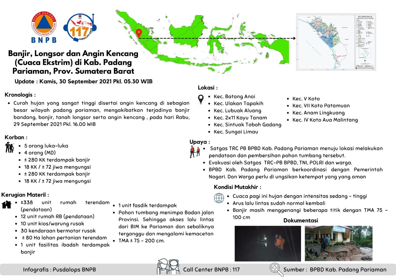
Floods, Landslides and Strong Winds (Extreme Weather) in Kab. Padang Pariaman, Prov. West Sumatra
Update : Thursday, September 30, 2021 Pkl. 05.30 WIB
Chronology :
• Very high rainfall accompanied by strong winds in most areas of Padang Pariaman, resulting in flash floods, floods, landslides and strong winds, on Wednesday, September 29, 2021 Pkl. 16.00 WIB
Location :
• Kec. Batang Anai
- Nagari Katapiang
- Nagari Sungai Buluah Timur
- Nagari Sungai Buluah Selatan
- Nagari Kasang
• Kec. Ulakan Tapakih
- Nagari Mangopoh Palak gadang Ulakan
• Kec. Lubuak Aluang
- Nagari Lubuak Aluang
- Nagari Pasie Laweh Lubuak Aluang
• Kec. 2x11 Kayu Tanam
- Nagari Anduriang
• Kec. Sintuak Toboh Gadang
- Nagari Sintuak
• Kec. Sungai Limau
- Nagari Kuranji Hilia
• Kec. V Koto
- Nagari Campago
• Kec. VII Koto Patamuan
- Nagari Tandikek
• Kec. Anam Lingkuang
- Nagari Parik Malintang
• Kec. IV Koto Aua Malintang
- Nagari III Koto Aua Malintang
Impacts:
• 5 people were injured
• 4 people dead
• ± 280 households affected by flood
• 18 families / ± 72 people evacuated
Material Losses:
• ± 338 housing units submerged (data collection)
• 12 housing units heavily damaged(data collection)
• 10 units of store damaged
• 30 damaged motorcycles
• ± 80 Ha of agricultural land
• 1 unit of worship place
• 1 educational facility
• A fallen tree fell on the provincial road agency. So that traffic access from BIM to Pariaman and vice versa is disrupted and experiences congestion
• Flood depth ± 75 – 200 cm.
Effort :
• TRC PB BPBD Kab. Padang Pariaman went to the location to collect data and clean up the fallen tree.
• Evacuation by the BPBD TRC-PB Task Force, TNI, POLRI and residents.
• BPBD Kab. Padang Pariaman coordinates with the Nagari Government. And residents need to be evacuated to a safe place
Latest Condition:
Thursday, September 30, 2021 Pkl. 05.30 WIB
• The weather this morning is raining with moderate to high intensity
• Traffic flow is back to normal
• Floods still inundate several points with a TMA of 75 - 100 cm
Source :
• Pusdalops BPBD Padang Pariaman
Informed By:
BNPB PUSDALOPS
Complaint Number / Call Center : 117 (Toll Free)
Instagram : pusdalops_bnpb
Twitter : @Bnpbpusdalops
Impact Statistic
8
Dead
0
Missing
5
Injured
1.4K
Affected Person
72
Displaced
External Video
News
Human SADDD
- Dead 8
- Missing -
- Injured 5
- Affected Person 1,400
- Affected Family 280
- Internaly Displaced People 72
- Refugees -
- Evacuation Center (in Country) -
- Evacuation Center (out Of Country) -
House
- Affected Houses 338
- Damage Partial -
- Totally Damage 12
Infrastructure
- Bridges -
- Number of Roads -
- Road Distance (km) -
Public
- Schools 1
- Health -
- Government Office / Public Facilities -
- Settlements -
- Worship Places 1
- Others 10
General
Cost
- Local Currency 0.00
- Cost of Damages -
- Cost of Damages (USD) -
- Cost of Assistance -
- Cost of Assistance (USD) -
Agricultural
- Rice Field 80.00
- Other Crops -
- Fish Ponds -
- Cattle -
- Poultries -
- Livestock -
Relevant Disasters
The ASEAN Disaster Information Network (ADINet) is a repository of information concerning hazards and disasters that have happened in the region. The platform is open for public, which means that the public can submit information about any hazard and disaster to the AHA Centre. Thereafter, the AHA Centre will verify and validate any submitted information to ensure the accuracy of the data inputs. The AHA Centre can also add new information when relevant and as necessary. ADINet has been recording disaster information in the region since the AHA Centre was operational in 2012.

Supported by :