Indonesia, Flooding in Tanah Datar (West Sumatera)
Apr 05, 2024 16:30
Apr 09, 2024 16:34
Location
Coordinate:
-0.46056082246973, 100.58597982586
Administrative:
Sumatera Barat, Indonesia
Affected Area:
Hazard
Main : Flood- Inundated Area (km) = -
- Maximum Flood Depth (cm) = -
Description
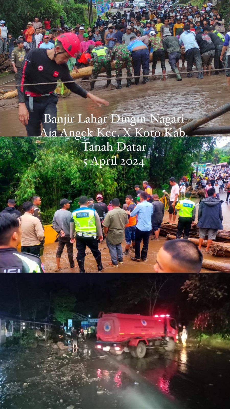
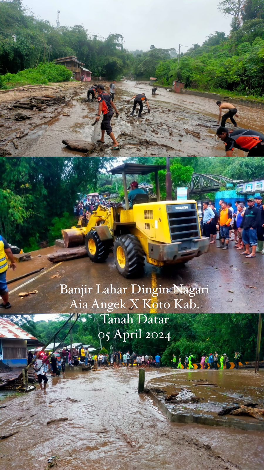
➢ Chronology: Triggered by high intensity rain around the peak of Mount Marapi Volcano in the Tanah Datar Regency area, resulting in a cold lava flow on Friday, 05 April 2024 at 16:30 WIB
➢ Location:
● Kali Koto District
● Batipuh District
● Pariangan District
● Lima Kaum District
● Sungai Tarab District
➢ Casualties:
● In Data Collection
➢ Material Losses:
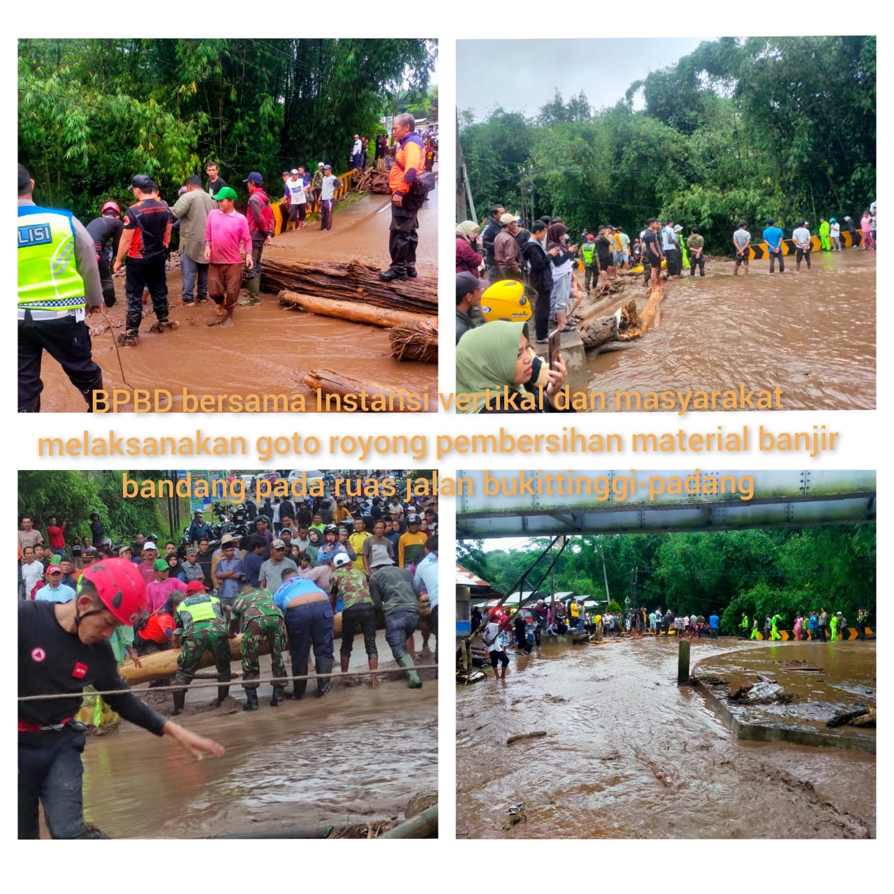
● Jalan Padang - Bukittinggi (in Aia Angek) was cut off at 16.00. However, after cross-sector efforts, it is now reconnected with an open and close system.
● There is damage to the embankment and road body
● Landslides that disrupted nagari roads, precisely in Jorong Lurah Ampang and Talang Dasun, Nagari Pasie Laweh
➢ Effort:
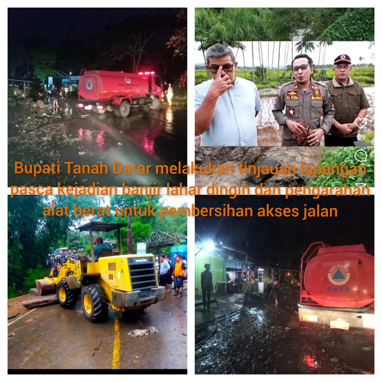
● BPBD Tanah Datar Regency is monitoring the development of the cold lava flood incident
● Carry out cross-sector coordination, Padang Panjang POLRES and together with Nagari/District officials in efforts to handle emergency cold lava floods
● Give an appeal to people whose settlements are located around the river that originates at Mount Marapi to be alert.
● Tanah Datar Regency PB Pusdalops, Padang Panjang POLRES, Forkopimcam carried out an impact evaluation and rapid study by deploying BPBD personnel and water tank vehicles.
➢ Current Conditions:
● Monitored the occurrence of Bukittinggi-Padang traffic jams (state roads) on the Aia Angek road with opening and closing
Source: Head of RR BPBD Tanah Datar Regency
Impact Statistic
0
Dead
0
Missing
0
Injured
0
Affected Person
0
Displaced
External Video
News
Human SADDD
- Dead -
- Missing -
- Injured -
- Affected Person -
- Affected Family -
- Internaly Displaced People -
- Refugees -
- Evacuation Center (in Country) -
- Evacuation Center (out Of Country) -
House
- Affected Houses -
- Damage Partial -
- Totally Damage -
Infrastructure
- Bridges -
- Number of Roads -
- Road Distance (km) -
Public
- Schools -
- Health -
- Government Office / Public Facilities -
- Settlements -
- Worship Places -
- Others -
General
Cost
- Local Currency -
- Cost of Damages -
- Cost of Damages (USD) -
- Cost of Assistance -
- Cost of Assistance (USD) -
Agricultural
- Rice Field -
- Other Crops -
- Fish Ponds -
- Cattle -
- Poultries -
- Livestock -
Relevant Disasters
The ASEAN Disaster Information Network (ADINet) is a repository of information concerning hazards and disasters that have happened in the region. The platform is open for public, which means that the public can submit information about any hazard and disaster to the AHA Centre. Thereafter, the AHA Centre will verify and validate any submitted information to ensure the accuracy of the data inputs. The AHA Centre can also add new information when relevant and as necessary. ADINet has been recording disaster information in the region since the AHA Centre was operational in 2012.

Supported by :