Indonesia, Flooding in Penajam Paser Utara Regency, East Kalimantan
Oct 07, 2021 08:28
Sep 27, 2026 15:19
Location
Coordinate:
-1.1574253219233, 116.59776096936
Administrative:
Kalimantan Timur, Indonesia
Affected Area:
Kalimantan Timur
Hazard
Main : Flood- Inundated Area (km) = fill value here
- Maximum Flood Depth (cm) = fill value here
Description
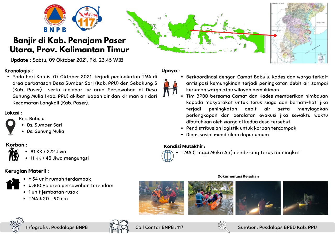
Floods in Kab. North Paser Sharpening, Prov. East Kalimantan
Update : Saturday, 09 October 2021, Pkl. 23.45 WIB
Chronology :
• On Thursday, October 07, 2021, there was an increase in the TMA in the border area of Sumber Sari Village (Kab. PPU) and Sebakung 5 (Kab. Paser) and widened to the rice fields in Gunung Mulia Village (Kab. PPU) due to overflowing water and shipments. water from Longkali District (Paser District).
Location :
• Kec. Babulu
• Ds. Sumber Sari
• Ds. Gunung Mulia
Impacts:
• 81 families / 272 people
• 11 families / 43 people displaced
Material Losses:
• ± 54 housing units affected
• ± 800 Ha of rice fields
• 1 bridge
• Flood depth ± 20 - 90 cm
Effort :
• Coordinate with the Babulu Camat, Kades and residents regarding the anticipation of the possibility of an increase in water discharge reaching residents' homes or residential areas
• The BPBD team together with the Camat and Kades gave an appeal to the community to continue to be alert and careful in case of an increase in water flow and to prepare evacuation equipment and equipment if at any time needed by residents in the two villages.
• Distribution of logistics for affected victims
• Social service establishes a soup kitchen
Up-to-date Condition:
• TMA (Water Level) tends to continue to increase
Source :
• BPBD Kab. Penajem Paser Utara
Informed By:
BNPB PUSDALOPS
Complaint Number / Call Center : 117 (Toll Free)
Instagram : pusdalops_bnpb
Twitter : @Bnpbpusdalops
Impact Statistic
0
Dead
0
Missing
0
Injured
1.5K
Affected Person
122
Displaced
External Video
News
Human SADDD
- Dead -
- Missing -
- Injured -
- Affected Person 1,545
- Affected Family 490
- Internaly Displaced People 119
- Refugees -
- Evacuation Center (in Country) -
- Evacuation Center (out Of Country) -
House
- Affected Houses 54
- Damage Partial -
- Totally Damage -
Infrastructure
- Bridges 1
- Number of Roads -
- Road Distance (km) -
Public
- Schools -
- Health -
- Government Office / Public Facilities -
- Settlements -
- Worship Places -
- Others -
General
Cost
- Local Currency 0.00
- Cost of Damages -
- Cost of Damages (USD) -
- Cost of Assistance -
- Cost of Assistance (USD) -
Agricultural
- Rice Field 800.00
- Other Crops -
- Fish Ponds -
- Cattle -
- Poultries -
- Livestock -
Relevant Disasters
The ASEAN Disaster Information Network (ADINet) is a repository of information concerning hazards and disasters that have happened in the region. The platform is open for public, which means that the public can submit information about any hazard and disaster to the AHA Centre. Thereafter, the AHA Centre will verify and validate any submitted information to ensure the accuracy of the data inputs. The AHA Centre can also add new information when relevant and as necessary. ADINet has been recording disaster information in the region since the AHA Centre was operational in 2012.

Supported by :