Indonesia, Flooding in Melawi (West Kalimantan)
Aug 22, 2024 19:30
Aug 25, 2024 07:00
Location
Coordinate:
-0.63134241303475, 111.72789456673
Administrative:
Kalimantan Barat, Indonesia
Affected Area:
Kalimantan Barat
Hazard
Main : Flood- Inundated Area (km) = -
- Maximum Flood Depth (cm) = -
Description
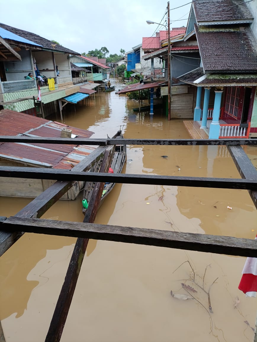
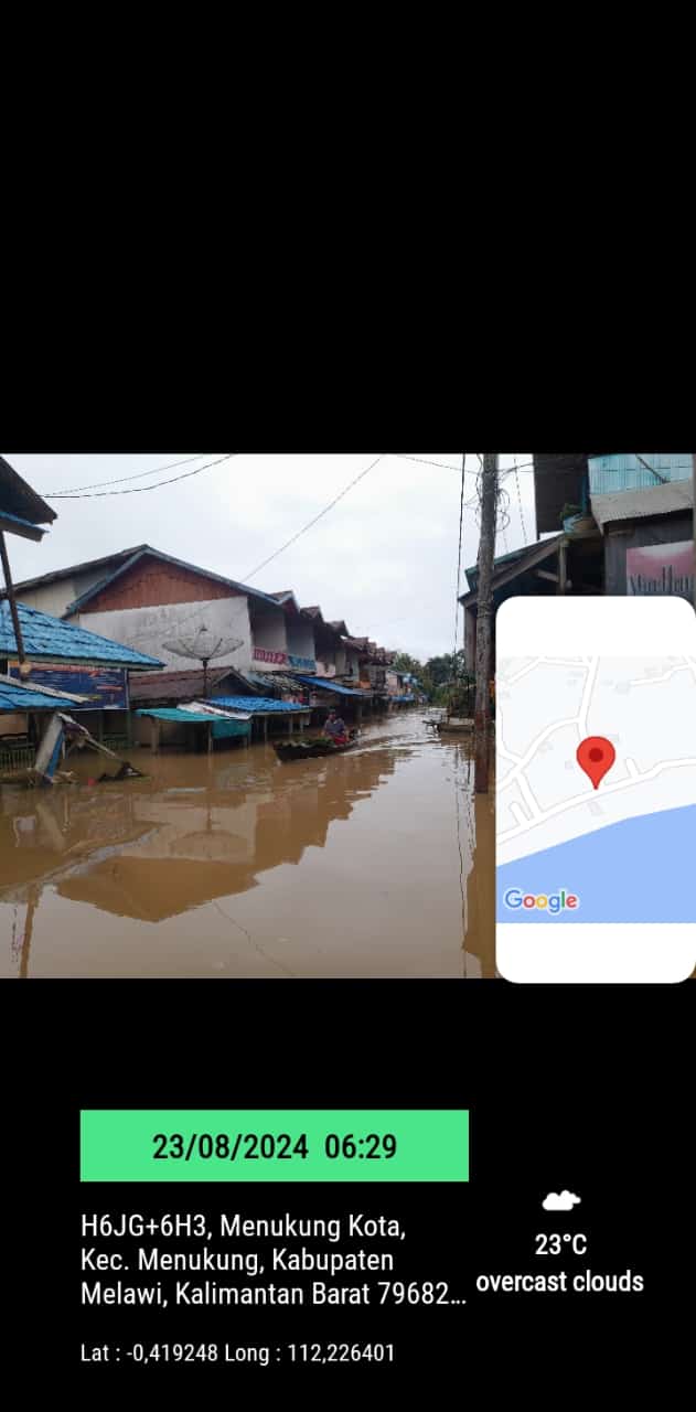
➢ Chronology: Thursday, August 22, 2024 at 19.30 WIB, a flood occurred triggered by high rainfall so that the Melawi River overflowed and inundated residents' houses and several public facilities and road access
➢ Location:
● Menukung District
- Menukung City Village
- Batu Badak Village
➢ Casualties:
● ± 377 families affected
➢ Material Losses:
● ± 400 houses affected (in data collection)
➢ Efforts:
● The Regency Government took steps by coordinating to utilize existing resources (Government, Community, Mass Organizations and Private Parties).
● Conducting cross-sector coordination regarding the availability of flood management budget.
● The BPBD Team monitored and evaluated flood conditions
➢ Elements Involved:
● BPBD Team of Kab. Melawi
● Menukung Sub-district Head
● Menukung City Village Apparatus
● Batu Badak Village Apparatus
➢ Field Constraints:
● Limited stock of goods that can be distributed to flood victims
➢ Current Condition:
● Current condition on Friday, August 23, 2004 at 19.00 WIB, the flood is still submerging residents' houses and the water level is still rising
Source: Mr. Arif Santoso, Head of BPBD Melawi Regency
Impact Statistic
0
Dead
0
Missing
0
Injured
3K
Affected Person
0
Displaced
External Video
News
Human SADDD
- Dead -
- Missing -
- Injured -
- Affected Person 2,964
- Affected Family 741
- Internaly Displaced People -
- Refugees -
- Evacuation Center (in Country) -
- Evacuation Center (out Of Country) -
House
- Affected Houses 648
- Damage Partial -
- Totally Damage -
Infrastructure
- Bridges -
- Number of Roads -
- Road Distance (km) -
Public
- Schools -
- Health -
- Government Office / Public Facilities -
- Settlements -
- Worship Places -
- Others -
General
Cost
- Local Currency -
- Cost of Damages -
- Cost of Damages (USD) -
- Cost of Assistance -
- Cost of Assistance (USD) -
Agricultural
- Rice Field -
- Other Crops -
- Fish Ponds -
- Cattle -
- Poultries -
- Livestock -
Relevant Disasters
The ASEAN Disaster Information Network (ADINet) is a repository of information concerning hazards and disasters that have happened in the region. The platform is open for public, which means that the public can submit information about any hazard and disaster to the AHA Centre. Thereafter, the AHA Centre will verify and validate any submitted information to ensure the accuracy of the data inputs. The AHA Centre can also add new information when relevant and as necessary. ADINet has been recording disaster information in the region since the AHA Centre was operational in 2012.

Supported by :