Indonesia, Flooding in Karawang (West Java)
Mar 14, 2024 19:00
Mar 18, 2024 21:24
Location
Coordinate:
-6.2520033263491, 107.35392699764
Administrative:
Jawa Barat, Indonesia
Affected Area:
Jawa Barat
Hazard
Main : Flood- Inundated Area (km) = -
- Maximum Flood Depth (cm) = -
Description
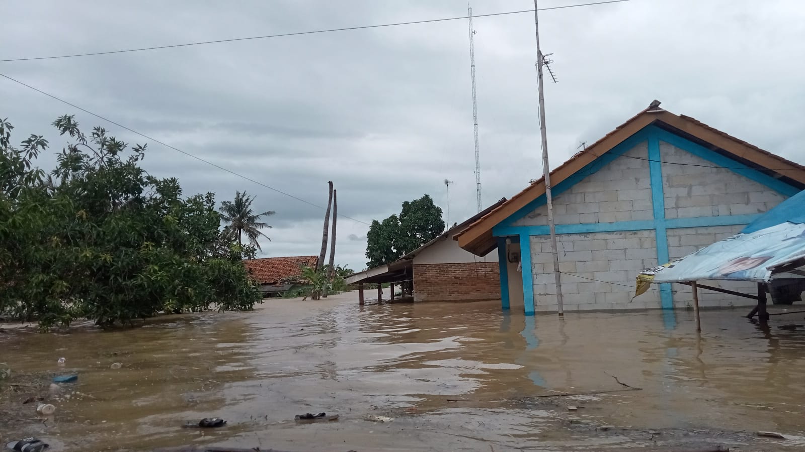
➢ Chronology: Triggered by heavy rain in the upstream area and several areas of Karawang district resulting in the overflow of the Citarum and Cibeet rivers as well as the Cidawolong river and Kedungurang River Thursday 14 March 2024 at 19.00 WIB
➢ Location:
● West Telukjambe District
● Karangligar Village
➢ Casualties:
● 319 families / 938 people affected
➢ Material Losses:
● 235 housing units affected
● 6 Public Facilities affected
● 20 - 180 cm
➢ Effort:
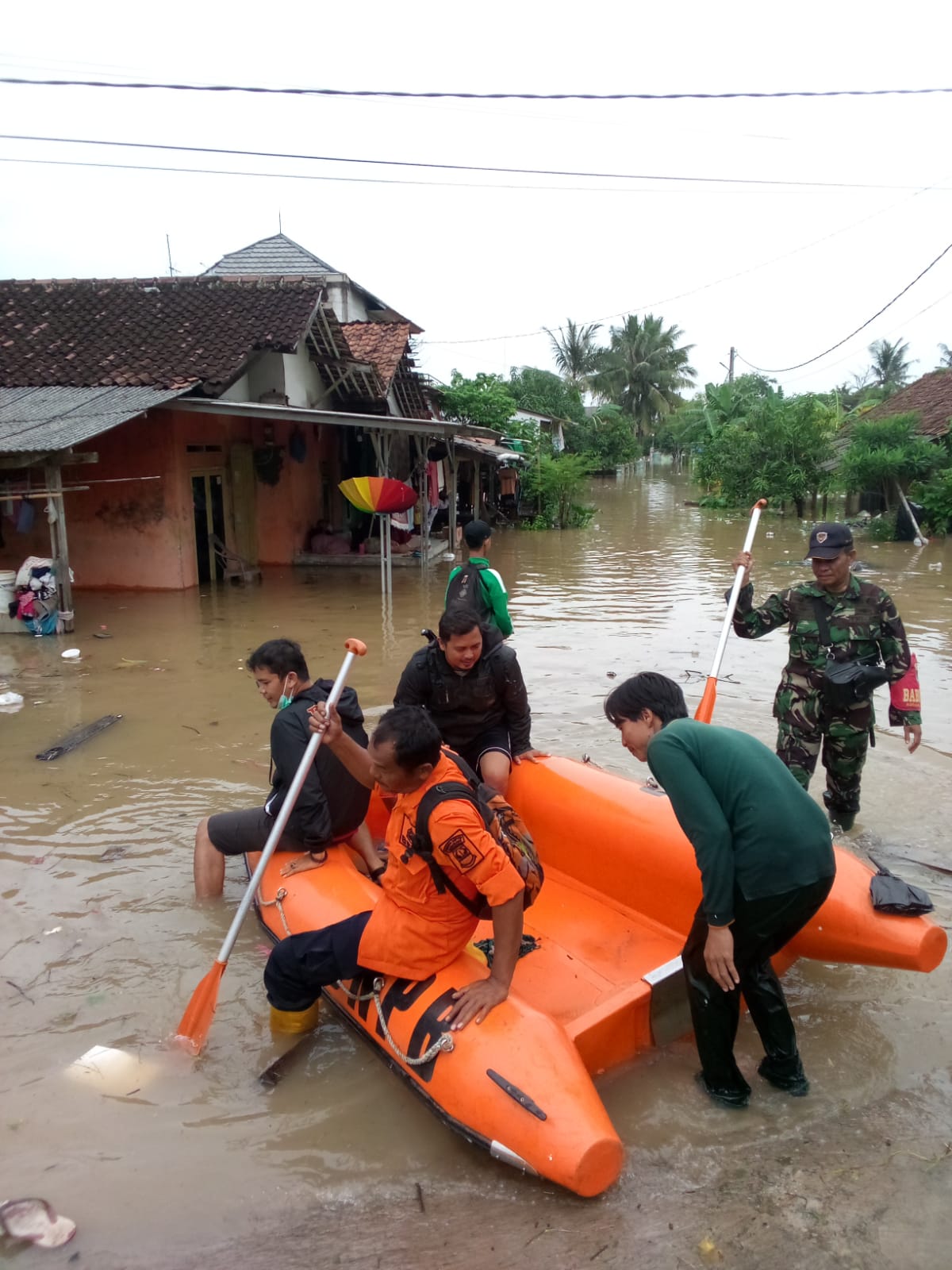
● Karawang Regency BPBD Rapid Response Team Assessment to the scene of the incident together with Muspika village officials, Head of Subdistrict Peace and Order Section, Army Village Development Officer and Police Community Development Officer
● Evacuation of flood-affected residents by BPBD Officer Units, Army Village Development Non-Commissioned Officers, Police Community Development, Community Protection and Village Officials
Source: Irawan Staff of Pusdalops BPBD Karawang Regency
Impact Statistic
0
Dead
0
Missing
0
Injured
938
Affected Person
0
Displaced
External Video
News
Human SADDD
- Dead -
- Missing -
- Injured -
- Affected Person 938
- Affected Family 319
- Internaly Displaced People -
- Refugees -
- Evacuation Center (in Country) -
- Evacuation Center (out Of Country) -
House
- Affected Houses 235
- Damage Partial -
- Totally Damage -
Infrastructure
- Bridges -
- Number of Roads -
- Road Distance (km) -
Public
- Schools -
- Health -
- Government Office / Public Facilities -
- Settlements -
- Worship Places -
- Others 6
General
Cost
- Local Currency -
- Cost of Damages -
- Cost of Damages (USD) -
- Cost of Assistance -
- Cost of Assistance (USD) -
Agricultural
- Rice Field -
- Other Crops -
- Fish Ponds -
- Cattle -
- Poultries -
- Livestock -
Relevant Disasters
The ASEAN Disaster Information Network (ADINet) is a repository of information concerning hazards and disasters that have happened in the region. The platform is open for public, which means that the public can submit information about any hazard and disaster to the AHA Centre. Thereafter, the AHA Centre will verify and validate any submitted information to ensure the accuracy of the data inputs. The AHA Centre can also add new information when relevant and as necessary. ADINet has been recording disaster information in the region since the AHA Centre was operational in 2012.

Supported by :