Indonesia, Flooding in Indragiri Hulu (Riau)
Jan 12, 2024 15:30
Jan 25, 2024 19:00
Location
Coordinate:
-0.53756759969858, 102.32736037629
Administrative:
Riau, Indonesia
Affected Area:
Riau
Hazard
Main : Flood- Inundated Area (km) = -
- Maximum Flood Depth (cm) = -
Description
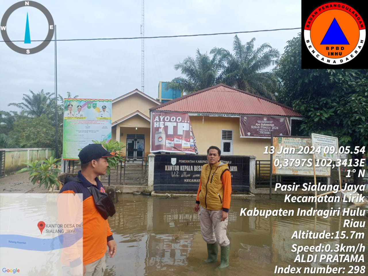
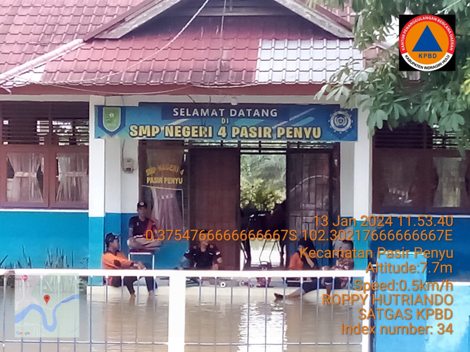
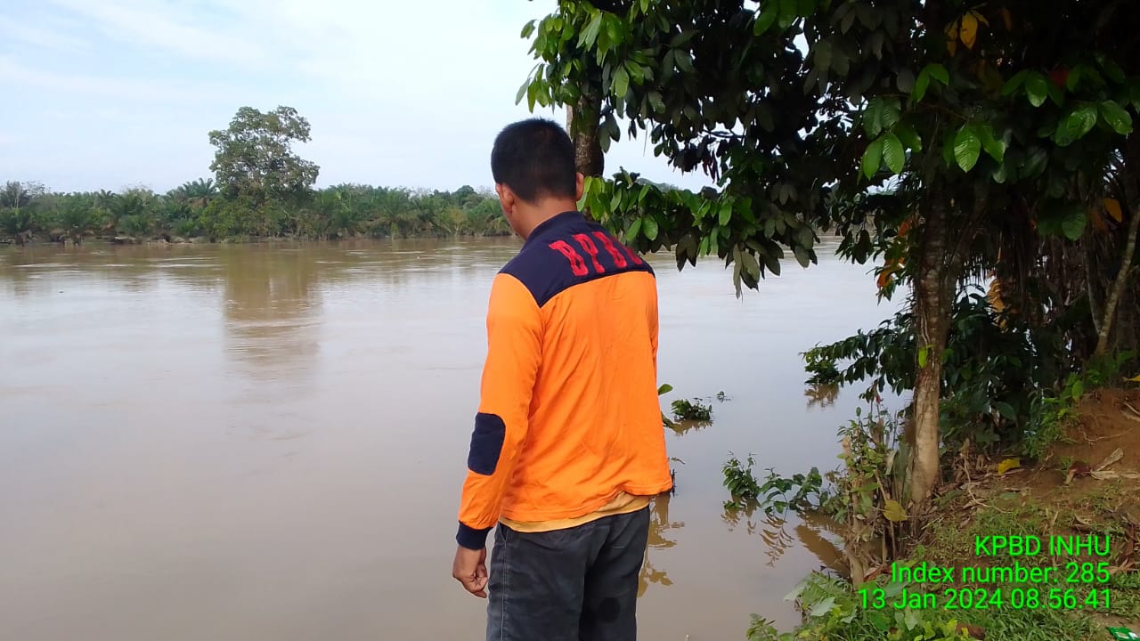
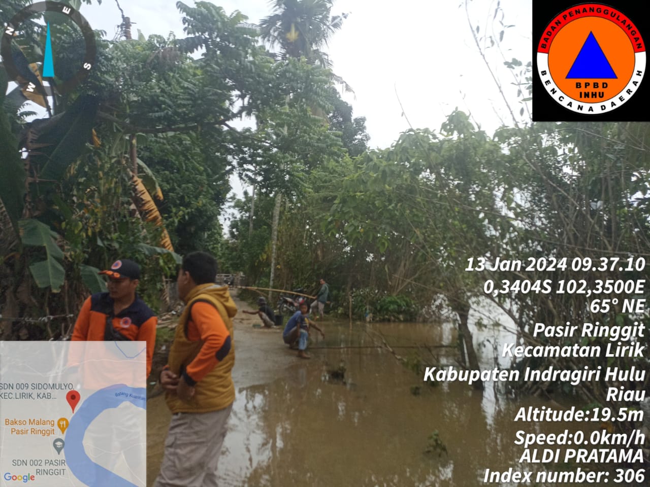
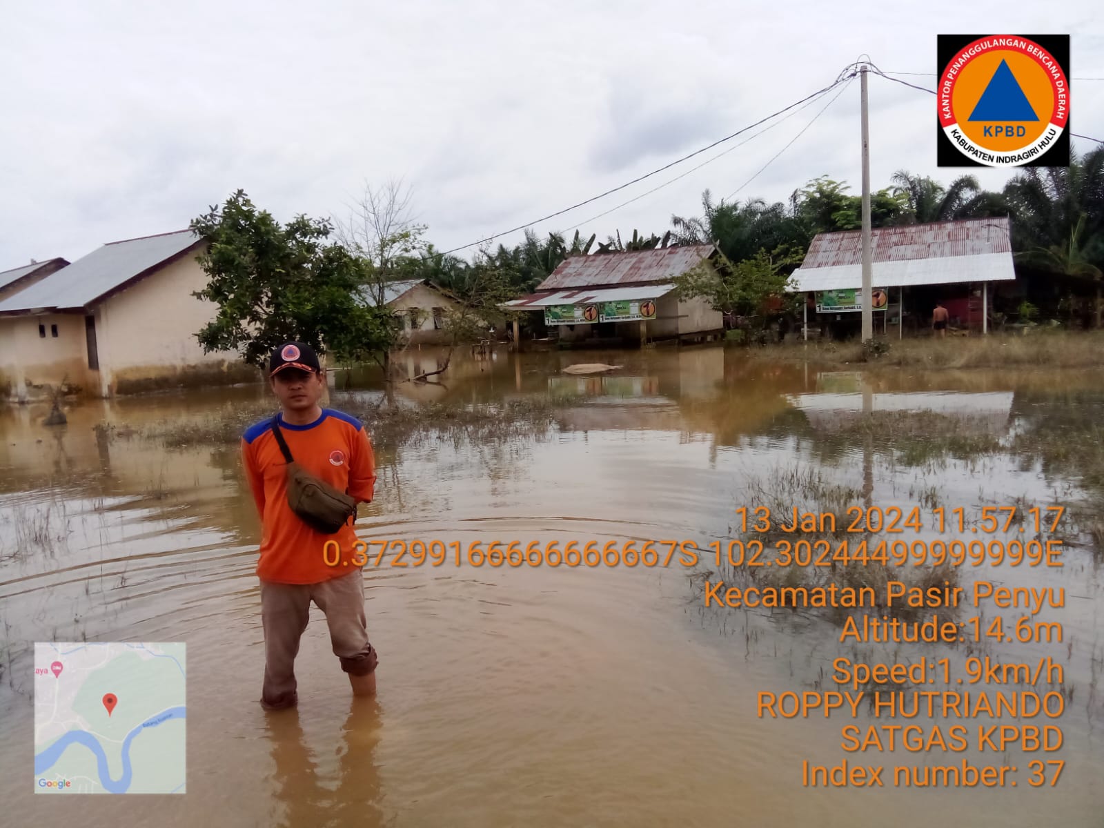
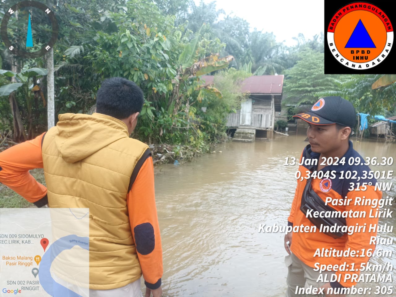
➢ Chronology: Triggered by high intensity rain on Friday 12 January 2024 at 15.30 WIB
➢ Location:
● Kec. Lirik
- Ds. Pasir Ringgit
- Ds. Pasir Sialang Jaya
- Ds. Jayapura
- Ds. Lambang Sari
● Kec. Rakit Kulim
- Ds. Batu Sawar
- Ds. Lubuk Sitarak
- Ds. Kelayang
- Ds. Kampung Bunga
- Ds. Kota Baru
- Ds. Petongan
- Ds. Kuantan Tenang
● Kec. Seilala
- Ds. Pasir Batu Mandi
- Ds. Kuala Lala
- Ds. Pasir Kelampaian
- Ds. Pasir Silabau
- Ds. Pasir Bongkal
- Ds. Tanjung Danau
- Ds. Morong
- Ds. Kelawat
● Kec. Peranap
- Ds. Setakoraya
- Ds. Baturijal Hulu
- Ds. Baturijal Barat
- Ds. Pauhranap
- Ds. Gumanti
- Ds. Semiling Tebing
- Ds. Ketipo Pura
- Ds. Batu Rijal Hilir
- Ds. Peranap
● Kec. Kuala Cenaku
- Ds. Desa Tambak
- Ds. Desa Rawa Asri
- Ds. Tanjung Sari
- Ds. Rawa Skip
- Ds. Kuala Mulya
- Ds. Suka Jadi
- Ds. Pulau Jumat
- Ds. Kuala Genaku
- Ds. Pulau Gelang
- Ds. Teluk Sungai
● Kec. Rengat
- Ds. Rawa Bangun
- Ds. Pulau Gajah
- Ds. Kampung Pulau
- Ds. Rantau Mempesai
- Ds. Sungai Guntung Hilir
- Ds. Sungai Guntung Tengah
- Ds. Sungai Beringin
- Ds. Sungai Raya
- Ds. Kuantan Babui
- Ds. Kampung Dagang
- Ds. Pasir Kemilu
- Ds. Sekip Hulu
- Ds. Sekip Hilir
- Ds. Kampung Besar Seberang
- Ds. Besar Kota
● Kec. Rengat Barat
- Ds. Alang Kepayang
- Ds. Danau Baru
- Ds. Sialang Dua Dahan
- Ds. Redang
- Ds. Barangan
- Ds. Pekan Heran
● Kec. Seberida
- Kel. Pangkalan Kasai Ds. Kelesa
● Kec. Batang Cenaku
- Ds. Cenaku Kecil
- Ds. Kepayang Sari
- Ds. Aur Cina
- Ds. Kuala Kilan
- Ds. Batu Papan
● Kec. Pasir Penyu
- Ds. Pasir Keranji
- Ds. Lembah Dusun Gading
- Ds. Petalongan
- Ds. Batui Gajah
- Ds. Air Molek I
- Ds. Candi rejo
- Ds. Air Molek II
● Kec. Kelayang
- Ds. Pulau Sengkilo
- Ds. Kota Medan
- Ds. Polak Pisang
- Ds. Teluk Sejuah
- Ds. Dusun Tuah
- Ds. Dusun Tua Pelang
- Ds. Simpang Kelayang
- Ds. Tanjung Beludu
- Ds. Pasir Beringin
● Kec. Batang Peranap
- Ds. Selunak
- Ds. Pematang
- Ds. Suka Maju
- Ds. Koto Tuo
- Ds. Pematang Benteng
- Ds. Punti Kayu
- Ds. Pesajian
➢ Effort:
● BPBD Indragiri Hulu Regency coordinates with local authorities and carries out an assessment
● provide a warning to residents to be careful and always look after their children
● warn residents to be wary of crocodiles that come ashore.
➢ Current Conditions:
● The water level in the Indragiri river was observed to have increased by 30 cm compared to the previous day.
Source: Mr. Yogi Pusdalops BPBD Indragiri Hulu Regency
Impact Statistic
0
Dead
0
Missing
0
Injured
44.3K
Affected Person
7.1K
Displaced
External Video
News
Human SADDD
- Dead -
- Missing -
- Injured -
- Affected Person 44,285
- Affected Family 12,208
- Internaly Displaced People 7,051
- Refugees -
- Evacuation Center (in Country) -
- Evacuation Center (out Of Country) -
House
- Affected Houses 12,208
- Damage Partial -
- Totally Damage -
Infrastructure
- Bridges 2
- Number of Roads 6
- Road Distance (km) -
Public
- Schools 56
- Health 16
- Government Office / Public Facilities 24
- Settlements -
- Worship Places 56
- Others -
General
Cost
- Local Currency -
- Cost of Damages -
- Cost of Damages (USD) -
- Cost of Assistance -
- Cost of Assistance (USD) -
Agricultural
- Rice Field 272.00
- Other Crops -
- Fish Ponds -
- Cattle -
- Poultries -
- Livestock -
Relevant Disasters
The ASEAN Disaster Information Network (ADINet) is a repository of information concerning hazards and disasters that have happened in the region. The platform is open for public, which means that the public can submit information about any hazard and disaster to the AHA Centre. Thereafter, the AHA Centre will verify and validate any submitted information to ensure the accuracy of the data inputs. The AHA Centre can also add new information when relevant and as necessary. ADINet has been recording disaster information in the region since the AHA Centre was operational in 2012.

Supported by :