Indonesia, Flooding in Batubara (North Sumatra)
Oct 10, 2024 06:00
Oct 21, 2024 19:28
Location
Coordinate:
3.2339937865219, 99.475030776754
Administrative:
Sumatera Utara, Indonesia
Affected Area:
Sumatera Utara
Hazard
Main : Flood- Inundated Area (km) = -
- Maximum Flood Depth (cm) = -
Description
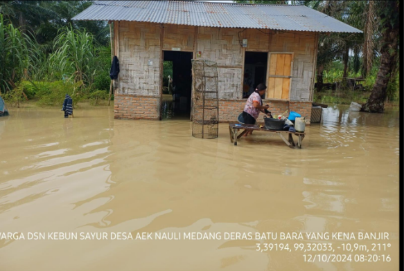
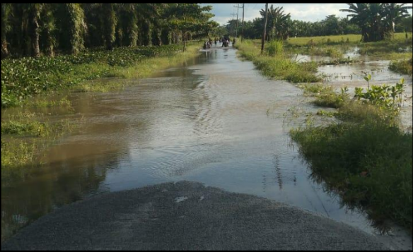
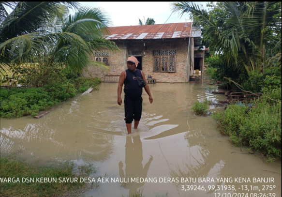
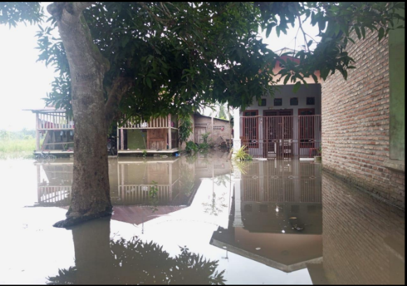
➢ Chronology: On Wednesday, October 10, 2024 at 06.00 WIB, a flood occurred due to the high intensity of rainfall in Batubara Regency, causing the Serdang River in Tanjung Kasau Plantation Village to overflow, affecting the Kandangan Village area, causing the river embankment to break along ± 20 meters, Nenasiam Village, Sei Buah Keras Village and Aek Nauli Village, causing several residents' houses to be submerged in floodwater, Thursday, October 10, 2024 PKl. 06.00 WIB
➢ Location:
● Laut Tador District
- Tanjung Kasau Plantation Village
- Kandangan Village
● Medang Deras District
- Nenassiam Village
- Aek Nauli Village
- Sei Buah Keras Village
➢ Casualties:
● Data Collection
➢ Material Losses:
● 405 houses affected with details:
- Tanjung Kasau Plantation Village: 13 houses
- Kandangan Village: 40 houses
- Nenassiam Village: 121 houses
- Aek Nauli Village: 10 houses
- Sei Buah Keras Village: 221 houses
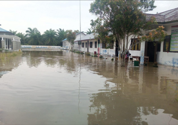
● 1 educational facility affected
● 15 fish ponds submerged in flood
● ± 310 hectares of agricultural land affected
➢ Efforts:
● Batu Regency BPBD coal coordinates with the local sub-district and village governments.
● Batu Bara Regency BPBD conducts an assessment
● Batu Bara Regency BPBD Provides assistance in the form of 1000 sacks and sets up 2 refugee tents
➢ Current Condition:
On Saturday, October 12, 2024 until 17.00
● The flood in Tanjung Kasau Village has receded
● The flood in Kandangan Village has receded
● The flood in Nenasiam Village has begun to recede
● The flood in Aek Nauli Village is still ongoing
● The flood in Sei Buah Keras Village is still ongoing
Source: Eka Rahman Coordinator of the Batu Bara Regency BPBD Rapid Reaction Team
Impact Statistic
0
Dead
0
Missing
0
Injured
1.6K
Affected Person
0
Displaced
External Video
News
Human SADDD
- Dead -
- Missing -
- Injured -
- Affected Person 1,620
- Affected Family 405
- Internaly Displaced People -
- Refugees -
- Evacuation Center (in Country) -
- Evacuation Center (out Of Country) -
House
- Affected Houses 405
- Damage Partial -
- Totally Damage -
Infrastructure
- Bridges -
- Number of Roads -
- Road Distance (km) -
Public
- Schools 1
- Health -
- Government Office / Public Facilities -
- Settlements -
- Worship Places -
- Others -
General
Cost
- Local Currency -
- Cost of Damages -
- Cost of Damages (USD) -
- Cost of Assistance -
- Cost of Assistance (USD) -
Agricultural
- Rice Field 310.00
- Other Crops -
- Fish Ponds 15
- Cattle -
- Poultries -
- Livestock -
Relevant Disasters
The ASEAN Disaster Information Network (ADINet) is a repository of information concerning hazards and disasters that have happened in the region. The platform is open for public, which means that the public can submit information about any hazard and disaster to the AHA Centre. Thereafter, the AHA Centre will verify and validate any submitted information to ensure the accuracy of the data inputs. The AHA Centre can also add new information when relevant and as necessary. ADINet has been recording disaster information in the region since the AHA Centre was operational in 2012.

Supported by :