Indonesia, Flooding in Aceh Jaya (Aceh)
Sep 17, 2024 10:00
Sep 24, 2024 14:59
Location
Coordinate:
4.8330623208699, 95.678511399088
Administrative:
Aceh, Indonesia
Affected Area:
Aceh
Hazard
Main : Flood- Inundated Area (km) = -
- Maximum Flood Depth (cm) = -
Description
➢ Chronological :
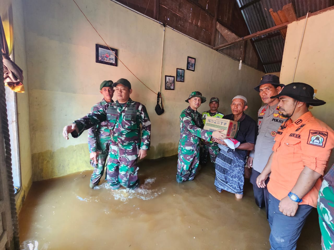
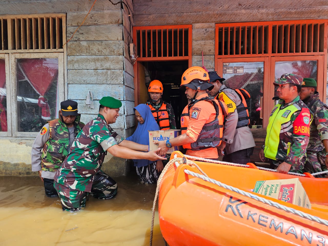
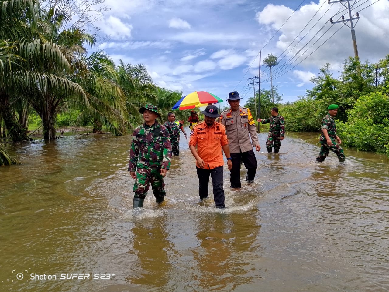
As a result of high-intensity rain accompanied by strong winds that hit the Aceh Jaya Regency, it has resulted in the fall of several trees on the road and partially closed access to transportation and overflowing
several rivers until the occurrence of stagnant floods in several regions, the average water height ranges between 15 s.d 50 cm. On Tuesday 17 September 2024 Pkl. 10.00 WIB
➢ Location :
(5 Districts / 14 Villages)
● Krueng Sabee District
- Panggong village
- Ranto Panyang village
● Darul Hikmah District
- Teupin Asan village
- Masen village
- Babah Dua village
- Baro village
- Lamteungoh village
- Village of Ujong Rimba
- Gunong Cut village
- Pantong Krueng Village
- Alue Gajah village
● Teunom District
- Rambong Payong village
● Loyalist Subdistrict
- Lhok Bot village
● Panga District
- Batee Meutudong village
➢ Casualties:
● 409 KK / 1,090 souls affected
➢ Material Loss :
● Darul Hikmah District
- Teupin Asan village, 20 houses affected
- Masen village, 56 house units were affected
- Village Babah dua, 12 houses affected
- Village Gp Baro L, 25 houses affected
- Lamteungoh village, 41 houses affected
- Ujong Rimba village, 12 houses affected
- Gunong Cut village, 16 houses affected
- Pantong Krueng village, 20 houses affected
- Alue Gajah village, 29 houses affected
● Dist. Teunom
- Rambong Payong village, 90 housing units were affected
● Dist. Loyal Devotion
- Village Lhok Bot, 15 houses affected
● Dist. Krueng Sabee
- Panggong village, 15 houses affected
- Ranto Panyang village, 42 houses affected
● Dist. Panga
- Batee Meutudong village, 16 houses affected
➢ Efforts:
● BPBK of Aceh Jaya Regency deployed the TRC Team to the scene of the incident in coordination with the local government and carried out an assessment
➢ State-of-the-art conditions:
● The water has not receded
Source: Mother Linda Pusdatin BPBD Aceh Province
Impact Statistic
0
Dead
0
Missing
0
Injured
1.1K
Affected Person
0
Displaced

External Video
News
Human SADDD
- Dead -
- Missing -
- Injured -
- Affected Person 1,090
- Affected Family 409
- Internaly Displaced People -
- Refugees -
- Evacuation Center (in Country) -
- Evacuation Center (out Of Country) -
House
- Affected Houses 409
- Damage Partial -
- Totally Damage -
Infrastructure
- Bridges -
- Number of Roads -
- Road Distance (km) -
Public
- Schools -
- Health -
- Government Office / Public Facilities -
- Settlements -
- Worship Places -
- Others -
General
Cost
- Local Currency -
- Cost of Damages -
- Cost of Damages (USD) -
- Cost of Assistance -
- Cost of Assistance (USD) -
Agricultural
- Rice Field -
- Other Crops -
- Fish Ponds -
- Cattle -
- Poultries -
- Livestock -
Relevant Disasters
The ASEAN Disaster Information Network (ADINet) is a repository of information concerning hazards and disasters that have happened in the region. The platform is open for public, which means that the public can submit information about any hazard and disaster to the AHA Centre. Thereafter, the AHA Centre will verify and validate any submitted information to ensure the accuracy of the data inputs. The AHA Centre can also add new information when relevant and as necessary. ADINet has been recording disaster information in the region since the AHA Centre was operational in 2012.

Supported by :