Indonesia, Flooding in Aceh Jaya (Aceh)
Aug 18, 2024 16:15
Aug 19, 2024 18:16
Location
Coordinate:
4.8330623208699, 95.678511399088
Administrative:
Aceh, Indonesia
Affected Area:
Aceh
Hazard
Main : Flood- Inundated Area (km) = -
- Maximum Flood Depth (cm) = -
Description
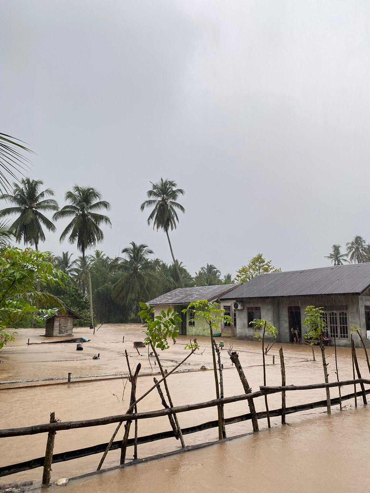
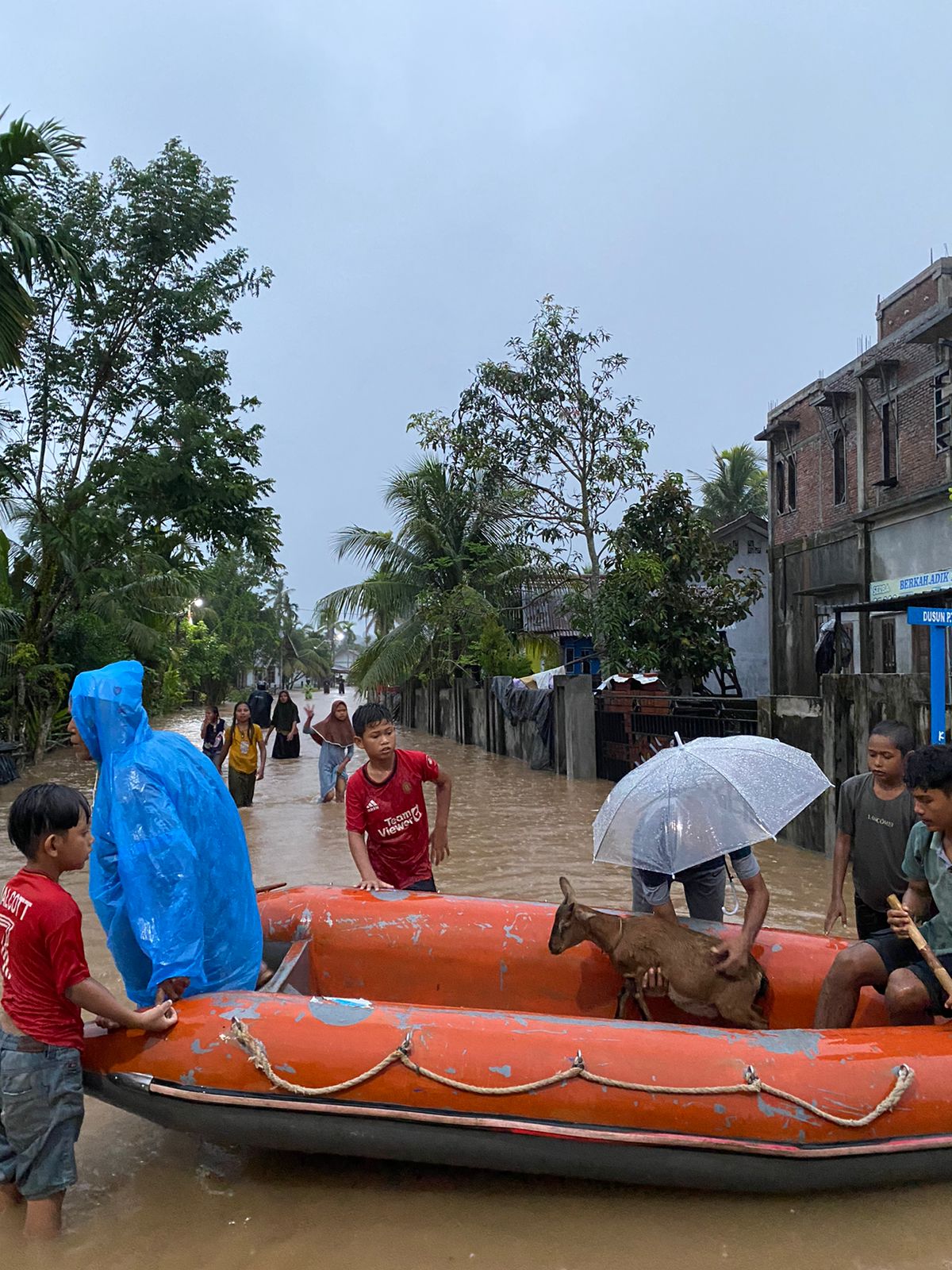
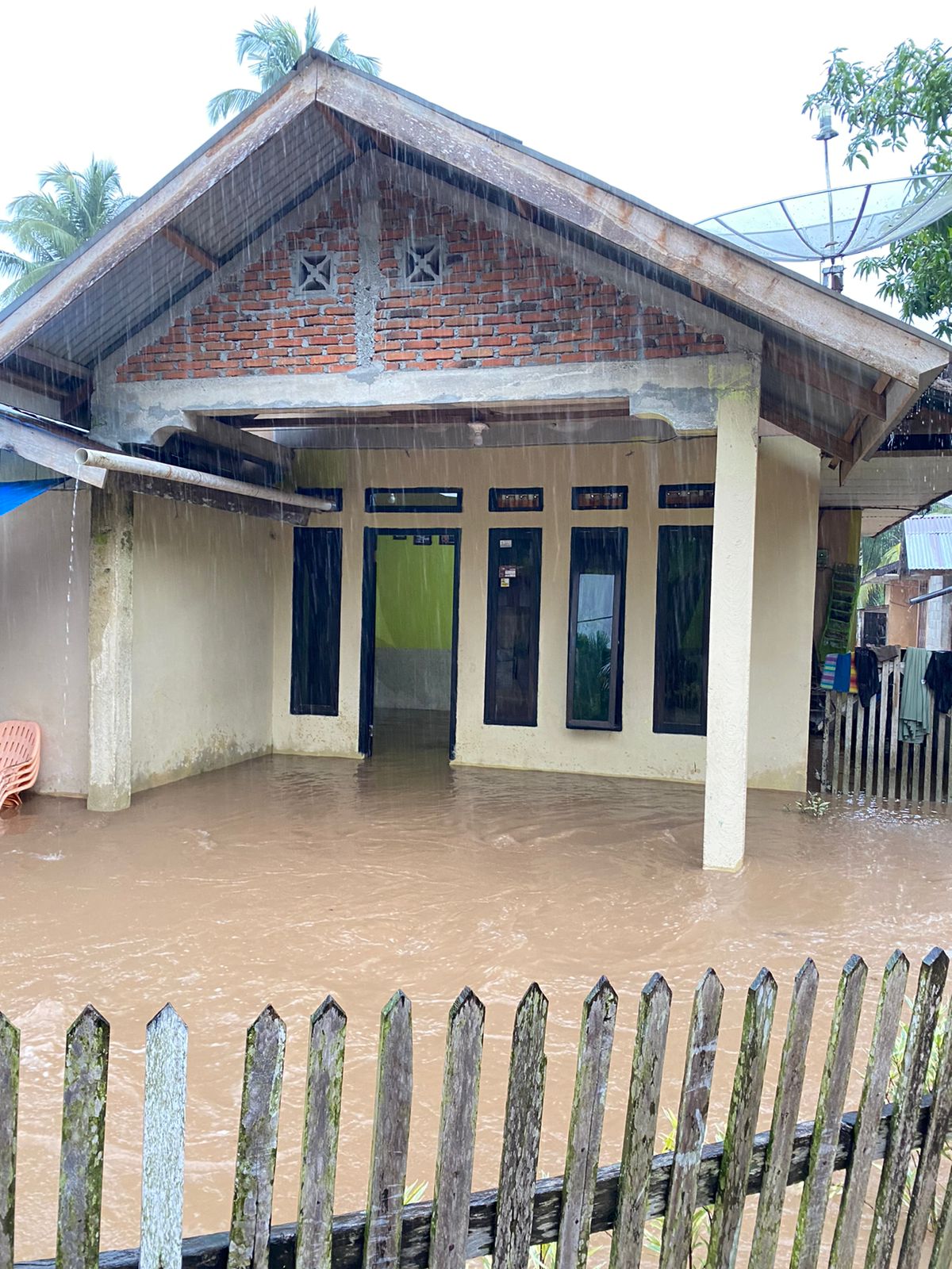
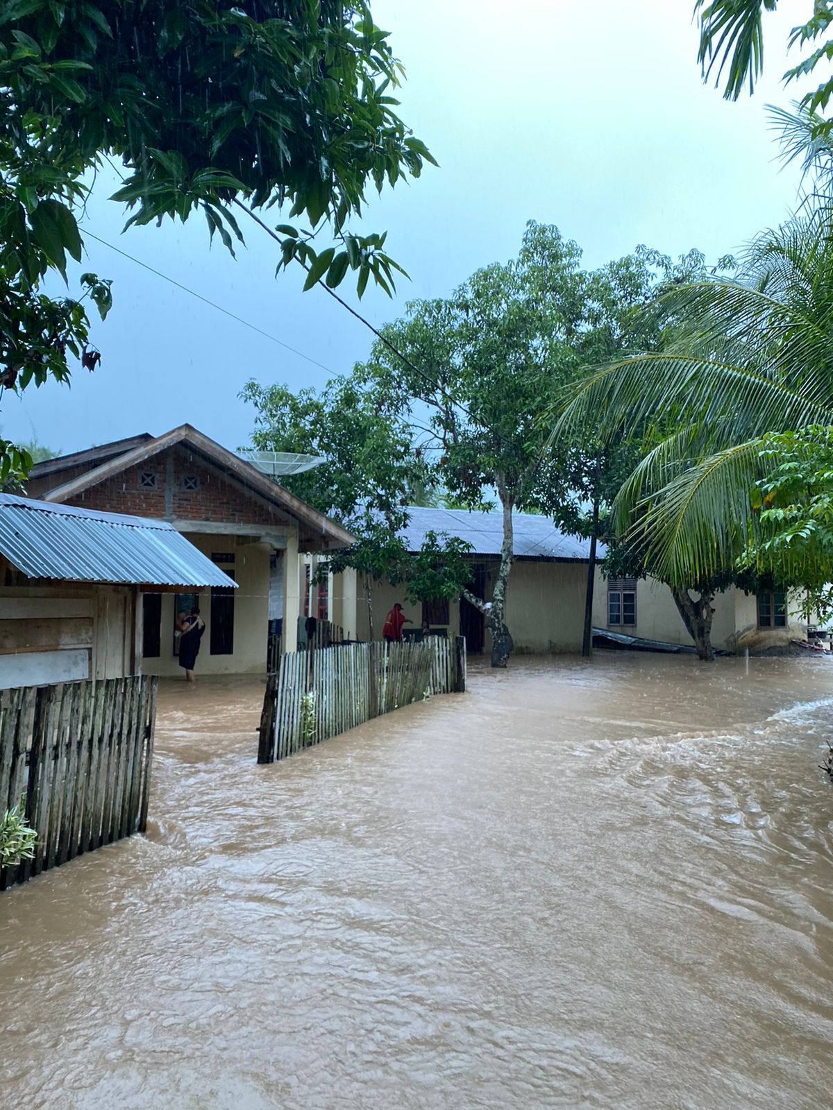
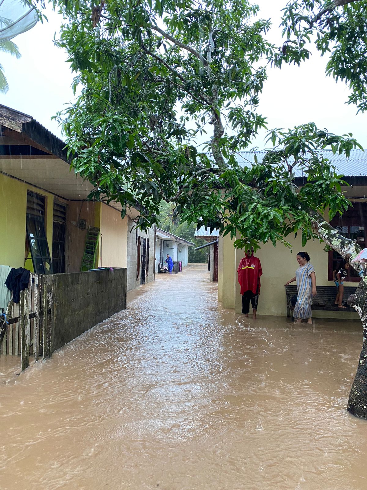
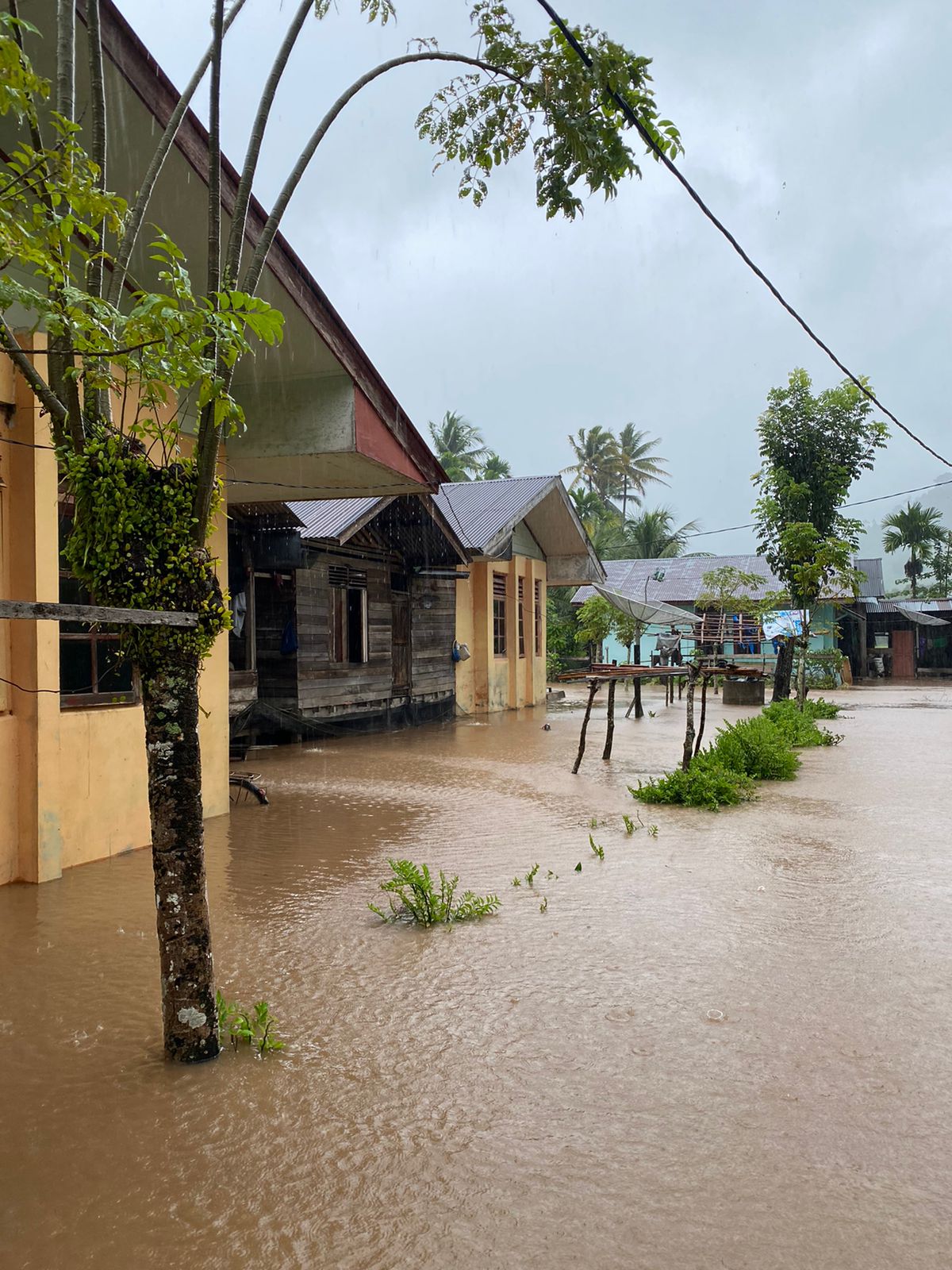
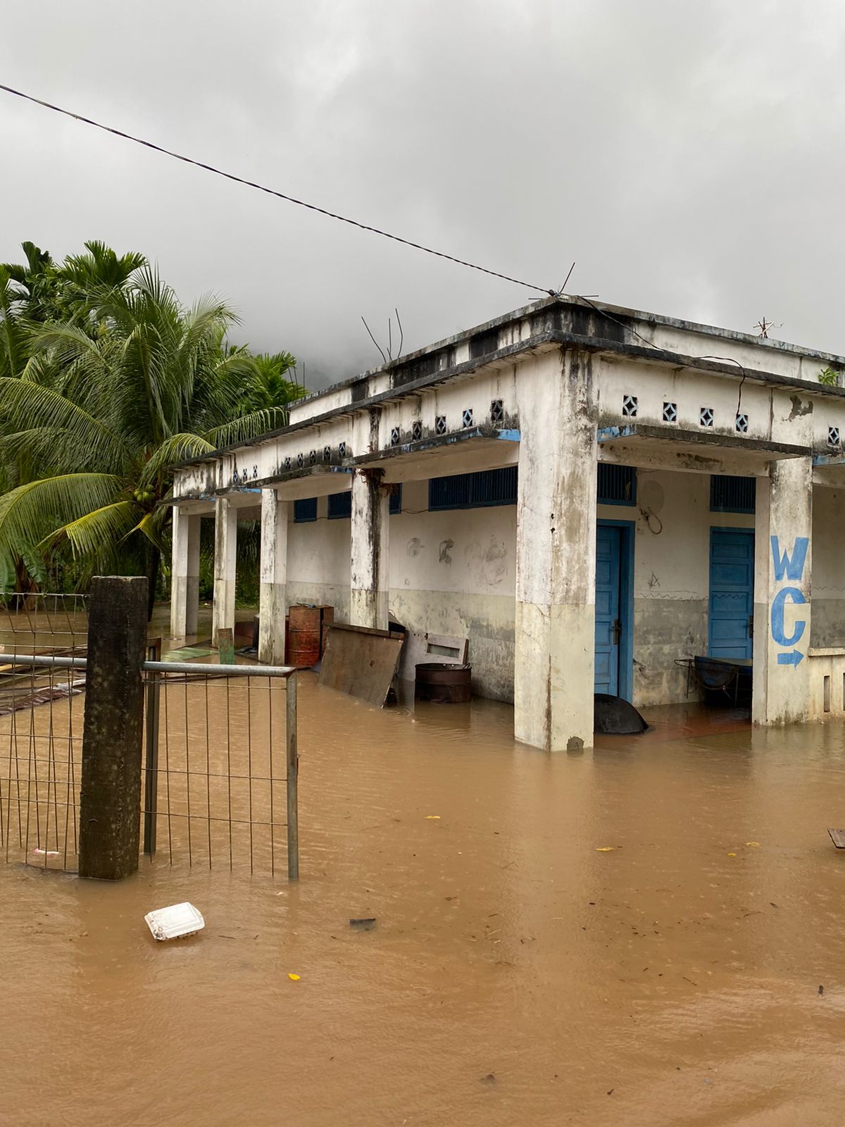
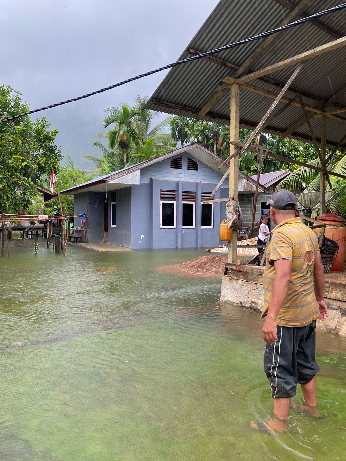
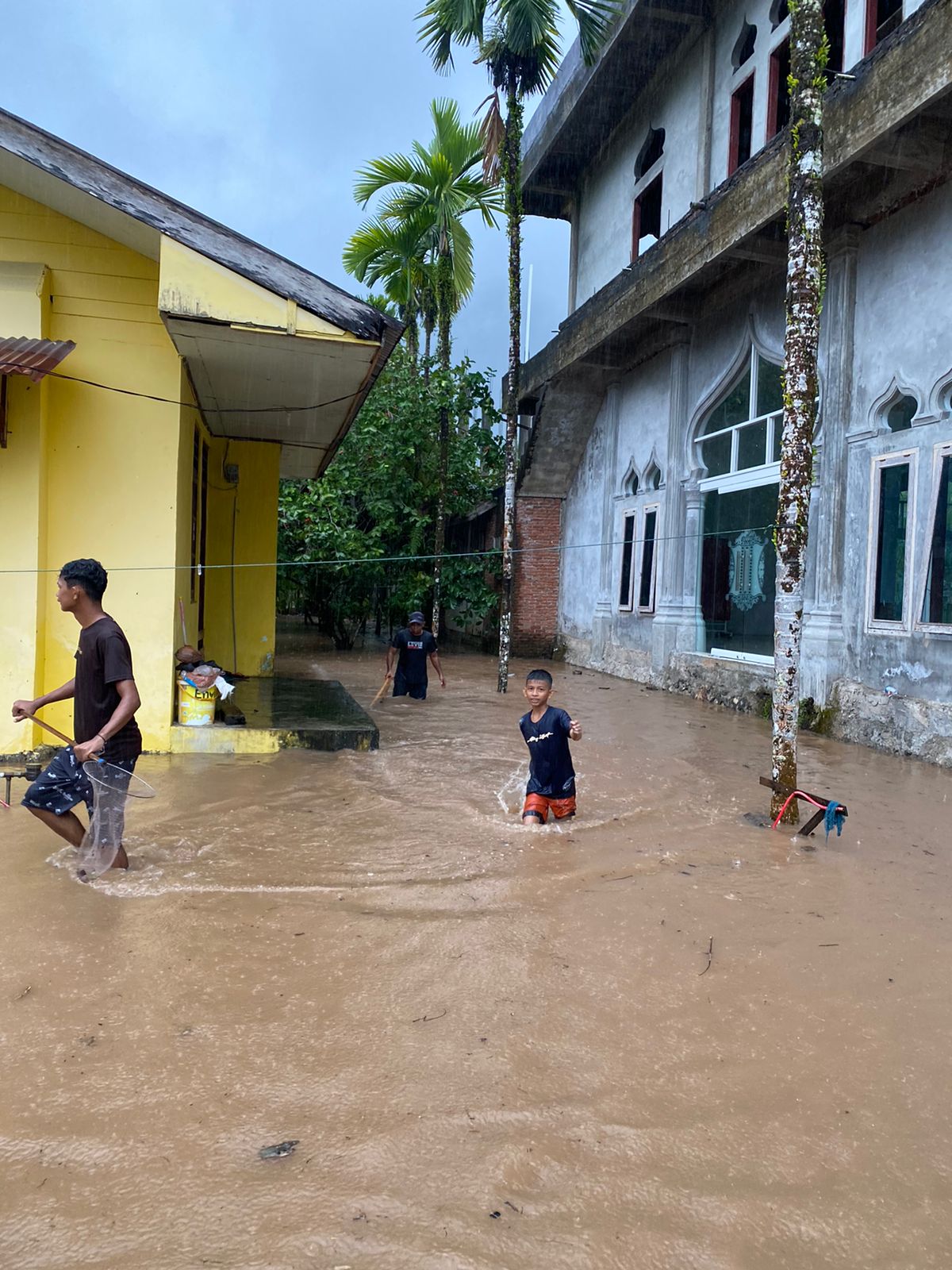
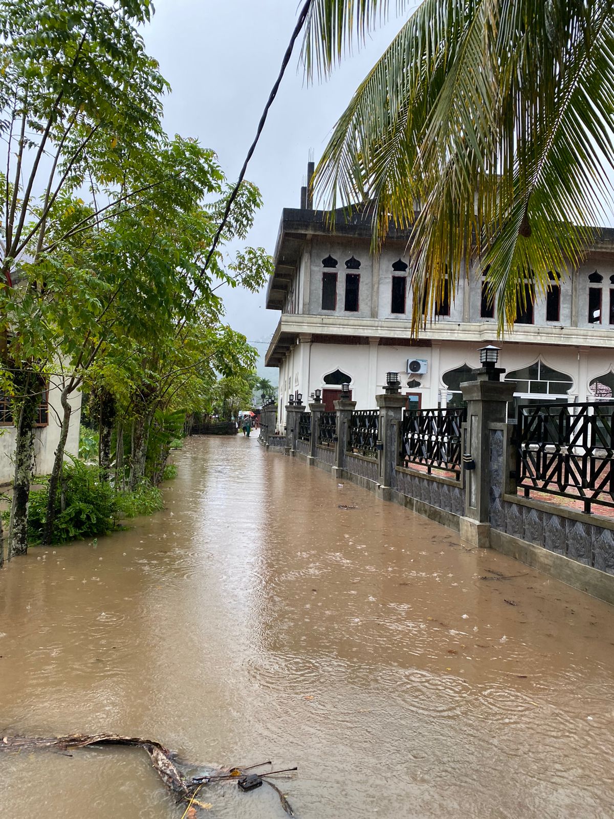
➢ Chronology: Triggered by rain accompanied by strong winds that poured over Aceh Jaya Regency on Sunday, August 18, 2024, at 14.30 WIB, causing the river to overflow, inundating residential areas and community housing at 16.15 WIB and making road access difficult to pass.
➢ Location :
● Jaya District
- Sapek Village
- Meudhenun Village
● Indra Jaya District
- Meudhang Ghon Village
➢ Casualties :
● ± 378 families / 1,362 people affected
● 670 people displaced
➢ Material Losses :
● ± 339 houses affected (Data Collection)
● Water Level ± 20-40 cm
➢ Efforts :
● BPBD Aceh Jaya Regency Coordinates with stakeholders in mobilizing disaster preparedness teams and resources
● BPBD Aceh Jaya Regency Deploys TRC/Damkar for Rapid Assessment at flood-prone points
● BPBD Aceh Regency Deploys Rubber Boat for evacuation
● BPBD Aceh Regency Monitors current field conditions and disseminates warning information (rainfall, water level) and potential risks (areas inundation)
➢ Elements involved:
● Rapid Reaction Team/Damkar
● Indonesian National Army
● Indonesian National Police
● Tagana
● Indonesian Red Cross
● SAR Officer Unit
● Community, and
● Disaster Management Volunteer Elements, and
● Related Agencies
➢ Field Obstacles:
● Road access is difficult to pass because rain is still continuing in the disaster-affected areas
➢ Current Conditions:
● Light intensity rain, the water discharge of the Krueng Meudheun River has dropped 160 cm from the peak flood condition, although it is still above the normal water level
● The average water level is 30 to 80 cm
● For the time being, the water discharge has generally not receded and the rain intensity is still moderate, residents and other parties are still on alert if the flood water level conditions can rise again at any time. ● For Sapek Village, 1 unit of Gampong post tent has been set up for temporary evacuation and there are 2 evacuation points with a total of 670 people.
Source: Pusdatin BPBD Aceh Province Ibu Linda
Impact Statistic
0
Dead
0
Missing
0
Injured
1.4K
Affected Person
670
Displaced
External Video
News
Human SADDD
- Dead -
- Missing -
- Injured -
- Affected Person 1,362
- Affected Family 378
- Internaly Displaced People 670
- Refugees -
- Evacuation Center (in Country) -
- Evacuation Center (out Of Country) -
House
- Affected Houses 339
- Damage Partial -
- Totally Damage -
Infrastructure
- Bridges -
- Number of Roads -
- Road Distance (km) -
Public
- Schools -
- Health -
- Government Office / Public Facilities -
- Settlements -
- Worship Places -
- Others -
General
Cost
- Local Currency -
- Cost of Damages -
- Cost of Damages (USD) -
- Cost of Assistance -
- Cost of Assistance (USD) -
Agricultural
- Rice Field -
- Other Crops -
- Fish Ponds -
- Cattle -
- Poultries -
- Livestock -
Relevant Disasters
The ASEAN Disaster Information Network (ADINet) is a repository of information concerning hazards and disasters that have happened in the region. The platform is open for public, which means that the public can submit information about any hazard and disaster to the AHA Centre. Thereafter, the AHA Centre will verify and validate any submitted information to ensure the accuracy of the data inputs. The AHA Centre can also add new information when relevant and as necessary. ADINet has been recording disaster information in the region since the AHA Centre was operational in 2012.

Supported by :