Indonesia, Flooding and Landslide in Sinjunjung (West Sumatera)
Apr 21, 2024 06:00
May 03, 2024 08:42
Location
Coordinate:
-0.68436234213491, 101.08969142424
Administrative:
Sumatera Barat, Indonesia
Affected Area:
Sumatera Barat
Hazard
Main : Flood- Inundated Area (km) = -
- Maximum Flood Depth (cm) = -
Description
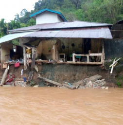
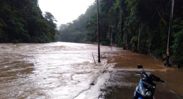
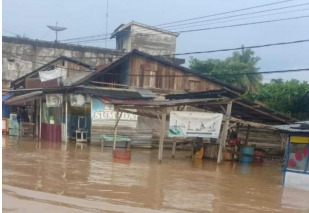
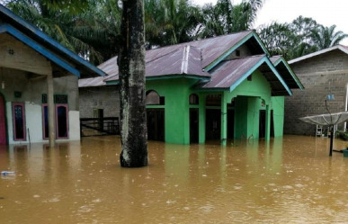
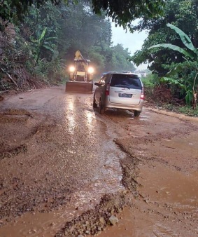
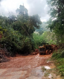
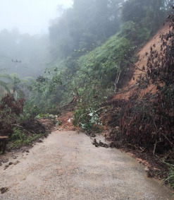
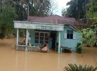
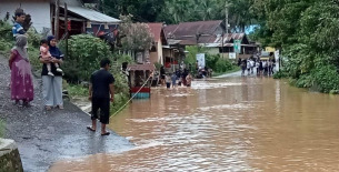
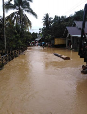
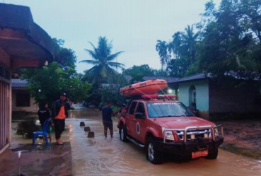
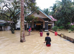
➢ Chronology: Triggered by extreme weather which caused high intensity rain accompanied by strong winds on Sunday 21 April 2024 at 06:00 WIB
➢ Location:
Sijunjung District
• Nagari Silokek
• Nagari Sijunjung
• Nagari Muaro
• Nagari Aie Angek
• Nagari Pamatang Panjang
Kamang District
• Nagari Kamang
Kamang Baru District
• Nagari Tanjung Kaliang
Lubuk Tarok District
• Nagari Latang
• Nagari Kampung Dalam
District IV Nagari
• Nagari Koto Baru
• Nagari Muaro Bodi
Sumpur Kudus District
• Nagari Tamparungo
• Nagari Tanjung Labuh
Tanjung Gadang District
• Nagari Tanjung Gadang
• Nagari Bukit Sabalah
• Nagari Timbulun
• Nagari Pulasan
• Nagari Silongo
Koto VII District
• Nagari Padang Laweh Selatan
Kupitan District
• Nagari Padang Sibusuk
➢ Casualties:
• ±215 families / 420 people affected
➢ Material Losses:
• 170 housing units were submerged
• 15 housing units (lightly damaged)
• ±5 hectares of rice fields submerged
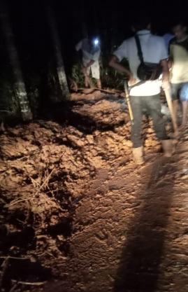
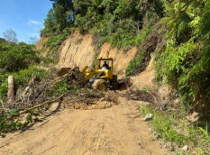
• 18 landslides blocked access roads across villages and sub-districts
➢ Effort:
• Sijunjung Regency BPBD coordinates with related agencies for further data collection and handling
• BPBD Sijunjung Regency evacuated residents affected by the flood
➢ Status:
• Determination of Emergency Response status is in process
➢ Obstacles in the Field:
• Limited amount of equipment used by field personnel such as chain saw machines, floating pumps, tents and heavy equipment
➢ Current Condition:
• The flood has now receded
Source: Chief Executive of BPBD Sijunjung Regency, Mr. Hendry C. & Head of Logistics Section BPBD Sijunjung Regency Mr. Heries
Impact Statistic
0
Dead
0
Missing
0
Injured
420
Affected Person
0
Displaced

External Video
News
Human SADDD
- Dead -
- Missing -
- Injured -
- Affected Person 420
- Affected Family 215
- Internaly Displaced People -
- Refugees -
- Evacuation Center (in Country) -
- Evacuation Center (out Of Country) -
House
- Affected Houses 170
- Damage Partial 15
- Totally Damage -
Infrastructure
- Bridges -
- Number of Roads 18
- Road Distance (km) -
Public
- Schools -
- Health -
- Government Office / Public Facilities -
- Settlements -
- Worship Places -
- Others -
General
Cost
- Local Currency -
- Cost of Damages -
- Cost of Damages (USD) -
- Cost of Assistance -
- Cost of Assistance (USD) -
Agricultural
- Rice Field 5.00
- Other Crops -
- Fish Ponds -
- Cattle -
- Poultries -
- Livestock -
Relevant Disasters
The ASEAN Disaster Information Network (ADINet) is a repository of information concerning hazards and disasters that have happened in the region. The platform is open for public, which means that the public can submit information about any hazard and disaster to the AHA Centre. Thereafter, the AHA Centre will verify and validate any submitted information to ensure the accuracy of the data inputs. The AHA Centre can also add new information when relevant and as necessary. ADINet has been recording disaster information in the region since the AHA Centre was operational in 2012.

Supported by :