Indonesia, Flooding and Landslide in Minahasa Utara (North Sulawesi)
Apr 07, 2024 06:40
Apr 24, 2024 06:00
Location
Coordinate:
1.5511167641055, 125.00670335635
Administrative:
Sulawesi Utara, Indonesia
Affected Area:
Sulawesi Utara
Hazard
Main : Flood- Inundated Area (km) = -
- Maximum Flood Depth (cm) = -
Description
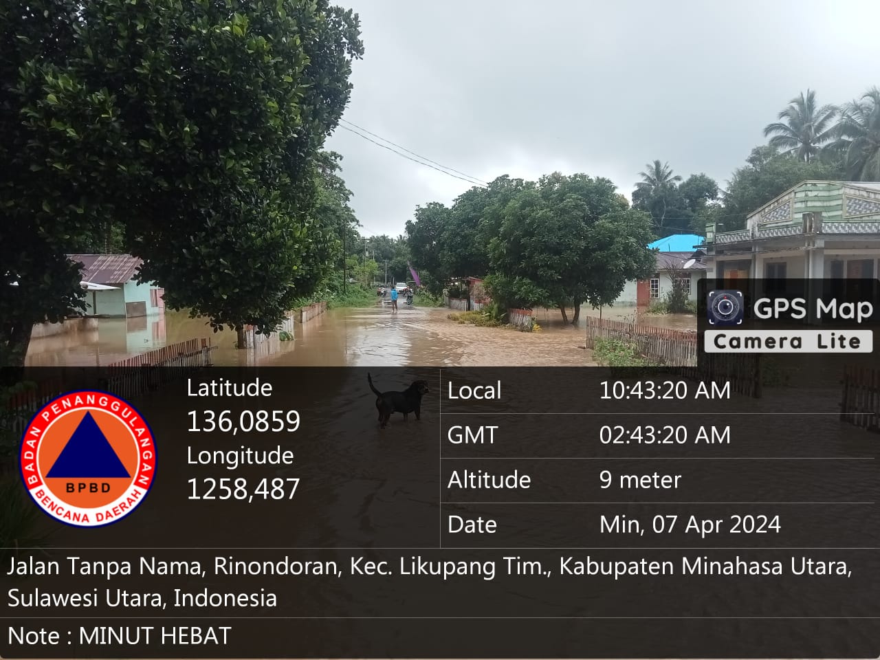
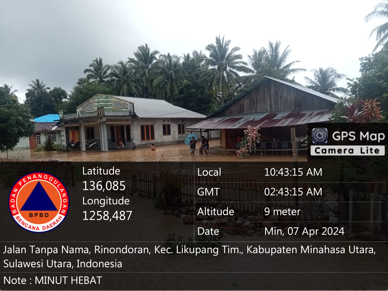
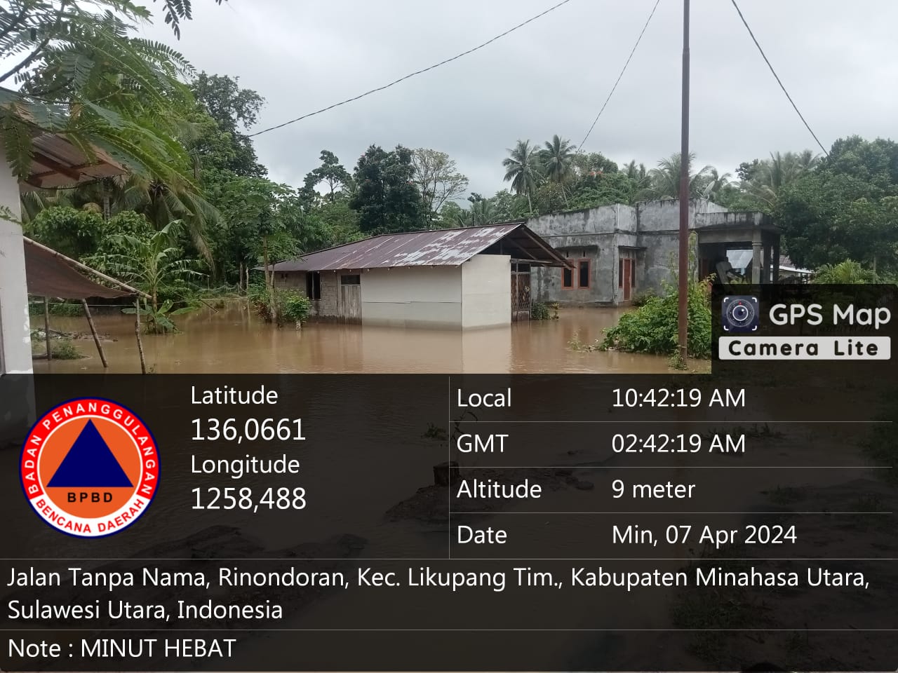
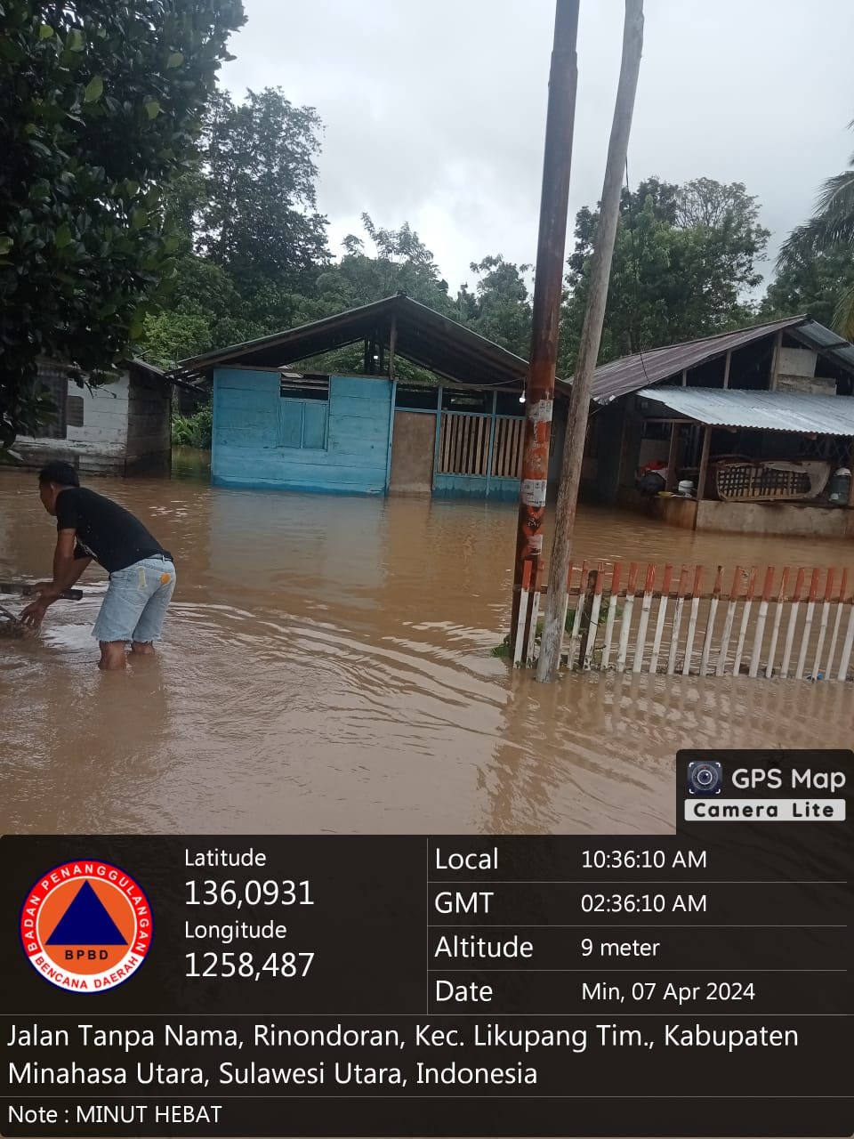
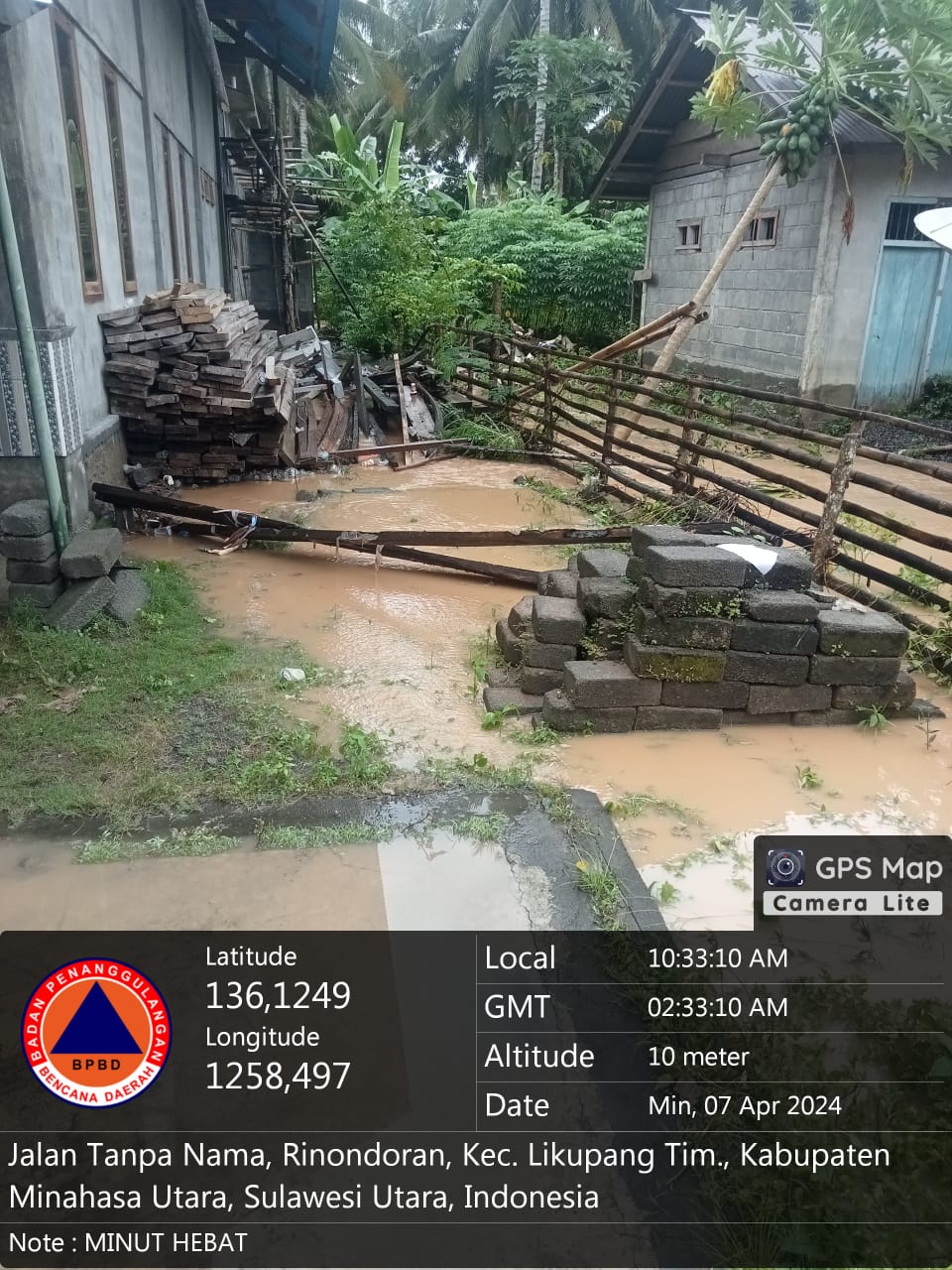
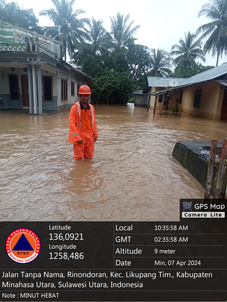
➢ Chronology: Triggered by high intensity rain that occurred in the North Minahasa Regency area, especially in South Likupang District, East Likupang District, West Likupang District & Wori District, causing floods, landslides and fallen trees on Sunday 07 April 2024 at 06:40 WIB
➢ Location:
● East Likupang District
- Rinondoran Village
- Main Village
- Likupang Satu Village
- Winuri Village
- Kampung Ambong Village
- Sarawet Village
- Pinenek Village
- Kokoleh Dua Village
- Marinsow Village
● West Likupang District
- Maliambao Village
- Thermal Village
- Munte Village
● South Likupang District
- Paslaten Village
- Batu Village
- Kaweruan Village
● Wori District
- Bulo Village
- Pontoh Village
- Upper Talawaan Village
- Lansa Village
- Talawaan Bantik Village
- Tiwoho Village
➢ Casualties:
● 475 families / 1,071 people affected (data collection)
● 154 families / 615 people displaced (data collection)
➢ Material Losses:
● ± 422 housing units affected (still under data collection)
● Several housing units were swept away (data collection is still being collected)
● 1 educational facility was seriously damaged
● Main road access was cut off due to landslides
● Water level ± 70 cm
➢ Effort:
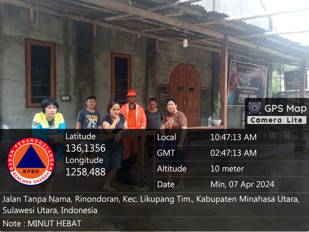
● North Minahasa Regency BPBD coordinates with the local sub-district/village to collect data, evacuate and handle landslide material covering the road
● North Minahasa Regency BPBD gives an appeal to the public to remain alert when high intensity / heavy rain occurs
➢ Urgent Needs:
● Heavy equipment for cleaning and lifting landslide material
➢ Current Conditions:
● Disconnection of electricity & communication networks
● Emergency Response Decree is in process
Source: Mr. Gerald BPBD North Minahasa Regency
Impact Statistic
0
Dead
0
Missing
0
Injured
5.3K
Affected Person
2.2K
Displaced
External Video
News
Human SADDD
- Dead -
- Missing -
- Injured -
- Affected Person 5,255
- Affected Family 1,889
- Internaly Displaced People 2,156
- Refugees -
- Evacuation Center (in Country) -
- Evacuation Center (out Of Country) -
House
- Affected Houses 1,622
- Damage Partial 239
- Totally Damage 28
Infrastructure
- Bridges 4
- Number of Roads 5
- Road Distance (km) -
Public
- Schools 5
- Health -
- Government Office / Public Facilities -
- Settlements -
- Worship Places -
- Others 4
General
Cost
- Local Currency -
- Cost of Damages -
- Cost of Damages (USD) -
- Cost of Assistance -
- Cost of Assistance (USD) -
Agricultural
- Rice Field -
- Other Crops -
- Fish Ponds -
- Cattle -
- Poultries -
- Livestock -
Relevant Disasters
The ASEAN Disaster Information Network (ADINet) is a repository of information concerning hazards and disasters that have happened in the region. The platform is open for public, which means that the public can submit information about any hazard and disaster to the AHA Centre. Thereafter, the AHA Centre will verify and validate any submitted information to ensure the accuracy of the data inputs. The AHA Centre can also add new information when relevant and as necessary. ADINet has been recording disaster information in the region since the AHA Centre was operational in 2012.

Supported by :