Indonesia, Flood in Medan City (North Sumatra)
Sep 07, 2024 11:20
Sep 11, 2024 21:08
Location
Coordinate:
3.627659163959, 98.667985129893
Administrative:
Sumatera Utara, Indonesia
Affected Area:
Sumatera Utara
Hazard
Main : Flood- Inundated Area (km) = -
- Maximum Flood Depth (cm) = -
Description
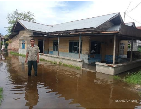
➢ Chronology: Triggered by high intensity rain and rising sea tides, the water overflowed on Saturday, September 7, 2024, at 11.20 WIB.
➢ Location:
● Medan Marelan District
- Paya Pasir Village
● Medan Labuhan District
- Martubung Village
➢ Casualties:
● 330 families / 985 people affected
with details:
● Medan Marelan District
- Paya Pasir Village 85 families / 400 people
- Labuhan Deli Village 160 families / 365 people
● Medan Labuhan District
- Martubung Village 85 families / 220 people
➢ Material Losses:
● 295 houses affected
with details:
● Medan Marelan District
- Paya Pasir Village 65 houses affected
- Labuhan Deli Village 150 houses affected
● Medan Labuhan District
- Martubung Village 80 houses affected
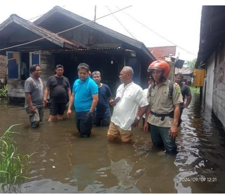
● TMA 30 - 50 cm
➢ Efforts:
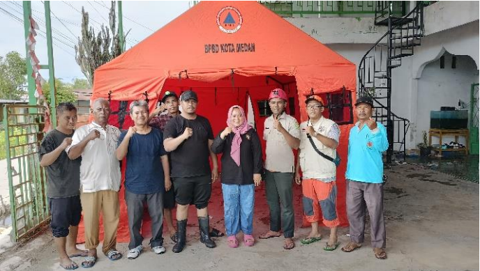
● Medan City BPBD conducted a rapid assessment, coordinated with local officials and conducted an assessment at the location
● Opened the Water Gate to Lake Siombak to accelerate the receding water
● Conducted suction by the North UPT Service, SDABMBK Service together with the Head of T. 600 and the Head of Environment 10
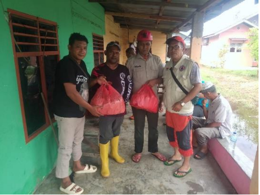
● Opened a Public Kitchen Post and evacuation point at the location at the Al-Husaini Mushola in collaboration with BPBD and the Medan City Social Service.
● To anticipate high tide in the afternoon and evening. Standby personnel at the location: Sub-district Head, Head of Paya Pasir Village, Village ASN ranks, Head of Environment 8 and TRC BPBD Medan City
● Currently, 500 packages of Emergency Response Rice are being distributed from the Medan City BPBD
➢ Elements involved
● Medan City BPBD
● Medan City Social Service
● North Integrated Service Unit Service SDABMBK Service
● Village Environment Head
● Head of Paya Pasir Village and ranks of State Civil Apparatus
➢ Current Condition
● Tidal flood has not receded with an average water height of approximately 30 to 50 cm
Source: Pusdalops PB BPBD Medan City
Impact Statistic
0
Dead
0
Missing
0
Injured
985
Affected Person
0
Displaced

External Video
News
Human SADDD
- Dead -
- Missing -
- Injured -
- Affected Person 985
- Affected Family 330
- Internaly Displaced People -
- Refugees -
- Evacuation Center (in Country) -
- Evacuation Center (out Of Country) -
House
- Affected Houses 295
- Damage Partial -
- Totally Damage -
Infrastructure
- Bridges -
- Number of Roads -
- Road Distance (km) -
Public
- Schools -
- Health -
- Government Office / Public Facilities -
- Settlements -
- Worship Places -
- Others -
General
Cost
- Local Currency -
- Cost of Damages -
- Cost of Damages (USD) -
- Cost of Assistance -
- Cost of Assistance (USD) -
Agricultural
- Rice Field -
- Other Crops -
- Fish Ponds -
- Cattle -
- Poultries -
- Livestock -
Relevant Disasters
The ASEAN Disaster Information Network (ADINet) is a repository of information concerning hazards and disasters that have happened in the region. The platform is open for public, which means that the public can submit information about any hazard and disaster to the AHA Centre. Thereafter, the AHA Centre will verify and validate any submitted information to ensure the accuracy of the data inputs. The AHA Centre can also add new information when relevant and as necessary. ADINet has been recording disaster information in the region since the AHA Centre was operational in 2012.

Supported by :