Indonesia, Flash floods in Padang
Nov 05, 2018 10:00
Sep 27, 2026 15:17
Location
Coordinate:
-0.954206, 100.427454
Administrative:
Sumatera Barat, Indonesia
Affected Area:
Sumatera Barat
Hazard
Main : Flood- Inundated Area (km) = fill value here
- Maximum Flood Depth (cm) = fill value here
Description
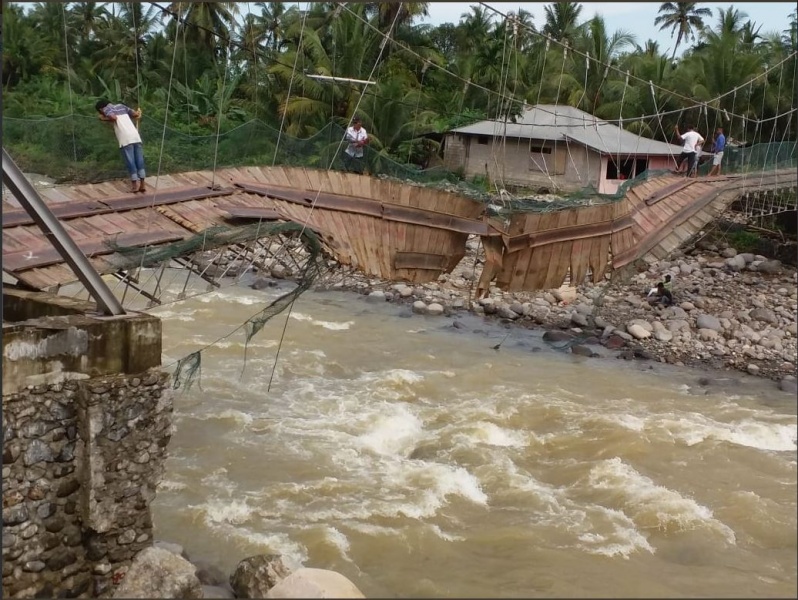
The flood emergency and landslide period of the city of Padang is set for 3-9 / 11/2018. Disaster impact: 2 people died (children aged 6 and 10 were washed away), 756 families were affected, 1,400 houses were submerged, 3 houses were washed away, 1 bridge was washed away, 1 suspension bridge was broken. ---------------------- The National Disaster Mitigation Agency (BNPB) reported that at least two children were killed during floods that swamped Padang, West Sumatra over the weekend. The children were identified as Jihat Melani, 6, and Pasilah Azhan, 10, the agency has said in a release. The flood inundated around 1,400 houses in seven districts, including Pauh, Lubuk Kilangan, Lubuk Begalung and Koto Tangah. “The Padang administration has declared an emergency status for seven days from Nov. 3 to Nov. 9,” BNPB spokesperson Sutopo Purwo Nugroho said in a statement. At least 29 families in Lubuk Kilangan district are isolated currently as the flood brought down a bridge connecting their houses with nearby settlements. Joint personnel from the police, Indonesian Military (TNI) and related agencies have been deployed to the location to help the residents clean up the mud. The local disaster mitigation agency and social affairs agency have also distributed aid to the affected residents, Sutopo added. (dmr)
Impact Statistic
2
Dead
0
Missing
0
Injured
3.8K
Affected Person
0
Displaced
Human SADDD
- Dead 2
- Missing -
- Injured -
- Affected Person 3,780
- Affected Family 756
- Internaly Displaced People -
- Refugees 0
- Evacuation Center (in Country) -
- Evacuation Center (out Of Country) 0
House
- Affected Houses 1,400
- Damage Partial 0
- Totally Damage 3
Infrastructure
- Bridges 2
- Number of Roads 0
- Road Distance (km) 0.00
Public
- Schools -
- Health -
- Government Office / Public Facilities 0
- Settlements 0
- Worship Places 0
- Others 0
General
Cost
- Local Currency 0.00
- Cost of Damages 0.00
- Cost of Damages (USD) -
- Cost of Assistance 0.00
- Cost of Assistance (USD) -
Agricultural
- Rice Field 0.00
- Other Crops 0.00
- Fish Ponds 0
- Cattle 0
- Poultries 0
- Livestock 0
Relevant Disasters
The ASEAN Disaster Information Network (ADINet) is a repository of information concerning hazards and disasters that have happened in the region. The platform is open for public, which means that the public can submit information about any hazard and disaster to the AHA Centre. Thereafter, the AHA Centre will verify and validate any submitted information to ensure the accuracy of the data inputs. The AHA Centre can also add new information when relevant and as necessary. ADINet has been recording disaster information in the region since the AHA Centre was operational in 2012.

Supported by :