Brunei Darussalam, Floods in Tutong District
Jun 02, 2018 14:50
Sep 27, 2026 15:17
Location
Coordinate:
4.682165, 114.767274
Administrative:
Tutong, Brunei Darussalam
Affected Area:
Tutong
Hazard
Main : Flood- Inundated Area (km) = fill value here
- Maximum Flood Depth (cm) = fill value here
Description
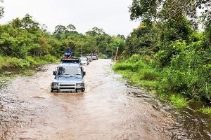
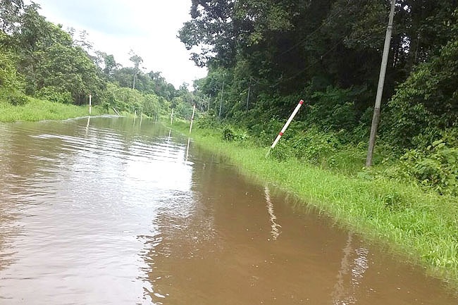
BRUNEI Darussalam is currently experiencing uncertain weather conditions causing heavy downpour as well as thundershowers, leading to flash floods particularly at lowland areas. The Fire and Rescue Department has found that a number of roads in Tutong District have been affected by floods including Jalan Keranching, Jalan Benutan in Kampong Benutan, Jalan Kuala Ungar/Rambai and Jalan Bengkuru in Mukim Rambai. Currently, these roads are not accessible for low or salon vehicles. The Fire and Rescue Department has been put on 24 hours standby and has carried out patrol on land and coastal areas to take extra precautions. The department has advised members of the public especially residents around or nearby flood-prone areas to always be aware of their safety. The public has also been advised to obtain information on weather conditions from time to time; monitor the water level of their surroundings; not let children play outside particularly at affected areas; keep important documents at a safe place, and keep enough supplies of subsistence as well as emergency relief supplies. Brunei Four-Wheel Drive Association (PKTLB) and Lotus Light Charity Society (LLCS) joined forces to help the needy in Tutong and Kampong Sungai Mau, Bukit Sawat and Merangking in Ulu Belait on May 31.
Impact Statistic
0
Dead
0
Missing
0
Injured
0
Affected Person
0
Displaced
Human SADDD
- Dead -
- Missing -
- Injured -
- Affected Person -
- Affected Family -
- Internaly Displaced People -
- Refugees 0
- Evacuation Center (in Country) -
- Evacuation Center (out Of Country) 0
House
- Affected Houses 0
- Damage Partial 0
- Totally Damage -
Infrastructure
- Bridges 0
- Number of Roads 0
- Road Distance (km) 0.00
Public
- Schools -
- Health -
- Government Office / Public Facilities 0
- Settlements 0
- Worship Places 0
- Others 0
General
Cost
- Local Currency 0.00
- Cost of Damages 0.00
- Cost of Damages (USD) -
- Cost of Assistance 0.00
- Cost of Assistance (USD) -
Agricultural
- Rice Field 0.00
- Other Crops 0.00
- Fish Ponds 0
- Cattle 0
- Poultries 0
- Livestock 0
Relevant Disasters
The ASEAN Disaster Information Network (ADINet) is a repository of information concerning hazards and disasters that have happened in the region. The platform is open for public, which means that the public can submit information about any hazard and disaster to the AHA Centre. Thereafter, the AHA Centre will verify and validate any submitted information to ensure the accuracy of the data inputs. The AHA Centre can also add new information when relevant and as necessary. ADINet has been recording disaster information in the region since the AHA Centre was operational in 2012.

Supported by :