Brunei Darussalam, Flash flood
Jan 03, 2018 01:14
Sep 27, 2026 15:11
Location
Coordinate:
4.446708, 114.635438
Administrative:
Belaitt, Brunei Darussalam
Affected Area:
Tutong
Hazard
Main : Flood- Inundated Area (km) = fill value here
- Maximum Flood Depth (cm) = fill value here
Description
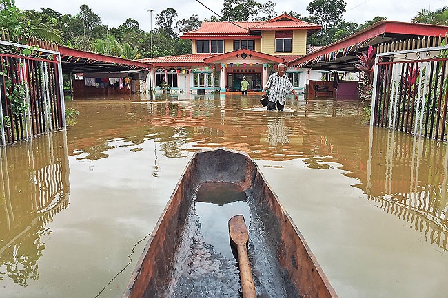
Heavy rains coupled with strong winds pounded Brunei Darussalam on 19-20 December 2017 caused flash floods and landslides across Brunei Darussalam. The torrential rain and floods were the side effect of tropical storm Kai-Tak in the South China Sea. Tutong district was the worst affected areas, with a 0.5 meters of water down transportation access and inundated residential areas. On 22-Dec-2017, government agencies of Brunei Darussalam started to provide assistance to flood victims. Ninety-four flood victims in Temburong District have received basic needs and food items, as well as support from volunteers to clean up their houses.
Impact Statistic
0
Dead
0
Missing
0
Injured
94
Affected Person
94
Displaced
Human SADDD
- Dead -
- Missing -
- Injured -
- Affected Person 94
- Affected Family 19
- Internaly Displaced People 94
- Refugees 0
- Evacuation Center (in Country) -
- Evacuation Center (out Of Country) 0
House
- Affected Houses 0
- Damage Partial 0
- Totally Damage -
Infrastructure
- Bridges 0
- Number of Roads 0
- Road Distance (km) 0.00
Public
- Schools -
- Health -
- Government Office / Public Facilities 0
- Settlements 0
- Worship Places 0
- Others 0
General
Cost
- Local Currency 0.00
- Cost of Damages 0.00
- Cost of Damages (USD) -
- Cost of Assistance 0.00
- Cost of Assistance (USD) -
Agricultural
- Rice Field 0.00
- Other Crops 0.00
- Fish Ponds 0
- Cattle 0
- Poultries 0
- Livestock 0
Relevant Disasters
The ASEAN Disaster Information Network (ADINet) is a repository of information concerning hazards and disasters that have happened in the region. The platform is open for public, which means that the public can submit information about any hazard and disaster to the AHA Centre. Thereafter, the AHA Centre will verify and validate any submitted information to ensure the accuracy of the data inputs. The AHA Centre can also add new information when relevant and as necessary. ADINet has been recording disaster information in the region since the AHA Centre was operational in 2012.

Supported by :